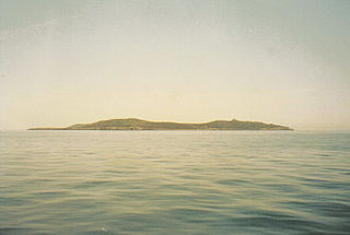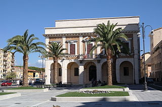
Elba is a Mediterranean island in Tuscany, Italy, 10 km (6.2 mi) from the coastal town of Piombino on the Italian mainland, and the largest island of the Tuscan Archipelago. It is also part of the Arcipelago Toscano National Park, and the third largest island in Italy, after Sicily and Sardinia. It is located in the Tyrrhenian Sea about 50 km (30 mi) east of the French island of Corsica.

The province of Grosseto is a province in the Tuscany region of Italy. Its capital is the city of Grosseto. As of 2013 the province had a total population of 225,098 people.

Giannutri is a small island in the Tyrrhenian Sea off the coast of Tuscany, Italy; it is the southernmost island of the Tuscan Archipelago and it is a frazione of the comune of Isola del Giglio in the Province of Grosseto.

Pianosa is an island in the Tuscan Archipelago in the Tyrrhenian Sea, Italy. It is about 10.25 km2 (3.96 sq mi) in area, with a coastal perimeter of 26 km (16 mi).

Montecristo, also Monte Cristo and formerly Oglasa, is an island in the Tyrrhenian Sea and part of the Tuscan Archipelago. Administratively it belongs to the municipality of Portoferraio in the province of Livorno, Italy. The island has an area of 10.39 km2 (4.01 sq mi), is approximately 4.1 km (2.5 mi) wide at its widest point, and is 3.4 km (2.1 mi) long; the coasts are steep, and extend for 16 km (9.9 mi). The island is a state nature reserve and forms part of the Tuscan Archipelago National Park.

Isola del Giglio, or Giglio Island in English, is an Italian island and comune (municipality) in the Tyrrhenian Sea, off the coast of Tuscany, and is part of the Province of Grosseto. The island is one of seven that form the Tuscan Archipelago, lying within the Arcipelago Toscano National Park. Giglio means "lily" in Italian, and though the name would appear consistent with the insignia of Medici Florence, it originally derives from the Latin name of the island, Igilium, which in turn could be related to the Ancient Greek name of the neighbouring Capraia, Αἰγύλιον, from αἴξ aíx "goat".

The province of Livorno or, traditionally, province of Leghorn, is a province in the Tuscany region of Italy. It includes several islands of the Tuscan Archipelago, including Elba and Capraia. Its capital is the city of Livorno. When formed in 1861, the province included only Livorno and Elba Island. It was extended in 1925 with land from the provinces of Pisa and Genoa. It has an area of 1,211 square kilometres (468 sq mi) and a total population of 343,003 (2012). The province contains 19 comuni. The coastline of the area is known as "Costa degli Etruschi".

The Tuscan Archipelago is a chain of islands between the Ligurian Sea and Tyrrhenian Sea, west of Tuscany, Italy.

The Maddalena Archipelago is a group of islands in the Strait of Bonifacio between Corsica (France) and Sardinia (Italy). The whole archipelago makes the territory of the La Maddalena comune in Sardinia.

Capraia is an Italian island, the northwesternmost of the seven islands of the Tuscan Archipelago, and the third largest after Elba and Giglio.

Gorgona is the northernmost island in the Tuscan Archipelago, a group of islands off the west coast of Italy. Between Corsica and Livorno, this diminutive island has been valued most for its wildlife, especially marine birds, and its isolation. The latter quality resulted in the foundation of Gorgona Abbey in the Middle Ages. After its closure the monastery grounds and buildings were appropriated in 1869, at the foundation of an agricultural penal colony, which is currently in use.

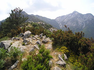
Mount Capanne is the highest mountain on the Italian island of Elba and in the province of Livorno, Tuscany, Italy. It is located in the western part of the island, reaching a height of 1,019 metres (3,343 ft) in elevation above the Mediterranean Sea.

Arcipelago di La Maddalena National Park is a geomarine national park on the coast of Sardinia. The park was established on 1 April 1994, followed by the change of DPR on 17 May 1996. It covers an area on land and sea of over 12,000 hectares and 180 kilometers of coasts. This region includes all the islands and islets within the territory of the Municipality of La Maddalena, Italy. The territory of the National Park will also represent an important part of the Bocche di Bonifacio international marine park which will soon be established.

Palmaiola is an islet located in the middle of Piombino Channel, at 3 kilometres (1.9 mi) from Elba and 7 kilometres (4.3 mi) from Piombino; it is part of the comune of Rio Marina and is wholly owned by the State.

Pianosa Lighthouse is an active lighthouse located on the east side of Pianosa Island.

Isola Razzoli Lighthouse is an active lighthouse located on an islet, 2.45 kilometres (1.52 mi) long, in the Maddalena archipelago. The lighthouse is the northernmost in Sardinia, on the eastern approach to the Strait of Bonifacio, and is at 7.42 kilometres (4.61 mi) from the French Lavezzi archipelago. The island is in the municipality of La Maddalena on the Tyrrhenian Sea.

Punta Filetto Lighthouse is an active lighthouse located on the Isola Santa Maria, which makes part of the Maddalena archipelago, on the northern point of the island facing Barrettinelli di Fuori Lighthouse from which it is 1.4 kilometres (0.87 mi) away. The island is in the municipality of La Maddalena on the Tyrrhenian Sea.

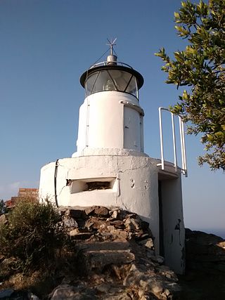
Monte Poro Lighthouse is an active lighthouse located on the summit of Monte Poro, in the south western part of Elba on the Tyrrhenian Sea, a region covered by Macchia Mediterranea. The place was of some strategic interest during World War II because close to the lighthouse are the ruins of a German position.

Pantelleria National Park is an Italian national park on the island of Pantelleria. The park was established in 2016, and covers an area of 66.4 km2 (25.6 sq mi), or 80% of the island.


