Elba is a Mediterranean island in Tuscany, Italy, 10 km (6.2 mi) from the coastal town of Piombino on the Italian mainland, and the largest island of the Tuscan Archipelago. It is also part of the Arcipelago Toscano National Park, and the third largest island in Italy, after Sicily and Sardinia. It is located in the Tyrrhenian Sea about 50 km (30 mi) east of the French island of Corsica.

The province of Grosseto is a province in the Tuscany region of Italy. Its capital is the city of Grosseto. As of 2013 the province had a total population of 225,098 people.
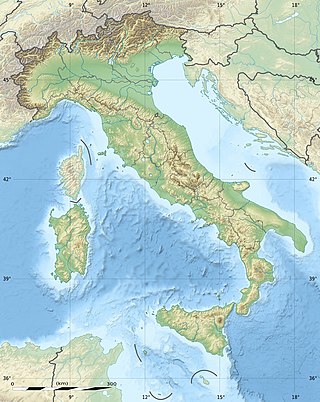
The geography of Italy includes the description of all the physical geographical elements of Italy. Italy, whose territory largely coincides with the homonymous geographical region, is located in southern Europe and comprises the long, boot-shaped Italian Peninsula crossed by the Apennines, the southern side of Alps, the large plain of the Po Valley and some islands including Sicily and Sardinia. Italy is part of the Northern Hemisphere. Two of the Pelagie Islands are located on the African continent.
Giannutri is a small island in the Tyrrhenian Sea off the coast of Tuscany, Italy; it is the southernmost island of the Tuscan Archipelago and it is a frazione of the comune of Isola del Giglio in the Province of Grosseto.

Piombino is an Italian town and comune of about 35,000 inhabitants in the province of Livorno (Tuscany). It lies on the border between the Ligurian Sea and the Tyrrhenian Sea, in front of Elba Island and at the northern side of Maremma.

Pianosa is an island in the Tuscan Archipelago in the Tyrrhenian Sea, Italy. It is about 10.25 km2 (3.96 sq mi) in area, with a coastal perimeter of 26 km (16 mi).

Montecristo, also Monte Cristo and formerly Oglasa, is an island in the Tyrrhenian Sea and part of the Tuscan Archipelago. Administratively it belongs to the municipality of Portoferraio in the province of Livorno, Italy. The island has an area of 10.39 km2 (4.01 sq mi), is approximately 4.1 km (2.5 mi) wide at its widest point, and is 3.4 km (2.1 mi) long; the coasts are steep, and extend for 16 km (9.9 mi). The island is a state nature reserve and forms part of the Tuscan Archipelago National Park.

Isola del Giglio, or Giglio Island in English, is an Italian island and comune (municipality) in the Tyrrhenian Sea, off the coast of Tuscany, and is part of the Province of Grosseto. The island is one of seven that form the Tuscan Archipelago, lying within the Arcipelago Toscano National Park. Giglio means "lily" in Italian, and though the name would appear consistent with the insignia of Medici Florence, it originally derives from the Latin name of the island, Igilium, which in turn could be related to the Ancient Greek name of the neighbouring Capraia, Αἰγύλιον, from αἴξ aíx "goat".
The province of Livorno or, traditionally, province of Leghorn, is a province in the Tuscany region of Italy. It includes several islands of the Tuscan Archipelago, including Elba and Capraia. Its capital is the city of Livorno. When formed in 1861, the province included only Livorno and Elba Island. It was extended in 1925 with land from the provinces of Pisa and Genoa. It has an area of 1,211 square kilometres (468 sq mi) and a total population of 343,003 (2012). The province contains 19 comuni. The coastline of the area is known as "Costa degli Etruschi".

The Tuscan Archipelago is a chain of islands between the Ligurian Sea and Tyrrhenian Sea, west of Tuscany, Italy.

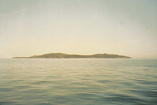
Gorgona is the northernmost island in the Tuscan Archipelago, a group of islands off the west coast of Italy. Between Corsica and Livorno, this diminutive island has been valued most for its wildlife, especially marine birds, and its isolation. The latter quality resulted in the foundation of Gorgona Abbey in the Middle Ages. After its closure the monastery grounds and buildings were appropriated in 1869, at the foundation of an agricultural penal colony, which is currently in use.

The Republic of Pisa was an independent state existing from the 11th to the 15th century and centered on the Tuscan city of Pisa. It rose to become an economic powerhouse, a commercial center whose merchants dominated Mediterranean and Italian trade for a century, before being surpassed and superseded by the Republic of Genoa.

Corsica is an island in the Mediterranean Sea and one of the 18 regions of France. It is the fourth-largest island in the Mediterranean and lies southeast of the French mainland, west of the Italian Peninsula and immediately north of the Italian island of Sardinia, the nearest land mass. A single chain of mountains makes up two-thirds of the island. As of January 2024, it had a population of 355,528.

The history of Corsica goes back to antiquity, and was known to Herodotus, who described Phoenician habitation in the 6th century BCE. Etruscans and Carthaginians expelled the Ionian Greeks, and remained until the Romans arrived during the Punic Wars in 237 BCE. Vandals occupied it in 430 CE, followed by the Byzantine Empire a century later.

Rogliano is a commune in the French department of Haute-Corse, Corsica.

Algajola is a commune in the Haute-Corse department of France on the island of Corsica.

Arcipelago Toscano National Park is a large Tuscan Archipelago national park and marine park in the Provinces of Grosseto and Livorno, western Tuscany, Italy.

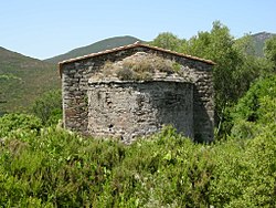
The Genoese towers in Corsica are a series of coastal defences constructed by the Republic of Genoa between 1530 and 1620 to stem the attacks by Barbary pirates.

The French conquest of Corsica was a successful expedition by French forces of the Kingdom of France under Comte de Vaux, against Corsican forces under Pasquale Paoli of the Corsican Republic. The expedition was launched in May 1768, in the aftermath of the Seven Years' War. A French expeditionary force was landed on the island of Corsica, then ruled by the Corsican Republic. Marching inland to overcome any Corsican opposition, the French force initially suffered an unexpected defeat at the Battle of Borgo. But a new commander, the Comte de Vaux, was appointed to lead the expedition, and decisively defeated the Corsican army at the Battle of Ponte Novu in 1769, effectively bringing an end to Corsican resistance.