Gargano National Park

Last updated
Parco Nazionale del Gargano
Gargano0001.jpg
Gargano coast near Vieste.
Parco del Gargano.jpg
Nearest city Foggia
Area118,144 ha
Established1991
Governing bodyMinistero dell'Ambiente
www.parcogargano.it/web/gargano/guida

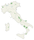
The Gargano National Park (Italian : Parco nazionale del Gargano) is a national park in the province of Foggia in southern Italy. [1] Aside from the Gargano promontory (encompassing the ancient woodlands of the Foresta Umbra) from which it takes its name, it includes also the Tremiti Islands archipelago and the wetlands Lago Salso. It is the largest park in Apulia. [2]

Contents

The National Park of Gargano (UNESCO site) is one of the few national protected areas efficiently contributing to the "un Bosco per Kyoto" project, which in 2007 has involved several schools in the realization of projects for a social and responsible tourism. It is one of the most appreciated areas, unique for the decrease of fires and for the politics of environmental awareness.[ citation needed ]

See also

Presidents

Related Research Articles

<span class="mw-page-title-main">Apulia</span> Region of Italy

Apulia, also known by its Italian name Puglia, is a region of Italy, located in the southern peninsular section of the country, bordering the Adriatic Sea to the east, the Strait of Otranto and Ionian Sea to the southeast and the Gulf of Taranto to the south. The region comprises 19,345 square kilometers (7,469 sq mi), and its population is about four million people. It is bordered by the other Italian regions of Molise to the north, Campania to the west, and Basilicata to the southwest. Its chief town is Bari.

<span class="mw-page-title-main">Sanctuary of Monte Sant'Angelo</span> Roman Catholic sanctuary on Mount Gargano, Apulia, Italy

The Sanctuary of Saint Michael the Archangel is a Roman Catholic shrine on Mount Gargano, Italy, part of the commune of Monte Sant'Angelo, in the province of Foggia, northern Apulia. It has the dignity of a minor basilica.

<span class="mw-page-title-main">Province of Foggia</span> Province of Italy

The province of Foggia is a province in the Apulia region of Italy.

<span class="mw-page-title-main">Gargano</span> Historical and geographical region of Italy

Gargano (Italian:[ɡarˈɡaːno], is a historical and geographical sub-region in the province of Foggia, Apulia, southeast Italy, consisting of a wide isolated mountain massif made of highland and several peaks and forming the backbone of the Gargano Promontory projecting into the Adriatic Sea, the "spur" on the Italian "boot".

<span class="mw-page-title-main">Abruzzo, Lazio and Molise National Park</span>

Abruzzo, Lazio and Molise National Park is an Italian national park established in 1923. The majority of the park is located in the Abruzzo region, with smaller parts in Lazio and Molise. It is sometimes called by its former name Abruzzo National Park. The park headquarters are in Pescasseroli in the Province of L'Aquila. The park's area is 496.80 km2 (191.82 sq mi).

<span class="mw-page-title-main">Tremiti Islands</span> Comune in Apulia, Italy

The Tremiti Islands, also literarily known as Isole Diomedee, are an archipelago in the Adriatic Sea, north of the Gargano Peninsula. They constitute a comune of Italy's Province of Foggia, Apulia and form part of the Gargano national park. The archipelago is composed of 5 islands: San Domino, San Nicola, Capraia, Cretaccio, and Pianosa.

<span class="mw-page-title-main">Mattinata</span> Comune in Apulia, Italy

Mattinata is a seaside resort town and comune (municipality) in the province of Foggia, Apulia, southern Italy.

<span class="mw-page-title-main">San Marco in Lamis</span> Comune in Apulia, Italy

San Marco in Lamis is a town and comune in the province of Foggia in the Apulia region of southeast Italy. It is located in the Gargano massif area within the Parco Nazionale del Gargano and it belongs to the Comunità Montana del Gargano. Part of the Via Sacra Langobardorum runs through the town's territory. As such, the town is home to the Santuario di Santa Maria di Stignano and the Convento di San Matteo apostolo. The Santuario di Santa Maria di Stignano is linked to the Castelpagano Castle, whose ruins dominate a slope in the territory of Apricena.

<span class="mw-page-title-main">Vico del Gargano</span> Comune in Apulia, Italy

Vico del Gargano is a village and comune in the province of Foggia in the Apulia region of southeast Italy. Called the "Village of Love", it is part of the Gargano National Park and the Mountain Community of Gargano.

<span class="mw-page-title-main">Alta Murgia National Park</span>

The Parco Nazionale dell'Alta Murgia is a national park in Apulia, southern Italy, established in 2004. It lies in the Murgia geographical area, with its headquarters in the town of Gravina in Puglia, and has an area of 677.39 square kilometres. It is part of a larger Special Protection Area established to protect the grass steppe, lesser kestrel's habitat.

The Apulia Carbonate Platform in Apulia, Italy, was a major palaeogeographic element of the southern margin of the Mesozoic Tethys Ocean. It is one of the so-called peri-Adriatic platforms, which are comparable to the Bahama Banks in their carbonate facies, shape, size, and subsidence rate and, also, in the internal architecture.

<span class="mw-page-title-main">Parco Nazionale del Cilento, Vallo di Diano e Alburni</span>

Cilento, Vallo di Diano and Alburni National Park is an Italian national park in the Province of Salerno, in Campania in southern Italy. It includes much of the Cilento, the Vallo di Diano and the Monti Alburni. It was founded in 1991, and was formerly known as the Parco Nazionale del Cilento e Vallo di Diano.

<span class="mw-page-title-main">Arcipelago Toscano National Park</span> Italian national park

Arcipelago Toscano National Park is a large Tuscan Archipelago national park and marine park in the Provinces of Grosseto and Livorno, western Tuscany, Italy.

<span class="mw-page-title-main">Cinque Terre National Park</span> Italian national park

Cinque Terre National Park is a protected area inducted as an Italian national park in 1999. Located in the province of La Spezia, Liguria, northern Italy, it is the smallest national park in Italy at 4,300 acres, but also the densest with 5,000 permanent inhabitants among the five towns. In addition to the territory of the towns of Cinque Terre, the Cinque Terre National Park encompasses parts of the communes of Levanto and La Spezia. Cinque Terre was included as a UNESCO World Heritage Site in 1999.

<span class="mw-page-title-main">Erminio Sipari</span> Italian politician (1879–1968)

Erminio Sipari was an Italian politician and naturalist, author of studies on the preservation of nature and founder of Parco Nazionale d'Abruzzo, which he chaired from 1922 to 1933.

<span class="mw-page-title-main">Pulsano Abbey</span>

Pulsano Abbey, is a Catholic sanctuary on Mount Gargano, Italy, part of the commune of Monte Sant'Angelo, in the province of Foggia.

<span class="mw-page-title-main">Regional Natural Park of the Ligurian Alps</span> Nature reserve in Italy

The Regional Natural Park of the Ligurian Alps is a natural park in Province of Imperia. It was established in 2007 by the legge regionale nr.34 of 15/11/2007.

The Beigua Natural Regional Park is a natural park located in province of Savona and the Metropolitan City of Genoa, both in Liguria (Italy). It's the largest protected area of the region. It gets the name from the highest mountain of the area, Monte Beigua.

Nicola Serena di Lapigio was an Italian nobleman, writer and journalist.

References

  1. Lauriola, Pietro (1994). Parco nazionale del Gargano : la Foresta Umbra, le riserve naturali, le zone umide, le Isole Tremiti. Nazario Palmieri. Fasano di Brindisi: Schena. ISBN   88-7514-741-8. OCLC   33080057.
  2. Buongiorno, Alessandro; Intini, Mario (2021-02-01). "Sustainable tourism and mobility development in natural protected areas: Evidence from Apulia". Land Use Policy. 101: 105220. doi:10.1016/j.landusepol.2020.105220. ISSN   0264-8377. S2CID   234068342.

41°48′22″N15°55′30″E / 41.80611°N 15.92500°E / 41.80611; 15.92500