Falzarego Pass

Last updated
Falzarego Pass
Falzaregopass.jpg
Traffic sign at the pass
Elevation 2,105 m (6,906 ft)
Length15 km (9.3 mi)
Traversed bySS48
Location Belluno, Italy
Range Dolomites
Coordinates 46°31′8″N12°0′34″E / 46.51889°N 12.00944°E / 46.51889; 12.00944
Alps location map.png
Red pog.svg
Falzarego Pass
Location of Falzarego Pass

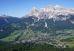
The Falzarego Pass (Italian : Passo di Falzarego, Ladin : Jou de Fauzare) (el. 2,105 m) is a high mountain pass in the province of Belluno in Italy.

Contents

It mainly connects the territory of Agordo and Cortina d'Ampezzo. From the pass, starts also SP24 (Strada provinciale del Passo di Valparola) directed northbound to Val Badia passing below Sass de Stria and through Valparola Pass.

A gondola rises to the Lagazuoi (2,762 m), which was the object of heavy combat and mine warfare in World War I. The tunnel that the Italians built under the Austro-Hungarian lines is open to the public.

Etymology

The name probably derives from Ladin fóuze, scythe. [1] A popular folk etymology claims that it supposedly comes instead from Faúza Règo, which would mean false king in Ladin, but is not attested in this form in the language. It would refer to the king of the Fanes, who was supposedly turned to stone for betraying his people.

Sports

The pass is occasionally in the program of the Giro d'Italia race.

The Falzarego Pass is one of the Dolomites mountain passes riders cross in the annual Maratona dles Dolomites single-day bicycle race. As riders proceed directly from the Falzarego Pass to the higher Valparola Pass the Falzarego is not counted as one of the canonical seven Maratona passes.

See also

Related Research Articles

<span class="mw-page-title-main">Dolomites</span> Mountain range in the Italian Alps

The Dolomites also known as the Dolomite Mountains, Dolomite Alps or Dolomitic Alps, are a mountain range in northeastern Italy. They form part of the Southern Limestone Alps and extend from the River Adige in the west to the Piave Valley in the east. The northern and southern borders are defined by the Puster Valley and the Sugana Valley. The Dolomites are in the regions of Veneto, Trentino-Alto Adige/Südtirol and Friuli Venezia Giulia, covering an area shared between the provinces of Belluno, Vicenza, Verona, Trentino, South Tyrol, Udine and Pordenone.

<span class="mw-page-title-main">Cortina d'Ampezzo</span> Town and comune in Veneto, Italy

Cortina d'Ampezzo is a town and comune in the heart of the southern (Dolomitic) Alps in the province of Belluno, in the Veneto region of Northern Italy. Situated on the Boite river, in an alpine valley, it is an upscale summer and winter sport resort known for its skiing trails, scenery, accommodation, shops and après-ski scene, and for its jet set and Italian aristocratic crowd.

<span class="mw-page-title-main">Trentino</span> Autonomous province of Italy

Trentino, officially the autonomous province of Trento, is an autonomous province of Italy in the country's far north. Trentino and South Tyrol constitute the region of Trentino-Alto Adige/Südtirol, an autonomous region under the constitution. The province is composed of 166 comuni. Its capital is the city of Trento (Trent). The province covers an area of more than 6,000 km2 (2,300 sq mi), with a total population of 541,098 in 2019. Trentino is renowned for its mountains, such as the Dolomites, which are part of the Alps.

<span class="mw-page-title-main">Alta Via 1</span> High altitude footpath, Dolomites

Alta Via 1 is a 125-kilometre-long high-level public footpath which runs through the eastern Dolomites in Italy. It is also known as the Dolomite High Route 1. It passes through some of the finest scenery in the Dolomites. The path runs south from Pragser Wildsee, near Toblach, to Belluno. Prags can be accessed by bus, and Belluno has both train and bus services.

<span class="mw-page-title-main">Pordoi Pass</span>

Pordoi is a pass in the Dolomites in the Alps, located between the Sella group in the north and the Marmolada group in the south. The pass is at an altitude of 2,239 m (7,346 ft), and the road crossing the pass connects Arabba with Canazei. It is the second highest surfaced road traversing a pass in the Dolomites, after the Sella Pass.

<span class="mw-page-title-main">Badia, South Tyrol</span> Comune in Trentino-Alto Adige/Südtirol, Italy

Badia is a comune (municipality) in South Tyrol, northern Italy. It is one of the five Ladin-speaking communities of the Val Badia which is part of the Ladinia region.

<span class="mw-page-title-main">Alta Badia</span>

Alta Badia is a ski resort in the Dolomites of northern Italy, in the upper part of the Val Badia in South Tyrol. It is part of the Dolomiti Superski ski area. It is included in the territories of the municipalities of Corvara, Badia, and La Val. Centered on Corvara, the extended area's lift-served summit elevation is 2,550 m (8,366 ft) on the Sella group, with an overall vertical drop of 1,226 m (4,022 ft) to Pedraces. The native language of the majority of the locals is Ladin.

<span class="mw-page-title-main">Campolongo Pass</span>

The Campolongo Pass (1875 m) is a high mountain pass in the Dolomites in South Tyrol in Italy.

<span class="mw-page-title-main">Giau Pass</span> Mountain pass in the Dolomites, Italy

The Giau Pass (el. 2236 m.) is a high mountain pass in the Dolomites in the province of Belluno in Italy. It connects Cortina d'Ampezzo with Colle Santa Lucia and Selva di Cadore.

<span class="mw-page-title-main">Gardena Pass</span>

Gardena Pass is a high mountain pass in the Dolomites of the South Tyrol in northeast Italy.

<span class="mw-page-title-main">Sella Pass</span> Mountain pass in Italy

The Sella Pass (2218 m) is a high mountain pass between the provinces of Trentino and South Tyrol in Italy.

<span class="mw-page-title-main">Valparola Pass</span>

The Valparola Pass is a high mountain pass in the Dolomites in the province of Belluno in Italy.

<span class="mw-page-title-main">Cristallo (mountain)</span> Mountain range in the Dolomites

Cristallo is a mountain massif in the Italian Dolomites, northeast of Cortina d'Ampezzo, in the province of Belluno, Veneto, northern Italy. It is a long, indented ridge with four summits higher than 3,000 metres. The mountain range is part of the Ampezzo Dolomites Natural Park.

<span class="mw-page-title-main">Maratona dles Dolomites</span> Road bicycle race in Italy

The Maratona dles Dolomites, is an annual single-day road bicycle race covering seven mountain passes in the Dolomites. Open to amateur cyclists, the Maratona—with 9,000 riders from over 70 nations—is one of the biggest Italian Granfondo bicycle races. National Geographic described it as "one of the biggest, most passionate, and most chaotic bike races on Earth."

<span class="mw-page-title-main">Cinque Torri</span> Mountain in Italy

Cinque Torri comprise a small rock formation belonging to Nuvolao group in the Dolomiti Ampezzane north-west of San Vito di Cadore and south-west of Cortina d'Ampezzo.

<span class="mw-page-title-main">Dolomites Gold Cup Race</span> Former automobile race held in Italy

The Dolomites Gold Cup Race was a car race on public roads open to traffic, which was run in the Dolomite Mountains of northern Italy for ten years from 1947 to 1956. It took place along an anti-clockwise circuit that was 304 km long and usually took about 3 to 4 hours to complete the one lap that made up the race distance, with the start and finish in the town of Cortina d'Ampezzo. The circuit went through many Italian towns, and it had nearly 2,000 meters of elevation change- more than 6 1/2 times that of the Nürburgring and the Isle of Man TT track.

<span class="mw-page-title-main">Forte Tre Sassi</span> Historic Austro-Hungarian fortress

Tre Sassi fort is a fortress and museum on the road to the Passo di Valparola, within the comune of Cortina d'Ampezzo in the southern (Dolomitic) Alps of the Veneto region of Northern Italy. Hidden between the Ampezzo valley and the high Val Badia, it was built by Austrians between 1897 and 1901 as a fortification against attack from the Italians on the Falzàrego and Valparo. During World War I it was a favorite target for the Italians, and the fort was destroyed as there was inadequate artillery to defend it.

<span class="mw-page-title-main">Sorapiss</span> Mountain ridge in the Dolomites

Sorapiss, also referred to as Sorapis or Punta Sorapiss, is a mountain in the Dolomites within the Veneto region of northern Italy. Situated in the comune of Cortina d'Ampezzo, it has an elevation of 3,205 metres (10,515 ft). In its vicinity is a mountain pass of the same name, as well as Sorapiss Lake, at the foot of the mountain. The mountain range is part of the Ampezzo Dolomites Natural Park.

<span class="mw-page-title-main">Kingdom of Fanes</span>

The Kingdom of Fanes is the national epic of the Ladin people in the Dolomites and the most important part of the Ladin literature. Originally an epic cycle, today it is known through the work of Karl Felix Wolff in 1932, gathered in his book Dolomitensagen. Until that time, this material was transmitted orally among the Ladin people. This legend is part of the larger corpus of the South Tyrolean sagas, whose protagonists are the Fanes themselves.

<span class="mw-page-title-main">White War</span> High-altitude mountain warfare in the Italian front of World War I

The White War is the name given to the fighting in the high-altitude Alpine sector of the Italian front during the First World War, principally in the Dolomites, the Ortles-Cevedale Alps and the Adamello-Presanella Alps. More than two-thirds of this conflict zone lies at an altitude above 2,000m, rising to 3905m at Mount Ortler. In 1917 New York World correspondent E. Alexander Powell wrote: “On no front, not on the sun-scorched plains of Mesopotamia, nor in the frozen Mazurian marshes, nor in the blood-soaked mud of Flanders, does the fighting man lead so arduous an existence as up here on the roof of the world.”

References

  1. Russo, Lorenza (1995). Palldii nomi di monti. La Cooperativa di Cortina. ISBN   8887174113.