Croda da Lago

Last updated
Croda da Lago
Croda da Lago nord.jpg
Highest point
Peak Cima d'Ambrizzola
Elevation 2,715 m (8,907 ft)
Coordinates 46°29′N12°6′E / 46.483°N 12.100°E / 46.483; 12.100 Coordinates: 46°29′N12°6′E / 46.483°N 12.100°E / 46.483; 12.100
Geography
Alps location map.png
Red triangle with thick white border.svg
Croda da Lago
Location in the Alps
Location Veneto, Italy
Parent range Dolomites

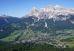
Croda da Lago is a small mountain chain in the central Dolomites in Veneto, northern Italy, just east of the Giau Pass. The highest peak of the group, the Cima d'Ambrizzola has an elevation of 2,715 metres. The range is very popular with hikers and mountain cyclists. [1]

Main Summits

    1. Cima Ambrizzola, 2715 m
    2. Croda da Lago, 2701 m
    3. Cima de Lastoi, 2657 m
    4. Monte Cernera, 2657 m
    5. Becco di Mezzodì, 2603 m

Related Research Articles

Presanella Mountain in Italy

Presanella is a mountain in the Adamello-Presanella range of the Italian Alps of northern Italy. Presanella has an elevation of 3,558 meters and is located in the Adamello Brenta National Park within the Trentino province of Italy.

Giau Pass

The Giau Pass (el. 2236 m.) is a high mountain pass in the Dolomites in the province of Belluno in Italy. It connects Cortina d'Ampezzo with Colle Santa Lucia and Selva di Cadore.

Tre Cime di Lavaredo Mountains in Italy

The Tre Cime di Lavaredo, also called the Drei Zinnen, are three distinctive battlement-like peaks, in the Sexten Dolomites of northeastern Italy. They are probably one of the best-known mountain groups in the Alps. The three peaks, from east to west, are:

Rosengarten group

The Rosengarten group is a massif in the Dolomites of northern Italy. It is located between the Tierser Tal and Eggental in South Tyrol and the Fassa Valley in Trentino.

Piz Medel Mountain in Switzerland

Piz Medel is a mountain in the Lepontine Alps, located on the border between the cantons of Ticino and Graubünden. At 3,210 metres (10,531 ft) above sea level it is the highest summit on the chain between Lukmanier Pass and Crap la Crusch. The mountain overlooks the Greina, an important pass connecting the cantons of Graubünden and Ticino.

Cima da Lägh is a mountain in the Oberhalbstein Range of the Alps, located on the border between Italy and Switzerland. On its southern side it overlooks the Val Bregaglia.

Cima della Bondasca Mountain in Switzerland

The Cima della Bondasca or Pizzo del Ferro centrale is a mountain in the Bregaglia Range (Alps), located on the border between Italy and Switzerland. Its summit is the triple watershed between Valle del Ferro (Italy), Val Bondasca and Val d'Albigna (Switzerland).

Cima di Castello Mountain in Switzerland

Cima di Castello is a mountain of the Bregaglia Range, located on the border between Italy and Switzerland. With a height of 3,379 metres (11,086 ft) above sea level, it is the second highest mountain in the Bregaglia Range. Its summit lies between the valleys of the Albigna and Forno Glacier and the valley of Val Mello.

Scima da Saoseo Mountain in Switzerland

The Scima da Saoseo is a mountain of the Livigno Alps, located on the border between Italy and Switzerland. It lies west of Cima Viola. On its west (Swiss) side it overlooks Lago di Saoseo.

Hinterer Seelenkogel Mountain in Italy

The Hinterer Seelenkogel is a mountain in the Gurgler Kamm group of the Ötztal Alps.

Cima Piazzi Mountain in Italy

Cima Piazzi, Cima de' Piazzi, del Piazzi or di Piazzi (3,439m) is the highest mountain of the Livigno Alps in Lombardy, Italy. It has a summit elevation of 3,439 m (11,283 ft) above sea level and is located near to the town of Bormio. It has a beautiful and imposing north face, which is covered with ice, and three long ridges, and is glaciated on all sides.

Cinque Torri Mountain in Italy

Cinque Torri comprise a small rock formation belonging to Nuvolao group in the Dolomiti Ampezzane north-west of San Vito di Cadore and south-west of Cortina d'Ampezzo.

Garda Mountains Northern Italian mountain range

The Garda Mountains, occasionally also the Garda Hills, are an extensive mountain range of the Southern Limestone Alps in northern Italy.

Cima Brenta Mountain in the Rhaetian Alps in Italy

Cima Brenta is the highest mountain in the Brenta group, a subgroup of the Rhaetian Alps in the Italian Region of Trentino-Alto Adige, with a reported height of 3,150 metres (10,330 ft). The mountain rises imposingly up between the rock towers and pinnacles of the central Brenta Group. A sharp ridge connects the mountain on its southern side to the Spallone die Massodi. The northern ridge steeply descends towards Bocca del Tuckett. Towards north west a slender couloir descends all the way from the top towards the Vedretta di Brenta Inferiore, the mountain's 'lower' glacier. Large shouldering formations extend towards the west, culminating in the Cima Mandrone and the Punti di Campiglio, and northwest, culminating in the Cima Massari. Above these formations a glacier, the Vedretta di Brenta Superiore, the 'upper' glacier descends the mountain, being cut off by a vertical precipice over the Vedretta di Brenta Inferiore. On the eastern side the mountain rises up with an imposing 700-meter high vertical rock face with on its left side a distinct orange-like color. Above this lies a horizontal ledge, the Cengia Garbari, on which the Via delle Bocchette Alte proceeds. The actual mountain has two summits that are some 250 meters apart, of which the eastern top reaches the highest altitude. The glaciers, vedrette, have been shrinking steadily over the last decades as a result of climate change. The historical name Cima Brenta was not always as evident as it is today. The toponymy of these parts was largely established by Nepomuceno Bolognini. The mountain, somehow, became a place where nationalistic sentiments were demonstrated. In 1889 the Austro-Hungarian authorities decided to rename the mountain to Kaiser Franz Josef-Spitze. The name never caught on -not even in German literature. When the occasion occurred to raise a large yellow-black imperial flag on the summit, fully visible from Val Rendena as well as from Molveno, local guide Giuseppe 'Bepaccia' Zeni and some companions climbed the mountain to take it down. In 1912, on the other hand, the Italian flag was hoisted by irredentists on Cima Brenta, deliberately just before the first snow fall, so that the flag remained visible until the next summer. Around 1953 electricity company SISM, predecessor of ENEL proposed to build a cable car trajectory from Molveno to the top of Cima Brenta. The plans were abandoned and in 1967 the mountain became protected as part of the Parco Naturale Adamello-Brenta.

Hohe Gaisl Mountain in Italy

Hohe Gaisl, (3,146m) is a mountain in the northern Dolomites, on the border of South Tyrol and Veneto, in northern Italy, located between the Braies Valley and the Val di Landro.

Becco di Mezzodì Mountain in Italy

Becco di Mezzodì (2,603m) is a mountain of the Croda da Lago chain, a small mountain group in the central Dolomites. It is located above the resort of Cortina d'Ampezzo in Belluno, northern Italy. The mountain's name means Midday Peak in the local dialect, as the sun appears directly above the peak at midday from Cortina. The climb usually starts from the Refuge Croda da Lago on the road to the Giau Pass. Climbing gear and slings are required.

Cima Bocche Mountain in Italy

Cima Bocche is a mountain of the Dolomites in Trentino, Italy. It is the highest peak of a small group that is located between the San Pellegrino Pass and the Predazzo valley. The mountain has a vertical 400m north face, whereas its southern slopes are far more gentle, making it an easy climb from this direction. Despite being geographically part of the Dolomites, the mountain is not geologically part of the range, as it is formed of Porphyry rather than dolomite.

Cima Fontanaccia Mountain in the Apennines

Cima Fontanaccia is a 1153 metres high mountain in the Ligurian Apennines, in Italy.

Cima Altemberg Mountain in Italy

The Altemberg is a mountain in the Pennine Alps of north-western Italy; with an elevation of 2,395 m (7,858 ft) is the highest peak of the Alpi Cusiane.

Cima di Cece Mountain in Italy

Cima di Cece is a peak in the Fiemme Mountains in Trentino, Italy. It is the highest peak of the Lagorai range, and lies south of the village of Predazzo. It is usually climbed from its northern side, from the Malga Di Valmaggiore mountain barn at 1,620 m, where a simple hike is required to reach the summit.

References

  1. "Croda da Lago - summitpost". summitpost.org. Retrieved 9 February 2015.