Transport in Guernsey

Last updated

Guernsey is the second largest of the Channel Islands. It is part of the Common Travel Area, allowing passport-free travel to and from the United Kingdom, Jersey, the Isle of Man or Ireland. Travel to the Schengen Area of Europe requires a passport or an EU national identity document and from 2025 entry to the Schengen Area will require compliance with the European Travel Information and Authorisation System (ETIAS) and non EU citizens may need a visa. Entry from the Schengen Area requires a passport, except when a concession is in place for short trips to Guernsey, when an EU ID card is acceptable.

Contents

This article includes some references to Alderney, Herm and Sark, which are part of the Bailiwick of Guernsey.

Road transport

Ruette Tranquille sign Guernsey July 2010 Ruette Tranquille.jpg
Ruette Tranquille sign

Traffic in Guernsey drives on the left. Roads are generally narrow, with an all-island speed limit of 35 miles per hour (56 km/h), however lower speed limits apply on certain roads. There are seasonal speed limit changes which sees the speed limit of 35 miles per hour reduced to 25 miles per hour (40 km/h) on some coast roads during the summer months. [1]

Motor tax was abolished in Guernsey from 1 January 2008. Vehicle registration plates in Guernsey carry between one and five numerals only; the international identification sticker/plate is "GBG".

Most road markings are the same as the UK, with the exception of:

Buses

CT Plus Guernsey Bus CT Plus Guernsey Bus.jpg
CT Plus Guernsey Bus
Former Guernsey bus - now preserved UK Guernsey tour bus 75 Albion Nimbus JNP 590C Metrocentre rally 2009 pic 1.JPG
Former Guernsey bus - now preserved UK

Bus services are operated by CT Plus Guernsey on behalf of the Environment Department of the States of Guernsey (the island's government). CT Plus was acquired by Tower Transit, owned by Kelsian Group, in September 2022 following the administration and subsequent collapse of CT Plus's parent company HCT Group. [2] [3] The service is currently branded as Buses.gg, with all service routes operating to and from the Town Terminus Bus Station in St Peter Port.

Vehicles used are based on buses used in the UK but with a slightly narrower construction, to allow them to circulate on the island's narrow roads, with the legal limit of 2.31 meters (7' 6¾"). Several narrower (and shorter) StreetVibe buses arrived from May 2017 onwards. [4]

Most bus fares have a fixed price of £1.50 per journey, [5] however fares also alternate depending on service types. Payments can only be made by contactless or by 'Puffin Pass', these passes come in different varieties covering Pay As You Go which is reduced to 75p, unlimited travel for a day or more, student passes for ages 5-16, concession cards for ages 65+ and family travel passes. 1.65m journeys were taken in 2016. [6] Bus usage increased year on year reaching a record high of 2 million journeys in 2019. However, usage subsequently fell due to the COVID-19 pandemic. In March 2023, monthly usage was higher than pre-pandemic levels for the first time. [7]

Private hire coaches and coach tours are available primarily from Island Coachways, and other companies.

Cycling

Cycling is encouraged in Guernsey and there are various cycle routes and paths on the island including a dedicated cycle route that runs along the island's east coast between Bulwer Avenue in St Sampson and the Weighbridge Roundabout in St Peter Port, with shared pedestrian usage. There are other routes in the north of the island. [8]

Ruettes Tranquilles provide safer and more pleasant cycle-friendly roads. The States of Guernsey provides details of cycling laws and recommendations for safety as well as details of cycle hire businesses.

Cycling is common on Sark due to the island's ban on cars. Bicycles can be hired from local bike hire companies.

Taxis

Guernsey has a regulated, licensed taxi service based at ranks in central St Peter Port and at Guernsey Airport. Taxis can also be called or phoned.

Accessible taxis capable of transporting a wheelchair passenger and with improved lighting to assist people who may have a visual impairment are available.

Visit Guernsey website has a list of taxi operators.

Carbon output

With effect from 2030 the sale of new combustion engine cars will be banned, this forms part of the net-zero climate change plan. [9]

Air transport

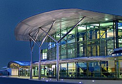
Guernsey Airport is located 3 miles (5 km) south-west of St Peter Port, the island's capital. It has direct flights throughout the year to many United Kingdom and International destinations. [10]

Alderney Airport has regular scheduled flights to Southampton and Guernsey

Both airports have private aircraft facilities and annual air rallies.

Maritime transport

Condor Ferries operate services to Poole and Portsmouth in England, St Malo in France, and to Jersey. Condor Ferries became the main operator to the UK following the closure of British Channel Island Ferries in 1994. Previously Sealink (and its railway ferries predecessors) had been the main operator for many decades. Freight goes on a traditional ferry via Portsmouth.

The French company Manche Îles Express operates a summer passenger-only ferry service between Guernsey and three small ports in Normandy, France: Barneville-Carteret, Diélette and Granville. Not every port is served daily.

The Isle of Sark Shipping Company operates small ferries to Sark. The service takes up to 45 minutes for the 9 miles (14 km) crossing.

The Trident Charter Company operates small ferries to Herm all year round. [11]

The Alderney Ferry Service operates services between Guernsey Alderney and Cherbourg during summer months. [12] The company has announced it will introduce year-round operations, along with a new ferry towards the end of August 2024. [13]

Channel Seaways operates freight routes between Poole, Jersey, Guernsey and Alderney.

Railways

Alderney

The Alderney Railway provides a rail link of approximately two miles, with a regular timetabled service during the summer months and at seasonal festivals including Easter and Christmas. It is now the only working railway on the Channel Islands to provide a public transport link. It is also one of the oldest railways in the British Isles, dating from 1847, and carried Queen Victoria and Prince Albert as the first 'official' passengers in 1857. [14]

There is also a 7+14 in (184 mm) gauge miniature railway on Alderney, which operates during the summer months. [15]

Guernsey

There are currently no railway services on Guernsey. The Guernsey Railway, which was virtually an electric tramway, and which began working on 20 February 1892, was abandoned on 9 June 1934. It replaced an earlier transport system which was worked by steam, and was named the Guernsey Steam Tramway. The latter began service on 6 June 1879 with six locomotives. [16]

See also

Related Research Articles

<span class="mw-page-title-main">Channel Islands</span> Archipelago in the English Channel

The Channel Islands are an archipelago in the English Channel, off the French coast of Normandy. They are divided into two Crown Dependencies: the Bailiwick of Jersey, which is the largest of the islands; and the Bailiwick of Guernsey, consisting of Guernsey, Alderney, Sark, Herm and some smaller islands. Historically, they are the remnants of the Duchy of Normandy. Although they are not part of the United Kingdom, the UK is responsible for the defence and international relations of the islands as it is for the other Crown Dependency, the Isle of Man, and the British Overseas Territories. The Crown Dependencies are neither members of the Commonwealth of Nations, nor part of the European Union. They have a total population of about 171,916, and the bailiwicks' capitals, Saint Helier and Saint Peter Port, have populations of 33,500 and 18,207 respectively.

<span class="mw-page-title-main">Guernsey</span> Island in the English Channel off the coast of Normandy

Guernsey is the second-largest island in the Channel Islands, located 27 miles (43 km) west of the Cotentin Peninsula, Normandy. It is the largest island in the Bailiwick of Guernsey, which includes five other inhabited islands and many small islets and rocks. The Bailiwick has a population of 63,950, the vast majority of whom live on Guernsey, and the island has a land area of 24 square miles (62 km2).

<span class="mw-page-title-main">Transport in Hong Kong</span>

Hong Kong has a highly developed transport network, encompassing both public and private transport. Based on Hong Kong Government's Travel Characteristics Survey, over 90% of daily journeys are on public transport, the highest rate in the world. However, in 2014 the Transport Advisory Committee, which advises the Government on transportation issues, issued a report on the much-worsened congestion problem in Hong Kong and pointed at the excessive growth of private cars during the past 10–15 years.

There are a number of transport services around the Isle of Man, mostly consisting of paved roads, public transport, rail services, sea ports and an airport.

<span class="mw-page-title-main">Transport in Jersey</span>

Transport in Jersey is primarily through the motor vehicle. The island, which is the largest of the Channel Islands has 124,737 registered vehicles (2016). The island is committed to combatting climate change, having declared a climate emergency, and policy is focused on reducing dependence on the car. The island has a cycle network and bus service. The primary modes of transport for leaving the island are by air or sea.

Transport in Saint Christopher and Nevis includes normal road traffic, public buses, taxis, ferries, airports, and one railway.

<span class="mw-page-title-main">Transport in the United Kingdom</span> Overview of transport in the United Kingdom

Transport in the United Kingdom is highly facilitated by road, rail, air and water networks. Transport is a devolved matter with each of the countries of the United Kingdom having separate systems under separate governments. A radial road network totals 29,145 miles (46,904 km) of main roads, 2,173 miles (3,497 km) of motorways and 213,750 miles (344,000 km) of paved roads.

<span class="mw-page-title-main">Transport in Anguilla</span>

One of the British overseas territories, the Caribbean island of Anguilla measures only 16 miles (26 km) long by 3 miles (4.8 km) wide, so transport is simpler than in many countries. There is no public transport, such as bus or rail systems, since there isn't enough need. However, Anguilla's roads are better maintained than on many Caribbean islands.

<span class="mw-page-title-main">Transport in Bermuda</span>

Bermuda consists of several islands with an area of 53.2 km2 (20.5 sq mi) with 447 km (278 mi) of paved roads — 225 km (140 mi) of which are public roads and 222 km (138 mi) are private paved roads. A former railway track has been converted into a walking trail. There are also two marine ports, and an airport, the L.F. Wade International Airport, located at the former U.S. Naval Air Station. A causeway links Hamilton Parish, Bermuda to St. George's and the airport.

<span class="mw-page-title-main">Herm</span> Island in the Bailiwick of Guernsey in the Channel Islands

Herm is one of the Channel Islands and part of the Parish of St Peter Port in the Bailiwick of Guernsey. It is located in the English Channel, north-west of France and south of England. It is 2,183 m (7,162 ft) long and under 873 metres (2,864 ft) wide; oriented north–south, with several stretches of sand along its northern coast. The much larger island of Guernsey lies to the west, Jersey lies to the south-east, and the smaller island of Jethou is just off the south-west coast.

<span class="mw-page-title-main">Sark</span> Jurisdiction of the Bailiwick of Guernsey

Sark is an island, part of the Channel Islands in the southwestern English Channel, off the coast of Normandy, France. It is a royal fief, which forms part of the Bailiwick of Guernsey, with its own set of laws based on Norman law and its own parliament. It has a population of about 500. Sark has an area of 2.10 square miles (5.44 km2). Little Sark is a peninsula joined by a natural but high and very narrow isthmus to the rest of Sark Island.

<span class="mw-page-title-main">Alderney</span> Jurisdiction of the Bailiwick of Guernsey

Alderney is the northernmost of the inhabited Channel Islands. It is part of the Bailiwick of Guernsey, a British Crown dependency. It is 3 miles (5 km) long and 1+12 miles (2.4 km) wide.

<span class="mw-page-title-main">Bailiwick of Guernsey</span> British Crown Dependency consisting of several islands of the Channel Islands

The Bailiwick of Guernsey is a self-governing British Crown Dependency off the coast of Normandy, France, comprising several of the Channel Islands. It has a total land area of 78 square kilometres (30 sq mi) and an estimated total population of 67,334.

<span class="mw-page-title-main">Saint Anne, Alderney</span> Town in Alderney

Saint Anne is the main town of Alderney in the Channel Islands.

<span class="mw-page-title-main">Transport in Wales</span> Overview of the transportation system in Wales

Transport in Wales is heavily influenced by the country's geography. Wales is predominantly hilly or mountainous, and the main settlements lie on the coasts of north and south Wales, while mid Wales and west Wales are lightly populated. The main transport corridors are east–west routes, many continuing eastwards into England.

<span class="mw-page-title-main">Trident Charter Company</span> Shipping company based in Guernsey

The Trident Charter Company is a shipping firm based in Guernsey, Channel Islands. The company operates the ferry route between Guernsey and Herm using the Herm Trident V, a twin Iveco diesel-powered catamaran with a steel hull. The ferry sails daily from St Peter Port Harbour, and docks at either Herm Harbour or Rosaire Steps, depending on the state of the tide. The crossing takes between 15 and 20 minutes depending on sea-state and tide.

<span class="mw-page-title-main">Outline of Guernsey</span> Overview of and topical guide to Guernsey

The following outline is provided as an overview of and topical guide to Guernsey:

The Alderney Steam Packet Company provided shipping services between Alderney and Sark, Guernsey and Cherbourg from 1897 to 1931.

Kelsian Group Limited, formerly SeaLink Travel Group, is an Australian public company that operates transport services in Australia, the Channel Islands nations of Guernsey and Jersey and Singapore.

<span class="mw-page-title-main">Vehicle registration plates of the Bailiwick of Guernsey</span> Guernsey number plates

Vehicle registration plates, commonly referred to as number plates, are the mandatory numeric or alphanumeric plates used to display the registration mark of a vehicle. The Crown dependency of Guernsey is outside the United Kingdom and the European Union, and its islands have registration marks that are different from those used in the UK. The international vehicle registration code for Guernsey is GBG.

References

  1. "Seasonal speed limit and traffic management changes - States of Guernsey".
  2. "Islands Bus Acquisition Unlocks Growth Potential for Tower Transit". Tower Transit (Kelsian Group). October 2022.
  3. "HCT Group enters administration". Coach and Bus Week magazine. 4 October 2022.
  4. "Narrower buses from May". Guernsey Press. 12 April 2017.
  5. "Bus fare increases to go ahead". BBC UK. 26 September 2023.
  6. "Number of bus passengers reaches record high in 2016". Guernsey Press. 12 January 2017.
  7. "Guernsey monthly bus use increases for first time since pandemic". BBC News. 23 April 2023. Retrieved 28 April 2023.
  8. "Walking & Cycling in Guernsey - States of Guernsey".
  9. "Island follows UK in cutting combustion". Guernsey press. 25 November 2020.
  10. "Destinations". www.airport.gg. Retrieved 29 May 2024.
  11. "Travel Trident - Daily Service to Herm Island". www.traveltrident.com. Retrieved 30 July 2024.
  12. Services, Alderney Ferry. "Alderney Ferry Services". Alderney Ferry Services.
  13. "Island to introduce year-round ferry service". 30 July 2024.
  14. See references at the Island tourist website.
  15. See miniature railway webpage here.
  16. Notes on the Railway taken from The Railway Magazine, September 1934 edition