Saint Sampson, Guernsey

Last updated • 3 min readFrom Wikipedia, The Free Encyclopedia

Saint Sampson
Guernsey July 2011 275, Saint Sampson harbour.jpg
Flag of Saint Sampson Parish, Bailiwick of Guernsey.gif
Parish of Saint Sampson in Guernsey.svg
Location of Saint Sampson in Guernsey
Crown Dependency Guernsey, Channel Islands
Government
   Electoral district St Sampson
Area
  Total6.0 km2 (2.3 sq mi)
Population
 (2019)
  Total8,966
  Density1,500/km2 (3,900/sq mi)
Time zone GMT
  Summer (DST) UTC+01

St Sampson (Guernésiais: Saint Samsaon) is a parish of Guernsey, an island in the Bailiwick of Guernsey, directly north of St Peter Port. It is on the north-west and north-east coasts of the island and is split into two sections, intersected by Vale.

Contents

The parish has a population of 8,966.[ citation needed ] Its residents are known as roînes (the Guernésiais for frogs).

What is currently the northern boundary of the parish originally ran along the south coast of Le Braye du Valle, a tidal channel that made the northern extremity of Guernsey, Le Clos du Valle, a tidal island. La Braye du Valle was drained and reclaimed in 1806 by the British Government as a defence measure. The eastern end of the former channel became the town and harbour (from 1820) of St. Sampson's, now the second biggest port in Guernsey. The western end of La Braye is now Le Grand Havre. The roadway called The Bridge across the end of the harbour at St. Sampson's recalls the bridge that formerly linked the two parts of Guernsey at high tide.

Historical facts

St Sampson Harbour Guernsey July 2011 276, Saint Sampson harbour.jpg
St Sampson Harbour

The parish church of St. Sampson claims to be the oldest of Guernsey's parish churches, standing on the coast where Samson of Dol arrived from Brittany in the sixth century, intending to convert Islanders to Christianity. The church was consecrated on 22 May 1111 by Antony Susar the Bishop of Coutances. [1] :126 The ceremony was witnessed by notable figures of the time including Julien De Prade, the governor of the island, Richard D'Anneville, son of Sampson D'Anneville, and other dignitaries. [2]

St Sampson is the Patron Saint of Guernsey.

In 1814 there were 125 dwellings, housing 788 residents of Saint Sampson. The parish providing 1/13th of all taxes collected in Guernsey. [1] :126

Harbour facilities improved as trade using the harbour increased. In 1822, 7,000 tons of granite cobbles were exported in 90 ships. By 1836 annual exports had increased to 57,584 tons. In 1841 the south quay was completed and by 1851, 542 ships were using the harbour each year. By 1861 granite exports had risen to 142,866 tons on 737 ships. [3] Today the harbour is used for non-containerised freight, including liquid and gas fuel.

Shipbuilding took place in Saint Sampson, from local trading craft to a tea clipper called Golden Spur and a steamship, the Commerce built in 1874. The Lydia, a local 173 ton brig, sailed in March 1853 from Saint Sampson to Adelaide with 60 emigrants, it took 132 days. [3]

Trams used to run from Saint Sampson to Saint Peter Port from 1879, taking over from a horse-drawn bus that had started operation in 1837. Originally the trams were steam powered, changing to electric in 1891 and continuing in service until 1934. [3]

Features

Politics

Prior to the States decision to introduce Island Wide Voting St Sampson comprised the whole of the St Sampson administrative division

In the 2016 Guernsey general election there was a 3,509 or 78% turnout to elect six Deputies. Those elected (in order of votes received) being Lyndon Trott , Paul Le Pelley, Jennifer Merrett, Gavin St Pier, Jane Stephens and Carl Meerveld.

In literature

Toilers of the Sea (1866) by French author Victor Hugo is set in the Saint Sampson surroundings.

Related Research Articles

<span class="mw-page-title-main">Guernsey</span> Island in the English Channel off the coast of Normandy

Guernsey is the second-largest island in the Channel Islands, located 27 miles (43 km) west of the Cotentin Peninsula, Normandy. It is the largest island in the Bailiwick of Guernsey, which includes five other inhabited islands and many small islets and rocks. The Bailiwick has a population of 63,950, the vast majority of whom live on Guernsey, and the island has a land area of 24 square miles (62 km2).

<span class="mw-page-title-main">History of Guernsey</span>

The history of Guernsey stretches back with evidence of Neolithic occupation, followed by Roman occupation. Christianity was brought to Guernsey by St Sampson.

<span class="mw-page-title-main">Saint Peter Port</span> Capital of the island of Guernsey

St. Peter Port is a town and one of the ten parishes on the island of Guernsey in the Channel Islands. It is the capital of the Bailiwick of Guernsey as well as the main port. The population in 2019 was 18,958.

<span class="mw-page-title-main">Fort Grey</span>

Fort Grey, colloquially known as the "cup and saucer", is a Martello tower located on a tidal rock in Rocquaine Bay in Saint Peter, Guernsey on the west coast of the island.

<span class="mw-page-title-main">Saint Martin, Guernsey</span> Parish

Saint Martin is a parish in Guernsey, The Channel Islands. The islands lie in the English Channel between Great Britain and France.

<span class="mw-page-title-main">Saint Andrew, Guernsey</span> Parish

Saint Andrew is located in the centre of Guernsey and as such is the only parish on the island to be landlocked.

<span class="mw-page-title-main">Saint Peter, Guernsey</span> Parish

St Peter's, known officially as Saint Pierre du Bois, is a parish in Guernsey. It is the centre for the Guernsey Western Parishes which includes Torteval, St Saviour's and the Forest.

Braye Harbour is the main harbour on the north side of the island of Alderney, in the Channel Islands, a dependency of the British Crown. A 3,000 feet (910 m) breakwater was built by the Admiralty to protect the Navy in the 19th century shelters Braye Harbour. The harbour faces out onto the Swinge, which is part of the English Channel, and it is at Braye that most of the island's freight comes in. Braye is more or less a suburb of St Anne, the island capital; the centre of St Anne lies approximately 1 mile from the harbour.
<span class="mw-page-title-main">Vale, Guernsey</span> Parish

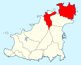
Vale is one of the ten parishes of Guernsey in the Bailiwick of Guernsey, Channel Islands.
<span class="mw-page-title-main">Castel, Guernsey</span> Parish in Guernsey

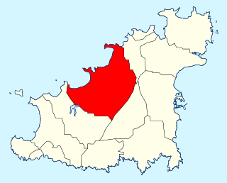
Castel /kætel/ is the largest parish in Guernsey in terms of area.

<span class="mw-page-title-main">Saint Saviour, Guernsey</span> Parish

St Saviour is one of the ten parishes of Guernsey. It is situated on the west coast of the island, west of the parish of Castel, east of St Pierre du Bois, and south of Perelle bay.

St. Michel du Valle is the parish church of Vale, Guernsey.
<span class="mw-page-title-main">Houmets</span> Islands east of Guernsey in the Channel Islands

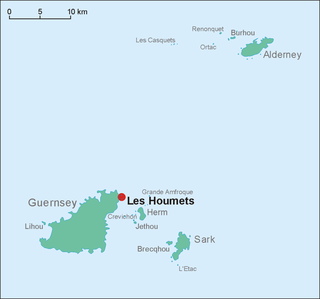
Les Houmets are to the east of Guernsey in the Channel Islands. Their name derives from a diminutive of hou, a Norman/Guernésiais word meaning islets. They are tidal islands.
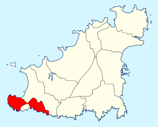
<span class="mw-page-title-main">Torteval, Guernsey</span> Parish

Torteval is the smallest of the ten parishes of Guernsey, one of the western parishes. Its name comes from the Guernésiais words for "twisting valley". The parish is split in two by the parish of St. Pierre du Bois, with the part in the east known as Torteval. The detached peninsula to the west is named Pleinmont-Torteval. It includes the westernmost point in Guernsey, and a nature reserve. The reserve, designed for birds in the 1970s, was to be redeveloped for the Diamond Jubilee of Queen Elizabeth II in 2012.

<span class="mw-page-title-main">Guernsey loophole towers</span>

The British built 15 Guernsey loophole towers at various points along the coast of Guernsey between August 1778 and March 1779 to deter possible French attacks after France had declared itself an ally of the Americans in the American Revolutionary War. Towards the start of the Napoleonic Wars several towers received additional reinforcement in the form of batteries at their bases. Today, 12 towers still survive, three having been destroyed at different times. Two of the survivors, Petit Bôt and Rousse, contain interpretive exhibits that the public may examine.
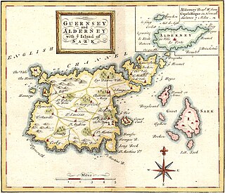
<span class="mw-page-title-main">Braye du Valle, Guernsey</span>

The Braye du Valle is the area between the main Island of Guernsey and Le Clos du Valle, which was a tidal island to the north.
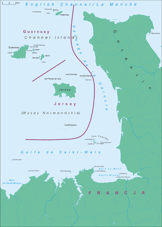
<span class="mw-page-title-main">Maritime history of the Channel Islands</span>

The Channel Islands are a group of islands off the coast of France. The largest island is Jersey, followed by Guernsey, Alderney, Sark, and a number of smaller islands, islets and rocky outcrops. The islands were separated from mainland Europe with rising sea levels in the Neolithic period; thereafter maritime activity commenced.
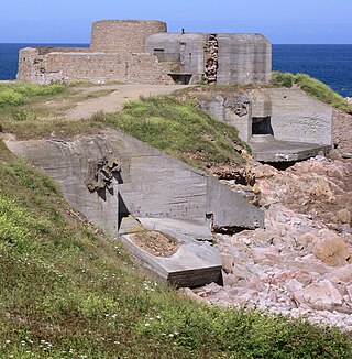
<span class="mw-page-title-main">Fortifications of Guernsey</span>

The island of Guernsey has been fortified for several thousand years, the number of defence locations and complexity of the defence increasing with time, manpower and the improvements in weapons and tactics.
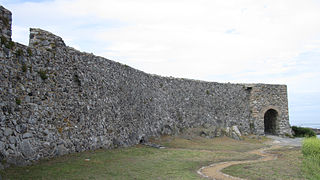
<span class="mw-page-title-main">Vale Castle, Guernsey</span>

Vale Castle, is a protected building located in the Vale, Guernsey. The original name was "Le Château St Michel", later it became "Château de Val" or "Château de Valle" and is over 1,000 years old. It defends both St. Sampson's harbour at the eastern end of the Braye du Valle, Guernsey, and Bordeaux Harbour.

References

  1. 1 2 Berry, William. The history of Guernsey from the remotest period of antiquity to the year 1814.
  2. "A treatise on the history, laws and customs of the island of Guernsey" by Warburton
  3. 1 2 3 Coysh, Victor. A short history of the town of Saint Sampson. Toucan Press 1985.
  4. "St Sampson's Parish Church, Guernsey".
  5. "The Rock Community Church, Guernsey".
  6. "Our Lady Star of the Sea, Guernsey".
  7. "Delancey Elim Church, Guernsey".
  8. "Les Capelles Methodist Church, Guernsey".
  9. "Kingdom Hall of Jehovah's Witnesses, Guernsey".
  10. "Doomsday Reloaded D-block CI-534000-5479000". BBC.
  11. "In pictures: Restoring Delancey Park and the Saumarez monument". BBC Guernsey. 12 August 2010.
  12. "St Sampson's Parish Memorial, Guernsey". Great War CI.
  13. "Delancey Park". megalithicguernsey. 15 January 2013.
  14. "L'Islet". megalithicguernsey.
  15. "PROTECTED BUILDINGS". Environment - Guernsey government.
  16. "Giving Opportunities, Guernsey".


49°28′55″N2°32′28″W / 49.48194°N 2.54111°W / 49.48194; -2.54111