Andorra is a small, landlocked country in southwestern Europe, located in the eastern Pyrenees mountain range and bordered by Spain and France. With an area of 468 km², it is the sixth smallest country in Europe and also the largest of the European microstates.
Andorra is a landlocked country in Europe, which lies between France and Spain, whose transport infrastructure is primarily road provision.

The Pan-American Highway is a network of roads stretching across the Americas and measuring about 30,000 kilometres (19,000 mi) in total length. Except for a break of approximately 106 km (66 mi) across the border between northwest Colombia and southeast Panama called the Darién Gap, the roads link almost all of the Pacific coastal countries of the Americas in a connected highway system. According to Guinness World Records, the Pan-American Highway is the world's longest "motorable road". It is only possible to cross by land between South America and Central America—the last town in Colombia to the first outpost in Panama—by a difficult and dangerous hike of at least four days through the Darién Gap, one of the rainiest areas of the planet.

La Massana is one of the seven parishes of the Principality of Andorra. It is located in the northwest of the country. La Massana is also the name of the main town of the parish. The name Massana derives from the Latin name mattianam for a variety of apple. Other settlements in the parish are Pal, Arinsal, Erts, Sispony, Anyós, L'Aldosa de la Massana, Puiol del Pui, Escàs, Els Plans, Mas de Ribafeta, Xixerella and Pui.
Puerto Rico Highway 52 (PR-52), a major toll road in Puerto Rico, is also known as Autopista Luis A. Ferré. It was formerly called Expreso Las Américas. It runs from PR-1 in southwest Río Piedras and heads south until it intersects with highway PR-2 in Ponce. At its north end, the short PR-18 continues north from PR-52 towards San Juan. This short segment is known as Expreso Las Américas, the only segment of the route still unofficially bearing this name, since PR-18 is officially named Roberto Sánchez Vilella Expressway. The combined route of PR-18 and PR-52 runs concurrent with the unsigned Interstate Highway PRI-1. Toll stations are located in San Juan, Caguas, Salinas, Juana Díaz, and Ponce.
Federal Highway 85 connects Mexico City with the Mexico–United States border at Nuevo Laredo, Tamaulipas. Highway 85 runs through Monterrey, Nuevo León; Ciudad Victoria, Tamaulipas; Ciudad Valles, San Luis Potosí; and Pachuca, Hidalgo. It ends at the intersection of Highway 95 in the San Pedro area of Mexico City. Highway 85 is the original route of the Pan-American Highway from the border to the capital as well as the Inter-American Highway.

Federal Highway 1 is a free (libre) part of the federal highway corridors of Mexico, and the highway follows the length of the Baja California Peninsula from Tijuana, Baja California, in the north to Cabo San Lucas, Baja California Sur, in the south. The road connects with Via Rapida, which merges into the American Interstate 5 (I-5) at the San Ysidro Port of Entry, which crosses the international border south of San Ysidro, California.
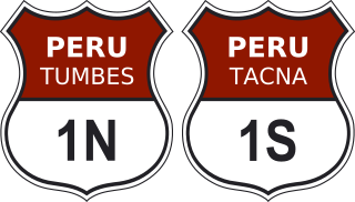
Highway 1, most widely known as the Pan-American Highway, is the most important highway in Peru, forming part of the larger Pan-American Highway.

The Carretera Austral is the name given to Chile's Route 7. The highway runs south for about 1,240 kilometers (770 mi) from Puerto Montt to Villa O'Higgins, passing through rural Patagonia.

The Autopista AP-1 is a Spanish autopista. It has two separate sections: the first from Burgos to Armiñón, and the second from Etxabarri Ibiña to Eibar. In Eibar, at the Malzaga junction, AP-1 meets Autopista AP-8, which connects with Irun and the French border.
Boquerón is a Cuban village and consejo popular of the municipality of Caimanera, in the Province of Guantánamo. Located near Guantánamo Bay, it is also known as Mártires de la Frontera, Spanish for "Martyrs of the Border".

European traffic signs present relevant differences between countries despite an apparent uniformity and standardisation. Most European countries refer to the 1968 Vienna Convention on Road Signs and Signals. The convention has been adopted by the following countries : Albania, Armenia, Austria, Belarus, Belgium, Bosnia and Herzegovina, Bulgaria, Croatia, Cyprus, the Czech Republic, Denmark, Estonia, Finland, France, Georgia, Germany, Greece, Hungary, Italy, Latvia, Liechtenstein, Lithuania, Luxembourg, Moldova, Montenegro, Netherlands, North Macedonia, Norway, Poland, Portugal, Romania, Russia, San Marino, Serbia, Slovakia, Slovenia, Spain, Sweden, Switzerland, Turkey, Ukraine and the United Kingdom. The convention has not been adopted by Ireland, Iceland or Malta.
Federal Highway 200, also known as Carretera Pacífico, is a Federal Highway of Mexico. The Carretera Pacífico is the main leg of the Pacific Coastal Highway within Mexico and travels along the Pacific Coast from Mexican Federal Highway 15 in Tepic, Nayarit in the north to the Guatemala-Mexico border at Talismán, Chiapas in the south. Upon entering Guatemala, the highway continues as Central American Highway 2 (CA-2).

La Carretera (The Road) is a studio album by Julio Iglesias. It was released in 1995. It was nominated for Pop Album of the Year at the Lo Nuestro Awards of 1996.

The M-501 is a road in the Spanish region of Madrid. Managed by the Madrid regional government as a primary road in the regional network, it comprises a motorway-grade (autovía) section and a two-lane road section.

National Primary Route 2, formally known as Carretera Interamericana Sur, is the southern segment of the Pan-American Highway that traverses Costa Rica.
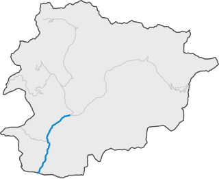
CG-1 is a road of the Andorra Road Network that connects the capital, Andorra la Vella with La Seu d'Urgell to Alt Urgell. The workers of FHASA contributed to its construction. It is also called Carretera d'Espanya.
Route 2 is a National Road in Bolivia. It connects La Paz to Khasani via Batallas and Copacabana, is paved for its entire length.