
Malaybalay, officially the City of Malaybalay, is a 1st class component city and capital of the province of Bukidnon, Philippines. According to the 2020 census, it has a population of 190,712 people.

Lantapan, officially the Municipality of Lantapan, is a 1st class municipality in the province of Bukidnon, Philippines. According to the 2020 census, it has a population of 65,974 people.
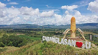
Cabanglasan, officially the Municipality of Cabanglasan, is a 3rd class municipality in the province of Bukidnon, Philippines. According to the 2020 census, it has a population of 36,286 people.

Kibawe, officially the Municipality of Kibawe, is a 2nd class municipality in the province of Bukidnon, Philippines. According to the 2020 census, it has a population of 41,897 people.

San Fernando, officially the Municipality of San Fernando, is a 1st class municipality in the province of Bukidnon, Philippines. According to the 2020 census, it has a population of 63,045 people.
Dalwangan is a barangay west of Malaybalay City situated on the foothills of the Kitanglad Range, 12 kilometers west of the city proper. It is bounded to the north by Impalutao of the municipality of Impasugong, to the east by Patpat and Kalasungay, to the south by Capitan Angel and the Mount Kitanglad Range Natural Park, and to the west by Kibenton of Impasugong. According to the 2015 census, Dalwangan has a population of 7,004 people.
Bangcud is an urban barangay in the South Highway District of Malaybalay City, Bukidnon, in the Philippines.
Aglayan is an urban barangay of the City of Malaybalay in the Province of Bukidnon, Philippines. According to the 2015 census, Aglayan has a population of 7,594 people.

Can-ayan is a rural barangay in the North Highway District of Malaybalay City, Bukidnon, Philippines. According to the 2015 census, Can-ayan has a population of 5,870 people.
San Jose is an urban barangay in the South Highway District of Malaybalay, Bukidnon. According to the 2015 census, it has a population of 6,856. It is located 6 kilometres south of the city proper and bounded to the north by Casisang, to the east by Can-ayan, to the south by Laguitas and Linabo, and to the west by Magsaysay. San Jose is divided by the Sawaga River into a billowy plain to the west and a hilly and rugged east. It is politically subdivided into fifteen purok. Sitios under its jurisdiction include Santo Niño, Mabuhay, and Panamucan. Santo Niño is located to the west, bordering Barangay Magsaysay. Mabuhay is located along the Sawaga. Panamucan is located to the east on the Paiwaig River. Economy is mainly driven by agriculture, but commerce and industry are growing as a result of the urbanization of Malaybalay. There are many infrastructure, land development and housing projects, including a water reservoir and a diversion road by-passing the city proper and leading into Dalwangan.

Manalog is a rural barangay of the North Highway District of Malaybalay City, Bukidnon, in the Philippines. According to the 2015 census, it has a population of 969 people. It is the northernmost village in Malaybalay, bounded to the north by Barangay Dumalaguing and Barangay Bulonay of Impasugong, to the east by Busdi, to the south by Kibalabag, to the southwest by Kalasungay, and to the west by Barangay Bontongon of Impasugong. Its inhabitants are mostly native Higaunons who has a legal ancestral domain claim in the area. In fact, Manalog is entirely within the Bukidnon Higaonon Tribal Association's (BUHITA) Ancestral Domain.
Busdi is a rural barangay of the Upper Pulangi District of Malaybalay, Bukidnon, Philippines. According to the 2015 census, it has a population of 2,377 people. It is bounded to the north by Barangay Bulonay of Impasug-ong, to the east by the Municipality of La Paz, Agusan del Sur, to the south by Saint Peter and Kulaman, and to the west by Kibalabag and Manalog.
Caburacanan is a rural barangay of the Upper Pulangi District in Malaybalay City, Bukidnon, Philippines. According to the 2015 census, it has a population of 1,150 people, making it the least populated village in Upper Pulangi. It is bounded to the north by Kulaman, to the east by Saint Peter and Zamboanguita, to the south by Mapulo, and to the west by Can-ayan and Kibalabag. The western part of the village is mountainous with vast old-growth forests and the east is a valley along the Pulangi River, where the village proper is found. The population is mostly Higaunen. It had two sitios under its jurisdiction which are now abandoned: Sambukan, a hamlet to the north; and Talahidan, on the west. Caburacanan has one elementary school administered by the Department of Education, Division of Malaybalay City
Patpat is the de facto name for barangay Lapu-Lapu of Malaybalay City, Philippines. As of the 2015 census, it has a population of 3,833 people.
Imbayao is a rural barangay in Malaybalay, Philippines. It is located in the North Highway District and is almost entirely within the Kitanglad Mountain Range.
Mailag is an urban barangay in Valencia, Bukidnon, Philippines. According to the 2015 census, it has a population of 6,805 people.
Mapayag is a rural barangay in the South Highway District of Malaybalay, Bukidnon, Philippines. According to the 2015 census, it has a population of 979 people.

Malaybalay, the capital of Bukidnon, is subdivided into 46 barangays. The Philippine Standard Geographic Code classifies 15 barangays as urban and 31 rural; however, the City of Malaybalay classifies 18 barangays as urban and 28 rural. These barangays are grouped into five administrative districts, namely Basakan, North Highway, Poblacion, South Highway, and Upper Pulangi.
Santo Niño is a rural barangay in the Basakan District of Malaybalay, Bukidnon, Philippines. According to the 2015 census, it has a population of 1,675 people. It is bordered to the north by Simaya and San Martin, to the east by Sinanglanan and Apo Macote, to the south by Nabag-o of the City of Valencia, and to the west by Bangcud and Mailag.
Violeta is a rural barangay in the Basakan District of Malaybalay, Bukidnon, Philippines. According to the 2015 census, it has a population of 2,199 people. It is bordered to the north by Linabo, to the east by Managok, to the south by Simaya, and to the west by Cabangahan and Aglayan, separated by the Sawaga River.
