
The City of Northglenn is a home rule municipality located in Adams and Weld counties, Colorado, United States. Northglenn is a part of the Denver–Aurora–Lakewood, CO Metropolitan Statistical Area. As of the 2020 census the city's population was 38,131. It was built as a master planned community in 1959 by Jordon Perlmutter.
The City of Cherry Hills Village is a home rule municipality located in Arapahoe County, Colorado, United States. The city population was 6,442 at the 2020 United States Census. Cherry Hills Village is a part of the Denver–Aurora–Lakewood, CO Metropolitan Statistical Area and the Front Range Urban Corridor.
The City of Englewood is a home rule municipality located in Arapahoe County, Colorado, United States. The town population was 33,659 at the 2020 United States Census. Englewood is a part of the Denver–Aurora–Lakewood, CO Metropolitan Statistical Area and the Front Range Urban Corridor. Englewood is located immediately south of Denver in the South Platte River Valley.

The City of Glendale is a home rule municipality located in an exclave of Arapahoe County, Colorado, United States. The city population was 4,613 at the 2020 United States Census. Glendale is an enclave of the City and County of Denver and is the most densely populated municipality in Colorado. The city is a part of the Denver–Aurora–Lakewood, CO Metropolitan Statistical Area and the Front Range Urban Corridor.
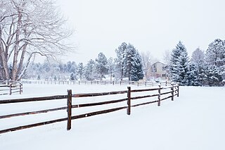
The City of Castle Pines is a home rule municipality located in Douglas County, Colorado, United States. The city population was 11,036 at the 2020 United States Census. Castle Pines is a part of the Denver–Aurora–Lakewood, CO Metropolitan Statistical Area and the Front Range Urban Corridor. The city is located north of the Town of Castle Rock and south of the City of Lone Tree, Colorado.
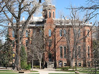
The University of Colorado (CU) is a system of public universities in Colorado. It consists of four institutions: the University of Colorado Boulder, the University of Colorado Colorado Springs, the University of Colorado Denver, and the University of Colorado Anschutz Medical Campus. It is governed by the elected, nine-member board of regents.

Located in the city and county of Denver, Colorado, the Capitol Hill neighborhood is bordered by Broadway, Downing Street, Colfax Avenue, and Seventh Avenue, which carry large volumes of traffic around the neighborhood. It is technically located in East Denver which begins immediately east of Broadway, the neighborhood's western boundary. Many consider the Cheesman Park neighborhood to be a part of the Capitol Hill neighborhood, but as defined by the city, Cheesman Park is a separate neighborhood. Denver also recognizes a statistical neighborhood called North Capitol Hill, also known as Uptown by some residents. Colfax Avenue is the border between these two neighborhoods.

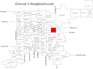
Civic Center, Denver is a neighborhood in Denver, Colorado, United States. The northern part of the neighborhood overlaps partially with the Denver Civic Center, an area of parks and civic buildings.
The Ellie Caulkins Opera House is located in Denver, Colorado as part of the large Denver Performing Arts Complex. It seats 2,225. The Caulkins family pledged $7 million towards the enhancement of the lyric opera house and adjacent public spaces which were constructed inside of the Newton Auditorium.

The Highlands Ranch Mansion is a historic property in Colorado.
Montclair is a neighborhood in the City and County of Denver, Colorado, United States. The Denver U.S. Post Office serves Montclair postal addresses.
The Mile High Music Festival was an annual two-day concert that took place for three years. It was held in Commerce City, Colorado at Dick's Sporting Goods Park, first done on July 19 and 20, 2008. The concert was originally scheduled to be held at City Park in Denver, but changed because of opposition from zoo officials. 2010 was the last year and promoter AEG announced that the festival would be cancelled for 2011 "due to the economy"

Congress Park is a park and a neighborhood in the City and County of Denver, Colorado, United States. In 2010, the neighborhood had 10,235 residents and 5,724 households.
Speer is the official name for the Denver neighborhood bounded by 7th Avenue (north), Broadway (West), Alameda Avenue (South) and Downing Street (East). The northeast portion northeast of Speer Boulevard is generally referred to as Alamo Placita due to a local park and historic district of this name.

Valverde is a neighborhood of Denver, Colorado. It is in the area known as West Denver or the "West Side". According to the Piton Foundation, in 2007, the population of the neighborhood was 4,093, and there were 1,276 housing units. Valverde home values are expected to grow substantially, due to the recent population growth in the Denver metro area. The commute to downtown Denver from the Valverde neighborhood is less than 5 minutes since the completion of 6th avenue, which no longer merges with I-25.
Lamont School of Music is the school of arts of the University of Denver, based in city of Denver, United States. In 1941, the school merged with the University of Denver.

Shangri-La is a Streamline Moderne mansion in Denver, Colorado, United States. Commissioned by Denver movie theater magnate Harry E. Huffman and designed by architect Raymond Harry Ervin, it is a replica of the fictional monastery featured in the 1937 film Lost Horizon. Built on a 5-acre (2.0 ha) tract of land in 1937–38, it was occupied by Huffman and his wife until 1969. Beginning in 1962, the west lawn was subdivided and populated with additional upscale housing, including Cableland, and the circular drive was remapped as Shangri La Drive. The current owners of the house are A. Barry and Arlene Hirschfeld.
