Diogo Cão, also known as Diogo Cam, was a Portuguese mariner and one of the most notable explorers of the fifteenth century. He made two voyages along the west coast of Africa in the 1480s, exploring the Congo River and the coasts of present-day Angola and Namibia.

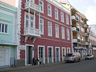
Praia is the capital and largest city of Cape Verde. Located on the southern coast of Santiago island, within the Sotavento Islands group, the city is the seat of the Praia Municipality. Praia is the political, economic and cultural center of Cape Verde.

José Maria Pereira Neves is a Cape Verdean politician who is currently the president of Cape Verde, having previously served as the Prime Minister of Cape Verde from 2001 to 2016. He is a member of the African Party for the Independence of Cape Verde (PAICV). In the 2021 presidential election, he was elected with 51.7% of votes, beating his nearest rival Carlos Veiga who got 42.4% of the total votes.

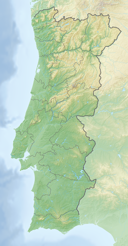
Cabo da Roca or Cape Roca is a cape which forms the westernmost point of the Sintra Mountain Range, of mainland Portugal, of continental Europe, and of the Eurasian landmass. It is situated in the municipality of Sintra, near Azóia, in the south west of the Lisbon District. Notably, the point includes a lighthouse that started operation in 1772.

This is a list of the extreme points of the European Union — the points that are farther north, south, east or west than any other location.

Barreta Island is an island in Algarve, Portugal, about 7 kilometres (4.3 mi) long and 50 to 600 metres wide.

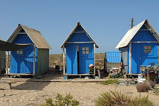
Culatra Island is a barrier island located in the Ria Formosa in the Algarve region of Portugal. It has an approximate population of around 700 people divided across three communities of Farol, Hângares and Culatra.

Sal is an island in Cape Verde. Sal is a tourist destination with white sandy beaches and over 350 days of sunshine a year. It is one of the three sandy eastern islands of the Cape Verde archipelago in the central Atlantic Ocean, 350 mi (560 km) off the west coast of Africa. Cabo Verde is known for year-round kiteboarding, for the large reserve of Caretta turtles which hatch from July to September, and the music of Cesaria Evora.

São Nicolau is one of the Barlavento (Windward) islands of Cape Verde. It is located between the islands of Santa Luzia and Sal. Its population is 12,424 (2015), with an area of 343 km2 (132 sq mi). The main towns are Ribeira Brava and Tarrafal de São Nicolau.

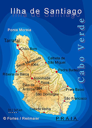
Santiago is the largest island of Cape Verde, its most important agricultural centre and home to half the nation's population. Part of the Sotavento Islands, it lies between the islands of Maio and Fogo. It was the first of the islands to be settled: the town of Ribeira Grande was founded in 1462. Santiago is home to the nation's capital city of Praia.

Santa Catarina is a concelho (municipality) of Cape Verde. It is situated in the western part of the island of Santiago. Its seat is the city of Assomada. Its population was 45,920 in 2017 (estimate). Its area is 242.6 km2 (93.7 sq mi).

The Radiotelevisão Caboverdiana is Cape Verde's first radio and television station broadcasting local programs from Cape Verde, Portugal and Brazil as well as the rest of the world especially France. It is a publicly owned company and enterprise and is located in the Capeverdean capital city of Praia, in the southern part in the middle of Achada Santo António RTC also has a few buildings, it also has offices in São Vicente, Sal, São Filipe on Fogo Island and Assomada in Santa Catarina. The building size is very small. The radio building is in the south on Rua 13 de Janeiro and the television station is in the north. Its current president is José Emanuel Tavares Moreira.

Ponta da Fragata is a headland on the east coast of the island of Sal, Cape Verde. It is situated at the southern end of the Serra Negra mountain, 6 km northeast of the town Santa Maria. To the south of the headland stretches the Costa da Fragata, a 4.7 km long sandy beach which is a protected nature reserve, important as nesting area for loggerhead sea turtles. The nature reserve covers 3.46 km2 (1.34 sq mi) of land and 23.47 km2 (9.06 sq mi) of ocean.

Praia de Atalanta is a beach on the north coast of the island of Boa Vista in Cape Verde. It is approximately 6 km northeast of the island capital of Sal Rei and 3 km west of Vigía. The wreck of the Spanish cargo ship Cabo Santa Maria, which ran aground on September 1, 1968, is located here.

The University of Cape Verde is the only public university of Cape Verde. The main campus is in Palmarejo, Praia, but there are also institutes in Mindelo, Assomada and São Jorge dos Órgãos. It has over 5000 students. A new campus for Uni-CV is under construction in Palmarejo, financed by the Chinese government. It should be completed by July 2020. It will have capacity for 4,890 students and 476 professors, with a library, dorms, cafeterias and sports facilities. It will have 61 class rooms, five auditoriums with a capacity of 150 seats, eight computer rooms, eight reading rooms and 34 laboratories.

The salt ponds of Santa Maria are a complex of salt evaporation ponds north of the city Santa Maria in the southernmost part of the island of Sal, Cape Verde. It is one of two on the island, the other is near Pedra de Lume. The salt ponds are a protected area as a protected landscape, covering 69 hectares.


