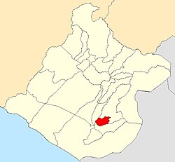
Calana District | |
---|---|
Coordinates: 17°56′20″S70°11′10″W / 17.9389°S 70.1862°W | |
Country | Peru |
Region | Tacna |
Province | Tacna |
Founded | August 20, 1872 |
Capital | Calana |
Government | |
• Mayor | Juan Ramos Arocutipa |
Area | |
• Total | 108.38 km2 (41.85 sq mi) |
Elevation | 875 m (2,871 ft) |
Population | |
• Total | 2,394 |
• Density | 22/km2 (57/sq mi) |
Time zone | UTC-5 (PET) |
UBIGEO | 230103 |
Calana District is one of ten districts of Tacna Province in Peru. [1]
Climate data for Calana, elevation 785 m (2,575 ft), (1991–2020) | |||||||||||||
---|---|---|---|---|---|---|---|---|---|---|---|---|---|
Month | Jan | Feb | Mar | Apr | May | Jun | Jul | Aug | Sep | Oct | Nov | Dec | Year |
Mean daily maximum °C (°F) | 26.4 (79.5) | 27.1 (80.8) | 26.4 (79.5) | 24.4 (75.9) | 22.3 (72.1) | 20.5 (68.9) | 19.9 (67.8) | 20.4 (68.7) | 21.5 (70.7) | 22.8 (73.0) | 24.0 (75.2) | 25.3 (77.5) | 23.4 (74.1) |
Mean daily minimum °C (°F) | 15.1 (59.2) | 15.6 (60.1) | 14.6 (58.3) | 12.6 (54.7) | 10.2 (50.4) | 8.2 (46.8) | 7.5 (45.5) | 8.0 (46.4) | 9.2 (48.6) | 10.6 (51.1) | 12.0 (53.6) | 13.4 (56.1) | 11.4 (52.6) |
Average precipitation mm (inches) | 4.1 (0.16) | 2.5 (0.10) | 0.9 (0.04) | 0.4 (0.02) | 1.6 (0.06) | 1.9 (0.07) | 2.9 (0.11) | 2.9 (0.11) | 2.6 (0.10) | 1.1 (0.04) | 1.1 (0.04) | 1.3 (0.05) | 23.3 (0.9) |
Source: National Meteorology and Hydrology Service of Peru [2] |
Lima, founded in 1535 as the Ciudad de los Reyes, is the capital and largest city of Peru. It is located in the valleys of the Chillón, Rímac and Lurín Rivers, in the desert zone of the central coastal part of the country, overlooking the Pacific Ocean. The city is considered the political, cultural, financial and commercial center of Peru. Due to its geostrategic importance, the Globalization and World Cities Research Network has categorized it as a "beta" tier city. Jurisdictionally, the metropolis extends mainly within the province of Lima and in a smaller portion, to the west, within the Constitutional Province of Callao, where the seaport and the Jorge Chávez Airport are located. Both provinces have regional autonomy since 2002.
Quinua District is one of fifteen districts of the province Huamanga in Peru.
Arapa District is one of fifteen districts of the province Azángaro in Peru.
Asillo District is one of fifteen districts of the province Azángaro in Peru.
Azángaro District is one of fifteen districts of the province Azángaro in Peru.
Desaguadero District is one of seven districts of the province Chucuito in Puno Region, Peru.
Capazo District is one of five districts of the province El Collao in Puno Region, Peru.
Ilave District is one of five districts of the province El Collao in Puno Region, Peru.
Santa Rosa District is one of five districts of the province El Collao in Puno Region, Peru.
Capachica District is one of fifteen districts of the province Puno in Peru. Its seat is Capachica.
Mañazo is one of fifteen districts of the province Puno in Peru.
Huancané District is one of eight districts of the province Huancané in Peru.
Anapia District is one of seven districts of the province Yunguyo in Puno Region, Peru.
Yunguyo District is one of seven districts of the province Yunguyo in Peru.
Ananea District is one of five districts of the San Antonio de Putina Province in Peru.
Zurite District is one of nine districts of the province Anta in Peru.
Caicay District is one of six districts of the province Paucartambo in Peru.
Ahuaycha District is one of sixteen districts of the province Tayacaja in Peru.
La Libertad District is one of twelve districts of the province Huaraz in Peru.
Chavín de Huántar District is one of sixteen districts of the Huari Province in Peru.