Alto de la Alianza District

Last updated
Alto de la Alianza
Distrito de Alto de la Alianza
District
COA Alto de la Alianza District in Tacna Province.png
Coat of arms
Distrito de Alto de la Alianza.svg
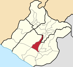
Location of Alto de la Alianza in the Tacna Province
Country Flag of Peru.svg  Peru
Region Tacna
Province Tacna
Founded May 9, 1984
Capital La Esperanza
Government
   Mayor Willy Méndez
Area
  Total 371.4 km2 (143.4 sq mi)
Elevation 620 m (2,030 ft)
Population (2005 census)
  Total 35,429
  Density 95/km2 (250/sq mi)
Time zone PET (UTC-5)
UBIGEO 230102
Website munialtoalianza.gob.pe

Alto de la Alianza District is one of ten districts of the province Tacna in Peru. [1]

Districts of Peru third level administrative subdivision of Peru

The districts of Peru are the third-level country subdivisions of Peru. They are subdivisions of the provinces, which in turn are subdivisions of the larger regions or departments. There are 1,838 districts in total.

Tacna Province Province in Tacna, Peru

Tacna is the largest of four provinces in the Tacna Region in southern Peru located on the border with Chile and Bolivia. Its capital is Tacna.

Peru republic in South America

Peru, officially the Republic of Peru, is a country in western South America. It is bordered in the north by Ecuador and Colombia, in the east by Brazil, in the southeast by Bolivia, in the south by Chile, and in the west by the Pacific Ocean. Peru is a megadiverse country with habitats ranging from the arid plains of the Pacific coastal region in the west to the peaks of the Andes mountains vertically extending from the north to the southeast of the country to the tropical Amazon Basin rainforest in the east with the Amazon river.

Contents

Authorities

Mayors

Festivities

Related Research Articles

Bloomington–Normal, officially known as the Bloomington, Illinois Metropolitan Statistical Area, is a metropolitan area in Central Illinois anchored by the twin municipalities of Bloomington and Normal. At the 2010 census, the municipalities had a combined urban population of 132,600, while the metropolitan area had a population of 169,572. The two-city area is colloquially known as "Blo-No".

Withlacoochee River (Florida) River in Florida, United States

The Withlacoochee River originates in central Florida's Green Swamp, east of Polk City. It flows west, then north, and then turns northwest and finally west again before it empties into the Gulf of Mexico near Yankeetown. The river is 141 miles (227 km) long and has a drainage basin of 1,170 square miles (3,000 km2). It is believed to have been named after the Withlacoochee River to the north.

Camilaca District is one of six districts of the province Candarave in Peru.

Curibaya District is one of six districts of the province Candarave in Peru.

Quilahuani District is one of six districts of the province Candarave in Peru.

Ciudad Nueva District is one of ten districts of the province Tacna in Peru.

Inclán District is one of ten districts of the province Tacna in Peru.

Pocollay District District in Tacna, Peru

Pocollay District is one of ten districts of the province Tacna in Peru.

Héroes Albarracín District District in Tacna, Peru

Héroes Albarracín District is one of eight districts of the province Tarata in Peru.

Estique District is one of eight districts of the province Tarata in Peru.

Estique-Pampa District is one of eight districts of the province Tarata in Peru.

Sitajara District is one of eight districts of the province Tarata in Peru.

Tarata District District in Tacna, Peru

Tarata District is one of eight districts of the province Tarata in Peru.

Arapa District is one of fifteen districts of the province Azángaro in Peru.

Asillo District is one of fifteen districts of the province Azángaro in Peru.

San Anton District is one of fifteen districts of the Azángaro Province in Peru.

Lampa District, Lampa District in Puno, Peru

Lampa District is one of ten districts of the province Lampa in Peru.

Umachiri District is one of nine districts of the province Melgar in Peru.

Cabana District is one of four districts of the province San Román in Peru.

Kosmos 2479 is a Russian US-KMO missile early warning satellite which was launched in 2012 as part of the Russian Aerospace Defence Forces' Oko programme. The satellite is designed to identify missile launches using infrared telescopes. It was the last US-KMO geostationary satellite, to be launched, prior to the system being replaced by EKS.

References

Coordinates: 17°59′41″S70°14′52″W / 17.9948°S 70.2479°W / -17.9948; -70.2479

Geographic coordinate system Coordinate system

A geographic coordinate system is a coordinate system that enables every location on Earth to be specified by a set of numbers, letters or symbols. The coordinates are often chosen such that one of the numbers represents a vertical position and two or three of the numbers represent a horizontal position; alternatively, a geographic position may be expressed in a combined three-dimensional Cartesian vector. A common choice of coordinates is latitude, longitude and elevation. To specify a location on a plane requires a map projection.