Caleta Olivia | |
|---|---|
 | |
 Caleta Olivia Location of Caleta Olivia in Argentina  Caleta Olivia Caleta Olivia (Argentina) | |
| Coordinates: 46°26′S67°32′W / 46.433°S 67.533°W | |
| Country | |
| Province | |
| Department | Deseado |
| Founded | 20 November 1901 |
| Founded by | Exequiel Guttero |
| Government | |
| • Intendente | Pablo Carrizo |
| Area | |
• Total | 35.03 km2 (13.53 sq mi) |
| Elevation | 13 m (43 ft) |
| Population (2022 census) | |
• Total | 56,310 |
| • Density | 1,600/km2 (4,200/sq mi) |
| Time zone | UTC−3 (ART) |
| CPA base | Z9011 |
| Dialing code | +54 297 |
| Climate | BSk |
| Website | Official website |
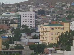
Caleta Olivia is a coastal city located in the northeast of the Argentine province of Santa Cruz, on the San Jorge Gulf by the Atlantic Ocean. It had a population of 56,310 in the 2022 census [INDEC]. It is the second most important city of the province after Rio Gallegos, and the most populated in the Deseado Department.
Contents
The city was founded on 20 November 1901, by Navy Lieutenant Exequiel Guttero, captain of the Guardia Nacional, a ship that was transporting cables, equipment, and workers for the construction of a telegraph line south of Comodoro Rivadavia. The settlement was given the name of his wife Olivia (caleta means "small bay", "inlet").

The main economic activities around the city are petroleum, sheep and fishing. Its port serves both as a fishing centre, and as an export point for locally produced goods.
Among the monuments of the city, probably the most characteristic is that of "El Gorosito," built to honour a petroleum industry worker.