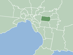
The City of Whitehorse is a local government area in Victoria, Australia in the eastern suburbs of Melbourne. It has an area of 64.3 km2 (25 sq mi) and an estimated residential population of 171,167 as of June 2021.
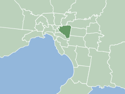
The City of Boroondara is a local government area in Victoria, Australia. It is located in the eastern suburbs of Melbourne. It was formed in June 1994 from the amalgamation of the Cities of Kew, Camberwell and Hawthorn.
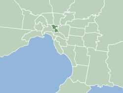
The City of Yarra is a local government area (LGA) in Victoria, Australia in the inner eastern and northern suburbs of Melbourne. It is the second smallest LGA in the state with an area of 19.5 square kilometres (7.5 sq mi), and in June 2021 it had a population of 91,543, making it the second most densely populated LGA, with around 4,695 people per square kilometre. The City of Yarra was formed in 1994 as a result of the amalgamation of the former Cities of Richmond, Collingwood, Fitzroy, and parts of Carlton North and parts of Alphington and Fairfield.
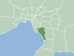
The City of Kingston is a local government area in Victoria, Australia in the south-eastern suburbs of Melbourne, its northern boundary lying approximately 15 km from the Melbourne city centre along the north-eastern shorelines of Port Phillip. It covers an area of 91 km² and has an estimated population of 163,431 people.
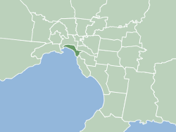
The City of Port Phillip is a local government area of Victoria, Australia on the northern shores of Port Phillip, south of Melbourne's central business district. It has an area of 20.7 km2 and had a population of 109,515 in 2023.

The City of Banyule is a local government area in Victoria, Australia in the north-eastern suburbs of Melbourne. It was created under the Local Government Act 1989 and established in 1994 as an amalgamation of former councils. It has an area of 63 square kilometres (24.3 sq mi) and lies between 7 and 21 km from central Melbourne. In 1994 it had a population of 116,000. In June 2018 Banyule had a population of 130,237. The Yarra River runs along the City's southern border while its western border is defined by Darebin Creek.
Christmas Hills is a town in Victoria, Australia, 35 km (22 mi) north-east of Melbourne's Central Business District, located within the Shire of Nillumbik local government area. Christmas Hills recorded a population of 365 at the 2021 census.

The Division of Chisholm is an Australian Electoral Division in Victoria located in the eastern suburbs of Melbourne. The Division was created in 1949 and is named after Caroline Chisholm, a social worker and promoter of women's immigration. The Division is an Inner Metropolitan area.

Northcote Town Hall Arts Centre is an arts and community centre located in High Street in Northcote, a suburb of Melbourne, Australia.

Camberwell Junction is a major intersection in Camberwell, a suburb of Melbourne, Australia. Burke, Riversdale and Camberwell Roads meet here on six different legs. Trams that pass through the junction run on the routes 70, 72 and 75.

The City of Kew was a local government area about 4 kilometres (2.5 mi) east of Melbourne, the state capital of Victoria, Australia, on the southeast bank of the Yarra River. The city covered an area of 14.56 square kilometres (5.62 sq mi), and existed from 1860 until 1994.
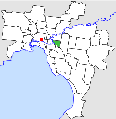
The City of Hawthorn was a local government area about 4 kilometres (2.5 mi) east of Melbourne, the state capital of Victoria, Australia, on the southeast bank of the Yarra River. The city covered an area of 9.71 square kilometres (3.75 sq mi), and existed from 1860 until 1994.

The City of Box Hill was a local government area about 15 kilometres (9 mi) east of Melbourne, the state capital of Victoria, Australia. The city covered an area of 21.50 square kilometres (8.30 sq mi), and existed from 1927 until 1994.
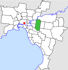
The City of Camberwell was a local government area about 10 kilometres (6 mi) east of Melbourne, the state capital of Victoria, Australia. The city covered an area of 36.01 square kilometres (13.90 sq mi), and existed from 1914 until 1994.
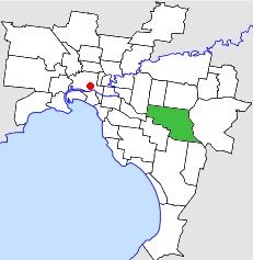
The City of Waverley was a local government area about 20 kilometres (12 mi) east-southeast of Melbourne, the state capital of Victoria, Australia. The city covered an area of 60.86 square kilometres (23.50 sq mi), and existed from 1857 until 1994.
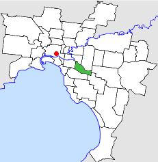
The City of Malvern was a local government area about 9 kilometres (6 mi) southeast of Melbourne, the state capital of Victoria, Australia. The city covered an area of 15.88 square kilometres (6.13 sq mi), and existed from 1856 until 1994, when it was merged with the City of Prahran to create the City of Stonnington.

Camberwell tram depot is located on Council Street, Hawthorn East, a suburb of Melbourne, Victoria, Australia. Opened in December 1929, it is operated by Yarra Trams. It is one of eight tram depots on the Melbourne tram network.

The City of Moorabbin was a local government area about 20 kilometres (12 mi) southeast of Melbourne, the state capital of Victoria, Australia. The city covered an area of 53.13 square kilometres (20.51 sq mi), and existed from 1862 until 1994.
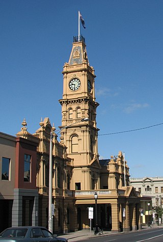
The Hawthorn Arts Centre is a former civic building located in Hawthorn, a suburb of Melbourne, Australia. Designed by architect John Beswicke in the Second Empire style, the hall was built from 1888 to 1890 and housed the council chambers for the City of Hawthorn. After the City of Hawthorn was dissolved in 1994 and absorbed into the newly created City of Boroondara, the building was used as a library, museum and gallery space. A $17.9 million redevelopment was commenced in April 2012 to convert the former town hall into a regional arts space. The hall was renamed to the Hawthorn Arts Centre and officially opened in November 2013.
The Boroondara Eisteddfod is a music competition held annually in the City of Boroondara, Melbourne, Australia.


