Related Research Articles

The Laurel District is one of the many culturally diverse neighborhoods in Oakland, California. It lies at an elevation of 226 feet, and encompasses the blocks northeast of Interstate 580 between High Street and 35th Avenue. It is bordered by the Allendale neighborhood to the west, the Redwood Heights neighborhood to the east, the Diamond District to the north, and the Maxwell Park neighborhood to the south. At the heart of the neighborhood lies MacArthur Blvd., a bustling shopping area with annual festivals and many local shops.

West Oakland is a neighborhood situated in the northwestern corner of Oakland, California, United States, situated west of Downtown Oakland, south of Emeryville, and north of Alameda. The neighborhood is located along the waterfront at the Port of Oakland and at the eastern end of the San Francisco–Oakland Bay Bridge. It lies at an elevation of 13 feet.
Fruitvale is a neighborhood in Oakland, California, United States. It is located approximately 4 miles (6.44 km) southeast of Downtown, and is home to the city's largest Hispanic population, with Hispanics constituting 53.8% of Fruitvale's population. Fruitvale's ZIP code is 94601. It lies at an elevation of 49 feet.

Maxwell Park is a neighborhood in Oakland, California located in the foothills of the city. It is geographically bordered by MacArthur Boulevard, High Street, Trask Street, Foothill Boulevard, and 55th Avenue and is adjacent to Mills College, I-580, Brookdale Park, and the Fairfax neighborhood. It lies at an elevation of from 138 feet to its highest point of 266 feet on Knowland Ave.
Trestle Glen is a neighborhood in Oakland, California. It is located east of Lakeshore Avenue, a shopping street which it shares with the Grand Lake District. It lies at an elevation of 144 feet. The streets are laid out in the curvilinear pattern of early 20th century garden suburbs. Many of the houses are nestled in the surrounding hills, and were built shortly before The Great Depression. The neighborhood is named after a railroad trestle built in 1893, which was dismantled in 1906 when the line was rerouted. The railroad line ran along Trestle Glen Creek, which was named Indian Gulch by early settlers after the Huchiun village that was located near the present-day intersection of Lakeshore Avenue and Trestle Glen Road. The streetcar was instrumental in spurring the development of residential neighborhoods in the area. It is often written that Mark Twain was a passenger on the maiden voyage of the streetcar, though Twain lived in Europe at the time.
Oakland City Center is an office, shopping and hotel complex in Downtown Oakland, Oakland, California. The complex is the product of a redevelopment project begun in the late 1950s. It covers twelve city blocks between Broadway on the east, Martin Luther King Jr. Way on the west, Frank H. Ogawa Plaza on 14th Street on the north side of the complex and the Oakland Convention Center and Marriott Hotel extend south to 10th Street. An hourly parking garage is located beneath the complex's shopping mall. The mall features an upscale fitness and racquet club, in addition to numerous take-out restaurants and other stores. The complex is served by the 12th Street/Oakland City Center BART station.

Old Oakland is a historic district in downtown Oakland, California. The area is located on the northwest side of Broadway, between the City Center complex and the Jack London Square district, and across Broadway from Chinatown.

The Oakland Estuary is the strait in the San Francisco Bay Area, California, separating the cities of Oakland and Alameda and the Alameda Island from the East Bay mainland. On its western end, it connects to San Francisco Bay proper, while its eastern end connects to San Leandro Bay.
Dogtown is a nickname for a portion of West Oakland in the city of Oakland, California. Oakland Police officers coined the phrase due to a large population of stray dogs dating from the early 1980s. It is bounded on the east by Adeline Street, on the west by Mandela Parkway, and its north-south limits are the 580 freeway and 28th Street. The area is undergoing rapid redevelopment from former industrial uses to live-work and other residential forms.

Middle Harbor Shoreline Park (MHSP) is located on San Francisco Bay and the Port of Oakland entrance channel, west of downtown Oakland, California. It is owned and operated by the Port of Oakland. The park entrance is at the intersection of 7th Street and Middle Harbor Road. It is open seven days a week from 8 a.m. to dusk.
Brookfield Village is an Oakland, California neighborhood located in East Oakland near Oakland International Airport. The main streets are 98th Avenue and Edes Avenue.

Oakland Point, or Gibbons' Point, was a small promontory formerly on the eastern shore of San Francisco Bay in West Oakland, California. It was located in the vicinity of what is now the Port of Oakland shipping terminal.
Ghost Town is the informal name of the Foster Hoover Historic District neighborhood in West Oakland, Oakland, California.
Acorn or Acorn Projects are a series of housing projects in the Acorn Redevelopment Project Area or the Acorn neighborhood of West Oakland. Acorn, also known as "The Corns" or the "Cornfields", neighbors a wide variety of public housing. It is bordered by the high rise City Towers Apartments and low rise Mohr Apartments to the South, Cypress Village to the West, Market Street to the east and 10th Street to the north.
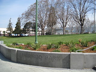
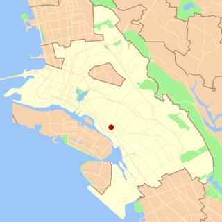
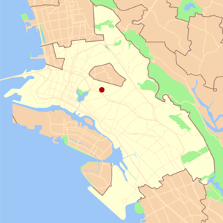
The Bushrod neighborhood in North Oakland, Oakland, California is an area surrounding its namesake park, and bounded by Martin Luther King, Jr. Way to the west, Claremont Avenue to the east, Highway 24 to the south, and the Berkeley border to the north. It borders the neighborhoods of Sante Fe to the west, Fairview Park to the east, and Temescal and Shafter to the south and southeast, respectively. Notable landmarks include the Bushrod Park ballfields and the former Bushrod Washington Elementary School, which share adjoining land on a large greenbelt and open space in the heart of the neighborhood.

Longfellow is a neighborhood of North Oakland, California. It is bounded by Temescal Creek to the north, State Route 24 to the east, Interstate 580 to the south, and Adeline Street to the west.

Recreation Park was the name applied to several former baseball parks in San Francisco, California in the late 19th century and early 20th century.
The Cypress Village housing projects are a series of housing complexes stretching from 10th Street to 14th Street and Kirkham Way. Cypress is located in between the Acorn neighborhood and Lower Bottoms neighborhood in West Oakland. Cypress Village is one of the three housing projects in West Oakland, along with the Campbell Village Court and the Acorn Projects.
The Village Bottoms is a historic cultural district in the predominantly Black neighborhood of West Oakland, California. Its current revitalization and cultural arts renaissance is being catalyzed by artist/cultural worker Marcel Diallo and a neighborhood of young, black artists including Githinji wa Mbire, Eesuu Orundide, letitia ntofon, and rappers Boots Riley of The Coup, Zumbi of Zion I and Adimu Madyun of rap group Hairdooo.
Campbell Village is a neighborhood of Oakland, California in Alameda County, California. It lies at an elevation of 16 feet. Campbell Village is the site of the Campbell Village Court housing projects.
References
- ↑ "Column: Undercurrents: Oakland Fails to Deal with Violence Problems". J. Douglas Allen.
Coordinates: 37°48′31″N122°17′56″W / 37.80869°N 122.29898°W
| This Alameda County, California building and structure-related article is a stub. You can help Wikipedia by expanding it. |