
Fisherman's Wharf is a neighborhood and popular tourist attraction in San Francisco, California. It roughly encompasses the northern waterfront area of San Francisco from Ghirardelli Square or Van Ness Avenue east to Pier 35 or Kearny Street. The F Market streetcar runs through the area, the Powell-Hyde cable car lines runs to Aquatic Park, at the edge of Fisherman's Wharf, and the Powell-Mason cable car line runs a few blocks away.

Brooklyn is a former city in Alameda County, California, now annexed to Oakland, California.
Elmhurst is a residential neighborhood in the southernmost part of Oakland, California. Originally a separate town, it was annexed by Oakland in 1909, and today is considered part of East Oakland. It lies at an elevation of 39 feet. It contains the Eastmont Town Center.

Grass Valley is a neighborhood in Oakland, California. Located in East Oakland in the hills east of Bishop O'Dowd High School and the Oakland Zoo. It straddles upper Golf Links Road and lies just west of Skyline Road's end. It is home to Fire Station #28, Grass Valley Elementary School and East Bay Bible Church.

Seminary is a neighborhood in the East Oakland section of Oakland, California. It is located just north of the Elmhurst neighborhood. Seminary's ZIP code is 94621. It is best known for its close proximity to Mills College.
Trestle Glen is a neighborhood in Oakland, California. It is located east of Lakeshore Avenue, a shopping street which it shares with the Grand Lake District. It lies at an elevation of 144 feet. The streets are laid out in the curvilinear pattern of early 20th century garden suburbs. Many of the houses are nestled in the surrounding hills, and were built shortly before The Great Depression. The neighborhood is named after a railroad trestle built in 1893, which was dismantled in 1906 when the line was rerouted. The railroad line ran along Trestle Glen Creek, which was named Indian Gulch by early settlers after the Huchiun village that was located near the present-day intersection of Lakeshore and Trestle Glen Road. The streetcar was instrumental in spurring the development of residential neighborhoods in the area. It is often written that Mark Twain was a passenger on the maiden voyage of the streetcar, though Twain lived in Europe at the time.

The Oakland Estuary is the strait in the San Francisco Bay Area, California, separating the cities of Oakland and Alameda and the Alameda Island from the East Bay mainland. On its western end, it connects to San Francisco Bay, while its eastern end connects to San Leandro Bay.

Middle Harbor Shoreline Park (MHSP) is located on San Francisco Bay and the Port of Oakland entrance channel, west of downtown Oakland, California. It is owned and operated by the Port of Oakland. The park entrance is at the intersection of 7th and Middle Harbor Streets. It is open seven days a week from 8 a.m. to dusk.
Brookfield Village is an Oakland, California neighborhood located in East Oakland near Oakland International Airport. The main streets are 98th Avenue and Edes Avenue.

North Oakland is an area in Oakland, California, United States, bordered by Downtown Oakland, Oakland Hills, and the adjacent cities of Berkeley, Emeryville and Piedmont. Annexed to Oakland in 1897. It is known as the birthplace of the Black Panther Party and is the childhood home of both the co-founders, which are Dr. Huey P. Newton and Bobby Seale. It is also the birthplace and childhood home of Sue Draheim, internationally recognized fiddler.
Rockridge Market Hall is a market hall opened in 1987 in Rockridge, a neighborhood of Oakland, California. It contains nine stores, including a caterer, a specialty foods shop, a flower shop, a wine shop, a produce shop, a coffee roaster, a fish shop, a butcher shop and a bakery. The food hall is across from the Rockridge BART station. The neighborhood is noted for its concentration of upscale retail and food establishments.
The Lower Bottoms is the colloquial name given to the Prescott/Oakland Point neighborhood in West Oakland in Oakland, California. The neighborhood boundaries are Mandela Parkway to the east, 7th Street to the south, West Grand Avenue to the north, and the former Oakland Army Base to the west. It includes the "central station development" of the former 16th Street Train Station, which served as a film location for the 2005 film Rent and Vallejo rapper E-40's "Tell Me When to Go" video. It is also the hometown of playground basketball legend Demetrius "Hook" Mitchell.
Lockwood Gardens, is a neighborhood and housing project located in East Oakland, California, on 65th and International Boulevard. The neighborhood lies at an elevation of 25 feet and is located less than a mile from the Oakland Coliseum.
The Campbell Village Court housing projects are a series of complexes located in the Campbell Village part of the Lower Bottoms area of West Oakland California. Campbell Village Court is bound by Willow Street to the west, Campbell Street to the east, 10th street to the north, and 8th street to the south.
The Cypress Village housing projects are a series of housing complexes stretching from 10th Street to 14th Street and Kirkham Way. Cypress is located in between the Acorn neighborhood and Lower Bottoms neighborhood in West Oakland. Cypress Village is one of the three housing projects in West Oakland, along with the Campbell Village Court and the Acorn Projects.

Oakland Hills is the city neighborhoods lying within the eastern portion of Oakland, California. The northernmost neighborhoods were devastated by the Oakland firestorm of 1991.
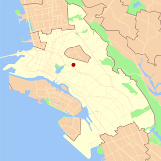
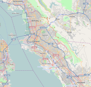
Eastmont is a neighborhood in Oakland, the county seat of Alameda County, California. It lies at an elevation of 95 feet. It was formerly an unincorporated community.
Alden is a former settlement in Alameda County, California. It was located 2 miles (3.2 km) north of Oakland.
Oakland Aviation Museum, formerly called Western Aerospace Museum, was founded in 1981 as a non-profit organization operating an aviation museum located at North Field of Oakland International Airport in Oakland, California. It has over 30 vintage and modern airplanes, both civilian and military, and other displays that highlight noted aviators and innovators.
MetWest High School is a public high school in Oakland, California, United States. It is especially focused on learning through internships. The Oakland Unified School District (OUSD) states that the school "has among the highest attendance rates, the highest California High School Exit Exam pass rates, and lowest suspension rates of all OUSD high schools".


