
The Gotthard Pass or St. Gotthard Pass at 2,106 m (6,909 ft) is a mountain pass in the Alps traversing the Saint-Gotthard Massif and connecting northern Switzerland with southern Switzerland. The pass lies between Airolo in the Italian-speaking canton of Ticino, and Andermatt in the German-speaking canton of Uri, and connects further Bellinzona and Lugano to Lucerne, Basel, and Zürich. The Gotthard Pass lies at the heart of the Gotthard, a major transport axis of Europe, and it is crossed by three traffic tunnels, each being the world's longest at the time of their construction: the Gotthard Rail Tunnel (1882), the Gotthard Road Tunnel (1980) and the Gotthard Base Tunnel (2016). With the Lötschberg to the west, the Gotthard is one of the two main north-south routes through the Swiss Alps.

The Bergamasque Alps or Bergamo Alps are a mountain range in the Italian Alps. They are located in northern Lombardy and named after the city Bergamo, south of the mountains. Within the Eastern Alps, the Alpine Club or AVE system places them within the Western Limestone Alps, while the SOIUSA system classifies them within the Southeastern Alps.

The Splügen Pass is an Alpine mountain pass of the Lepontine Alps. It connects the Swiss, Grisonian Splügen 5 kilometres (3.1 mi) to the north 675 metres (2,215 ft) below the pass with the Italian Chiavenna 21 kilometres (13 mi) to the south at the end of the Valle San Giacomo 1,789 metres (5,869 ft) below the pass.

Monti della Laga is a mountain range in the central Apennines of Italy. Their ruggedness and inaccessibility makes them one of the lesser known areas of the Italian peninsula.

Fondachelli-Fantina is a comune (municipality) in the Metropolitan City of Messina, Sicily, southern Italy. Situated between Novara and Francavilla di Sicilia, in the southern Peloritani mountains, it is 604 metres (1,982 ft) above sea level. The community borders the municipalities of Antillo and Rodì Milici. The most populated villages are Rubino, Evangelisti, Chiesa, Figheri and Fantina. It is 73 kilometres (45 mi) from Messina.

Addiopizzo is a grassroots movement established in Sicily to build a community of businesses and consumers who refuse to pay "pizzo"—Mafia extortion money. It is a grassroots social-conscience motivated consumer movement analogous to Fair Trade. The group, led by a generation whose adolescence was characterized by the murders of anti-Mafia judges, journalists and businessmen, operates in the Palermo and Catania metropolitan areas, traditionally Mafia strongholds.
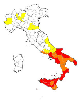
The pizzo is protection money paid to the Mafia often in the form of a forced transfer of money resulting from extortion. The term is derived from the Sicilian pizzu ('beak'). To "let someone wet their beak" is to pay protection money. The practice used to be widespread in Southern Italy, not only by the Sicilian Cosa Nostra but also by the 'Ndrangheta in Calabria and the Camorra in Campania. Another etymological explanation of the term is "beakerful", referring to the right of an overseer to scoop from the grain being threshed by peasants.

Pizzo Campo Tencia is a mountain in the Lepontine Alps, which lies in the canton of Ticino, Switzerland. Pizzo Campo Tencia is the highest peak located entirely inside the canton.

Pizzo Rotondo is a mountain in the Lepontine Alps. At 3,190 metres above sea level, it is the highest mountain lying on the border between the cantons of Ticino and Valais, as well as the highest summit of the Lepontine Alps lying between Nufenen Pass and Lukmanier Pass.
Pizzo Campolungo is a mountain of the Lepontine Alps, overlooking Prato and Dalpe in the Leventina valley of the canton of Ticino. It lies just south of the Campolungo Pass.
The Greina is a high mountain pass across the western Lepontine Alps, connecting Sumvitg in the canton of Graubünden in Switzerland and Olivone in the canton of Ticino. The pass lies between the Piz Medel on the north and Pizzo Marumo, Piz Terri on the south.

Tambohorn or Pizzo Tambo or Pizzo Tambò is a mountain located at the eastern extremity of the Lepontine Alps on the Swiss-Italian border. The mountain lies on the German-Italian language border, west of the Splügen Pass which divides the Western Alps from the Eastern Alps.

Pizzo Coca is a mountain that straddles the Val Seriana and the Valtellina in Lombardy, Italy. It is the highest peak in the Bergamo Alps. Its height is 3,050 metres with a prominence height of 1,878 metres and a saddle of 1,172 metres. A post-glacial valley exists near a point called Ometto in sassi at 2,400 meters.
The Gotthard Massif or Saint-Gotthard Massif is a mountain range in the Alps in Switzerland, located at the border of four cantons: Valais, Ticino, Uri and Graubünden. It is delimited by the Nufenen Pass on the west, by the Furka Pass and the Oberalp Pass on the north and by the Lukmanier Pass on the east. The eponymous Gotthard Pass, lying at the heart of the massif, is the main route from north to south.
The Rheinwald is a valley in the Canton of Grisons in Switzerland, the first section of the Hinterrhein valley. The river Hinterrhein flows through three valleys in the Grisons, the Rheinwald, the Schams and the Domleschg.

Paolo Pizzo is an Italian right-handed épée fencer, two-time individual world champion, two-time Olympian, and 2016 team Olympic silver medalist.
The following is a list of Romansh exonyms, that is to say Romansh-language names for towns and cities that do not speak Romansh.

The border between the modern states of Switzerland and Italy extends for 744 kilometres (462 mi), from the French-Swiss-Italian tripoint at Mont Dolent in the west to the Austrian-Swiss-Italian tripoint near Piz Lad in the east. Much of the border runs across the High Alps, rising above 4,600 metres (15,100 ft) as it passes east of Dufourspitze, but it also descends to the lowest point in Switzerland as it passes Lago Maggiore at below 200 metres (660 ft).

The Caldaccoli Aqueduct was an ancient Roman aqueduct dating to the 1st century. It carried water from the thermal springs at the resort of Caldaccoli, then known as the calidae acquae,, near the present-day San Giuliano Terme, to the Roman baths at Pisa.
The Passo di Predèlp (2,449 m, is a high mountain pass of the Lepontine Alps, located between the Valle Santa Maria and the Leventina, in Ticino.
