Related Research Articles

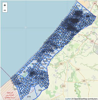
The Gaza Strip, also known simply as Gaza, is a small territory located on the eastern coast of the Mediterranean Sea; it is the smaller of the two Palestinian territories, the other being the West Bank, that make up the State of Palestine. Inhabited by mostly Palestinian refugees and their descendants, Gaza is one of the most densely populated territories in the world. An end of 2024 estimate puts the population of the Strip at 2.1 million. Gaza is bordered by Egypt on the southwest and Israel on the east and north. The territory has been under Israeli occupation since 1967.
Palestinian refugees are citizens of Mandatory Palestine, and their descendants, who fled or were expelled from their country, village or house over the course of the 1948 Palestine war and during the 1967 Six-Day War. Most Palestinian refugees live in or near 68 Palestinian refugee camps across Jordan, Lebanon, Syria, the West Bank and the Gaza Strip. In 2019 more than 5.6 million Palestinian refugees were registered with the United Nations.
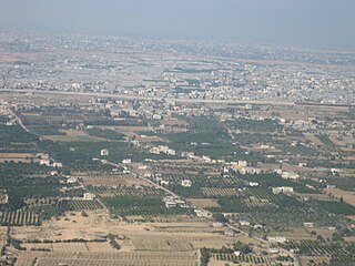
Rafah is a city in the southern Gaza Strip, Palestine. It is the capital of the Rafah Governorate of the State of Palestine, located 30 kilometers (19 mi) south-west of Gaza City. In 2017, Rafah had a population of 171,889. As a result of massive bombardment and ground assaults in Gaza City and Khan Yunis by Israel during the Israel–Hamas war, about 1.4 million Palestinians are believed to be sheltering in Rafah as of February 2024.

The Gaza Strip smuggling tunnels are smuggling tunnels that had been dug under the Philadelphi Route along the Egypt–Gaza border. They were dug to subvert the blockade of the Gaza Strip to smuggle in fuel, food, weapons and other goods into the Gaza Strip. After the Egypt–Israel peace treaty of 1979, the town of Rafah, in the southern Gaza Strip, was split by this buffer zone. One part is located in the southern part of Gaza, and the smaller part of the town is in Egypt. After Israel withdrew from Gaza in 2005, the Philadelphi Corridor was placed under the control of the Palestine Authority until 2007, when Hamas seized power in 2007, and Egypt and Israel closed borders with the Gaza Strip.

In 2004, the Israel Defense Forces (IDF) launched Operation Rainbow in Cloud in the southern Gaza Strip on 12–24 May 2004, involving an invasion and siege of Rafah. The operation was started after the deaths of eleven Israeli soldiers in two Palestinian attacks, in which M113 armored vehicles were attacked.

The Philadelphi Corridor, also called Philadelphi Route, is the Israeli code name for a narrow strip of land, some 100 metres wide and 14 km long, situated along the entirety of the border between the Gaza Strip and Egypt.
The 2004 Israeli operation in the northern Gaza Strip took place when the Israel Defense Forces launched Operation "Days of Penitence", otherwise known as Operation "Days of Repentance" in the northern Gaza Strip. The operation lasted between 29 September and 16 October 2004. About 130 Palestinians, and 1 Israeli were killed.
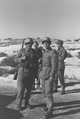
The United Nations Emergency Force (UNEF) was a military and peacekeeping operation established by the United Nations General Assembly to secure an end to the Suez Crisis of 1956 through the establishment of international peacekeepers on the border between Egypt and Israel. Approved by Resolution 1001 (ES-I) of 7 November 1956, the UNEF was developed in large measure as a result of efforts by UN Secretary-General Dag Hammarskjöld and a proposal from Canadian Minister of External Affairs Lester B. Pearson, who would later win the Nobel Peace Prize for it. UNEF was deployed along Sinai and Gaza until May 1967, when Egypt requested UNEF to withdraw its forces.
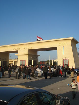
The Rafah Border Crossing or Rafah Crossing Point is the sole crossing point between Egypt and Palestine's Gaza Strip. It is located on the Egypt–Palestine border. Under a 2007 agreement between Egypt and Israel, Egypt controls the crossing but imports through the Rafah crossing require Israeli approval.

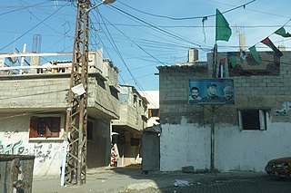
Rafah Camp is one of eight Palestinian refugee camps in the Gaza Strip. It is located in the Rafah Governorate along the Gaza–Egypt border. It was established in 1949 and currently forms part of the city of Rafah. During the period of its establishment, it was the largest refugee camp in the Gaza Strip; however its population has decreased due to migration to the Tall as-Sultan camp, an extension of Rafah camp, which was set up to absorb refugees repatriated from Canada Camp.

The Naksa was the displacement of around 280,000 to 325,000 Palestinians from the West Bank and the Gaza Strip, when the territories were captured by Israel in the 1967 Six-Day War. A number of Palestinian villages were destroyed by the Israeli military, such as Imwas, Yalo, Bayt Nuba, Beit Awwa, and Al-Jiftlik, among others.
Al-Shati, also known as Shati or Beach camp, is a Palestinian refugee camp located in the northern Gaza Strip along the Mediterranean Sea coastline in the Gaza Governorate, and more specifically Gaza City.

The restrictions on movement and goods in Gaza imposed by Israel date to the early 1990s. After Hamas took over in 2007, Israel significantly intensified existing movement restrictions and imposed a complete blockade on the movement of goods and people in and out of the Gaza Strip. In the same year, Egypt closed the Rafah crossing point. The blockade's current stated aim is to prevent the smuggling of weapons into Gaza; previously stated motivations have included exerting economic pressure on Hamas. Human rights groups have called the blockade illegal and a form of collective punishment, as it restricts the flow of essential goods, contributes to economic hardship, and limits Gazans' freedom of movement. The blockade and its effects have led to the territory being called an "open-air prison".
Tel al-Sultan or Tall as-Sultan is one of eight Palestinian refugee camps in the Gaza Strip. It is located in the Rafah Governorate just north of Rafah city and Rafah Camp. It was established mainly to absorb refugees repatriated from Canada Camp.

Egypt–Palestine relations are the bilateral relations between the Arab Republic of Egypt and the State of Palestine. Egyptian President Gamal Abdel Nasser was a strong supporter of the Palestinian cause and he favored self-determination for the Palestinians. Although the Egyptian government has maintained a good relationship with Israel since the Camp David Accords, most Egyptians strongly resent Israel, and disapprove of the close relationship between the Israeli and Egyptian governments.

Kerem Shalom border crossing is a border crossing at the junction of two border sections: one between the Gaza Strip and Israel, and one between the Gaza Strip and Egypt. It is used by trucks carrying goods from Israel or Egypt to the Gaza Strip.

The Khan Yunis massacre took place on 3 November 1956, perpetrated by the Israel Defense Forces (IDF) in the Palestinian town of Khan Yunis and the nearby refugee camp of the same name in the Gaza Strip during the Suez Crisis.
The Rafah massacre occurred on November 12, 1956, during Israel's occupation of the Sinai Peninsula and Gaza Protectorate following the Suez Crisis. The town of Rafah, lying on the Egypt–Gaza border, had been one of two invasion points during the initial incursion by the Israel Defense Forces into the Strip on November 1.
The Egypt–Palestine border, also called Egypt–Gaza border, is the 12-kilometre (7.5-mile) long border between Egypt and the Gaza Strip. There is a buffer zone along the border which is about 14 kilometres long.
During the Israel–Hamas war, the Israeli military ordered mass evacuations in Gaza, resulting in one of the largest displacements of Palestinians since 1948. On 13 October 2023, just one week after Hamas' attack on Israel, Israel instructed 1.1 million Gazans north of the Wadi Gaza, including those in Gaza City, to evacuate within 24 hours. This evacuation triggered a humanitarian crisis, which Palestinians have compared to the Nakba of 1948.
References
- 1 2 Population of Palestinian Refugees in Camps (official and unofficial), 31 March 2007 Archived February 16, 2012, at the Wayback Machine . Badil "During the 1970s, the Israeli military administration destroyed thousands of refugee shelters in the occupied Gaza Strip under the guise of security. Large refugee camps were targeted in particular. Refugees were forcefully resettled in other areas of the occupied Gaza Strip, with a smaller number transferred to the occupied West Bank. In the occupied Gaza Strip, several housing projects were established for these refugees. Some of these projects today are referred to as camps. These include the Canada project (1972), the Shuqairi project (1973), the Brazil project (1973), the Sheikh Radwan project (1974), and the al-Amal project (1979)."
- 1 2 3 4 5 6 7 8 Initial review: Canada Camp Relocation Archived October 26, 2015, at the Wayback Machine . By Ron Wilkinson, Foreign Affairs Trade and Development Canada, May 2001 (doc). Here available Archived July 21, 2017, at the Wayback Machine
- ↑ Razing Rafah, Map 2: Rafah Features. HRW, October 2004
- ↑ Talhami, G. H. 2003. Palestinian Refugees: Pawns to Political Actors. Nova Publishers, 2003 ISBN 1-59033-649-6, ISBN 978-1-59033-649-6 [ verification needed ]
- ↑ Canada Camp Archived October 27, 2015, at the Wayback Machine . Foreign Affairs Trade and Development Canada, 29 April 2013
- ↑ UNEF I. United Nations