al-Arroub Camp | |
|---|---|
| Arabic transcription(s) | |
| • Arabic | مخيّم العروبة |
| • Latin | al-'Arrub (official) al-Aroub (unofficial) |
 Palestinians demonstrating against the occupation in El-Arrub, 2011 | |
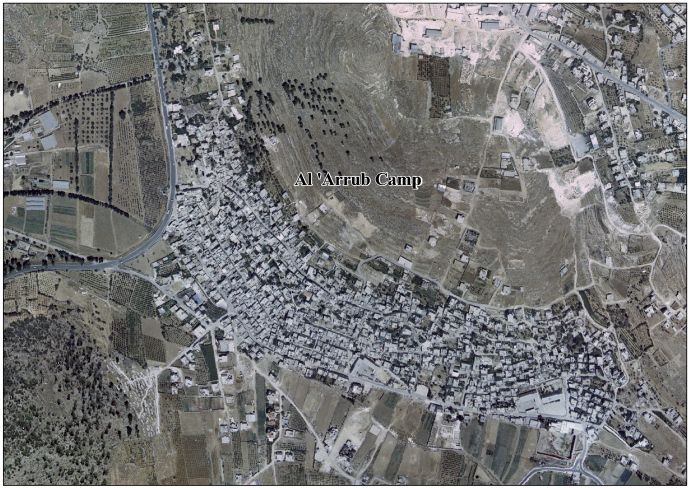
 al-Arroub Camp Location of al-Arroub Camp within Palestine  al-Arroub Camp al-Arroub Camp (the West Bank) | |
| Coordinates: 31°37′23.18″N35°08′12.19″E / 31.6231056°N 35.1367194°E | |
| State | State of Palestine |
| Governorate | Hebron |
| Government | |
| • Type | Refugee Camp (from 1950) |
| Area | |
• Total | 0.24 km2 (0.093 sq mi) |
| Population (2017) [1] | |
• Total | 8,941 |
| • Density | 37,000/km2 (96,000/sq mi) |
Al-Arroub (Arabic : مخيّم العروب, lit. 'Camp al-'Arrub') is a Palestinian refugee camp in the West Bank, located adjacent to the towns of Shuyukh al-Arrub and Halhul and along Highway 60 in the Hebron Governorate, Palestine. Al-Arroub is 15 kilometers south of Bethlehem, and has a total land area of 240 dunums.
Contents
Since the Six-Day War in 1967, the camp has been under Israeli occupation. The population in the 1967 census conducted by the Israeli authorities was 3,647. [2] In 2005, the UNRWA reported that the camp had a population of 9,859 registered refugees. [3] The population was 8,941 in 2011, according to the Palestinian Central Bureau of Statistics (PCBS). [1]
In 2002, two schools were built in the camp: the Arroup Secondary School for boys, and another school for girls. [3]

