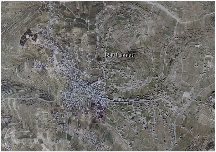
Beit Ummar

Last updated

Contents

Beit Ummar
Arabic transcription(s)
   Arabic بيت اُمّر
   Latin Bayt Ummar (official)
Beit Omar (unofficial)
BeitUmmar.JPG
Beit Ummar, in 2011 IMG_20241127_162711.jpg
Palestine location map wide.png
Red pog.svg
Beit Ummar
Location of Beit Ummar within Palestinian Authority
Coordinates: 31°37′17″N35°06′08″E / 31.62139°N 35.10222°E / 31.62139; 35.10222
Palestine grid 159/114
State State of Palestine
Governorate Hebron
Government
  Type Municipality (from 1997)
  Head of MunicipalityNasri Sabarna
Population
 (2017) [1]
  Total
16,977
Name meaning"House of Ummar" [2]

Beit Ummar (Arabic : بيت اُمّر) is a Palestinian town located eleven kilometers northwest of Hebron in the Hebron Governorate of the State of Palestine. [3] According to the Palestinian Central Bureau of Statistics, in 2017, the town had a population of 16,977 inhabitants. [1] Over 4,800 residents of the town are under the age of 18. Since the Second Intifada, unemployment ranges between 60 and 80 percent due mostly to the inability of residents to work in Israel and a depression in the Palestinian economy. [4] A part of the city straddles Road 60 and due to this, several propositions of house demolition have occurred. [5]

Beit Ummar is mostly agricultural and is noted for its many grape vines. This has a major aspect on their culinary tradition of stuffed grape leaves known as waraq al-'inib and a grape syrup called dibs. [5] Beit Ummar also has cherry, plum, apple and olive orchards. [6]

History

Antiquity

Beit Ummar is believed to be the site of Biblical village of Maarath. [6] [7] [8] [9] Another early name is Beit 'Amra. [10] Locals say they trace their origins back to the era of Abraham. [11] Ben-Zvi raises the possibility that remnants of an ancient Jewish population may exist in the village. [10] [12]

A church, tentatively dating to the 5th century CE, (but with changes probably done in the 8th century) was excavated in the 1930s at Khirbat Asida, to the east of the centre of Beit Ummar. [13]

Middle ages

According to some traditions, the town was named after the Islamic Caliph Umar ibn al-Khattab because he supposedly frequented the town. Many of the town's predominantly Muslim residents are descendants of Arab Christian families who converted during the 7th century Muslim conquest. Christian ruins in the old city are a testament to this conversion over 1,000 years ago. [5]

The Mosque of Nabi Matta, 2011 NabiMattaMosque1.JPG
The Mosque of Nabi Matta, 2011

The main mosque in Beit Ummar houses the tomb of Nabi Matta. Matta refers to Amittai, the father of Jonah. Mujir ad-Din writes that Matta was "a holy man from the people of the house of the prophecy." Nearby Halhul houses the purported tomb of Jonah with the inscription reading "Yunus ibn Matta" or "Jonah son of Amittai", confirming that Matta is indeed the Arabic name for Amittai (some suggested it referred to the apostle Matthew); the Beit Ummar tomb is dedicated to Amittai. [14] [15]

In 1226, the Ayyubid sultan al-Mu'azzam built a mosque with a minaret under the supervision of Jerusalem governor Rashid ad-Din al-Mu'azzami. The Mamluks constructed some additions to the mosque and engraved several inscriptions on its surface. [14]

Ottoman period

While Beit Ummar was mentioned in lists from the early part of the 16th century, there is no evidence of settlement in the second half of the 16th century. However, it was resettled at a later period. [16] In the latter part of the 16th century, its residents were moved to Kuffin, tasked with defending the road. [10] Beit Ummar is also known as "Kuffin al-Fauqa" ("Upper Kuffin"). [10]

In 1838, Edward Robinson noted the village from Al-Dawayima. [17]

Victor Guérin visited the village in 1863, and found it to have about 450 inhabitants. [18] Swiss orientalist Albert Socin, noting an official Ottoman village list circa 1870, wrote that Beit Ummar had a total of 44 houses and a population of 133, though the population count included only men. [19] Hartmann found that Bet Ummar had 60 houses. [20]

In 1883, the PEF's Survey of Western Palestine (SWP) described Beit Ummar as a "small but conspicuous village standing on the watershed, and visible from some distance on the north. An ancient road passes through it. Half a mile north-east is a good spring, ‘Ain Kufin. The mosque has a small tower to it. The surrounding neighbourhood is covered with brushwood." [21]

British Mandate

In the 1922 census of Palestine, conducted by the British Mandate authorities, Bait Ummar had a population of 829 inhabitants, all Muslims, [22] increasing in the 1931 census to 1,135, still entirely Muslim, in 217 inhabited houses. [23]

In the 1945 statistics the population of Beit Ummar was 80 Jews and 1,600 Muslims, and the total land area was 30,129 dunams of land, according to the official land and population survey. [24] [25] 2,912 dunams were plantations and irrigable land, 12,879 were for cereals, [26] while 55 dunams were built-up (urban) land. [27]

Jordanian rule

In the wake of the 1948 Arab–Israeli War, and after the 1949 Armistice Agreements, Beit Ummar came under Jordanian rule. It was annexed by Jordan in 1950.

In 1961, the population of Beit Ummar was 2,103. [28]

Post-1967

Demonstration against land expropriation, Beit Ummar, December 2011 byt Avmr 23.4.11 009.jpg
Demonstration against land expropriation, Beit Ummar, December 2011

Since the Six-Day War in 1967, Beit Ummar has been under Israeli occupation. The population in the 1967 census conducted by the Israeli authorities was 2,630. [29]

Beit Ummar became a municipality on April 17, 1997, after the dismantlement of the Israeli village council and Hussein Badr was appointed by the Palestinian National Authority. [5] The current mayor is Nasri Sabarna. [30] The town is currently located in Area B (civil affairs administered by the PNA) and Area C (civil and military affairs controlled by Israel). [5] Israel has confiscated [31] or expropriated [32] approximately 4,000 dunams of village land in order to construct Israeli bypass roads and several Israeli settlements: Karmei Zur, Migdal Oz, Kfar Etzion and Efrat.

The town is governed by a municipal council consisting of thirteen members including the mayor.

Several people in the village have been shot and killed by Israeli soldiers or settlers during Israeli occupation.

Jala

The nearby site of Jala, which belongs to Beit Ummar, was recorded as a village in 1525/6 and 1538/9 but not afterwards. Today it has a Bedouin population. In 1975, it had 228 residents. [10]

Notable people

Related Research Articles

<span class="mw-page-title-main">Beit Hanina</span> Palestinian neighborhood in East Jerusalem and the West Bank

Beit Hanina is an Arab Palestinian neighborhood in East Jerusalem. It is on the road to Ramallah, eight kilometers north of central Jerusalem, at an elevation of 780 meters above sea level. Beit Hanina is bordered by Pisgat Ze'ev and Hizma to the east, Ramot, Ramat Shlomo and Shuafat to the south, Beit Iksa and Nabi Samwil to the west, and Bir Nabala, al-Jib, Kafr Aqab and ar-Ram to the north.

<span class="mw-page-title-main">Halhul</span> Municipality type A in Hebron, Palestinian territories

Halhul is a Palestinian city located in the southern part of the West Bank, 5 kilometres (3.1 mi) north of Hebron in the Hebron Governorate of Palestine. The town, bordered by Sa'ir and al-Shuyukh to the east, Beit Ummar and al-Arroub refugee camp to the north, and Kharas and Nuba westwards, is located 916 m above sea level, and is the highest inhabited place in Palestine. According to the Palestinian Central Bureau of Statistics, the city had a population of 27,031 inhabitants in 2017.

<span class="mw-page-title-main">Surif</span> Municipality type A in Hebron, State of Palestine

Surif is a Palestinian City in the Hebron Governorate located 25 km northwest of the city of Hebron. According to the Palestinian Central Bureau of Statistics census, Surif had a population of 17,287 in 2017. The population is entirely Muslim.

<span class="mw-page-title-main">Al-Shuyukh</span> Municipality type C in Hebron, State of Palestine

Ash-Shuyukh or al-Shuyukh is a Palestinian town in the Hebron Governorate of the State of Palestine, located 6 km northeast of the city of Hebron. According to the Palestinian Central Bureau of Statistics, Ash-Shuyukh had a population of 12,052 in 2017.

<span class="mw-page-title-main">Idna</span> Municipality type B in Hebron, State of Palestine

Idna or Idhna is a Palestinian town in the southern West Bank, located in the Hebron Governorate of the State of Palestine, 13 kilometers west of Hebron and about one kilometer east of the Green Line. According to the Palestinian Central Bureau of Statistics, the town had a population of 26,009 inhabitants in 2017.

<span class="mw-page-title-main">Beit Iksa</span> Municipality type D in Jerusalem, State of Palestine

Beit Iksa is a Palestinian village in the Jerusalem Governorate, located northwest of Jerusalem in the West Bank.

<span class="mw-page-title-main">Beit Kahil</span> Municipality type C in Hebron, State of Palestine

Beit Kahil is a Palestinian village in the Hebron Governorate in the southern West Bank, located seven kilometers northwest of Hebron. The village had a population of 8,880 in 2017.

<span class="mw-page-title-main">Kharbatha al-Misbah</span> Arab village in the Ramallah and al-Bireh Governate

Kharbatha al-Misbah is a Palestinian town in the central West Bank, located 12.5 kilometers (7.8 mi) west of Ramallah in the Ramallah and al-Bireh Governorate. According to the Palestinian Central Bureau of Statistics, the town had a population of 6,366 in 2017. It has a total land area of 4,431 dunams, of which 644 are built-up areas and the remainder agricultural lands and forests.

<span class="mw-page-title-main">Beitillu</span> Municipality type C in Ramallah and al-Bireh, State of Palestine

Beitillu is a Palestinian town located in the Ramallah and al-Bireh Governorate in the northern West Bank, 19 kilometers Northwest of Ramallah. According to the Palestinian Central Bureau of Statistics, it had a population of 3,465 in 2017.

<span class="mw-page-title-main">Beit Liqya</span> Municipality type C in Ramallah and al-Bireh, State of Palestine

Beit Liqya is a Palestinian town located in the Ramallah and al-Bireh Governorate in the northern West Bank. According to the Palestinian Central Bureau of Statistics, it had a population of approximately 9,304 in 2017.

<span class="mw-page-title-main">Beit Sira</span> Municipality type D in Ramallah and al-Bireh, State of Palestine

Beit Sira is a Palestinian village in the central West Bank, located 22 kilometers west of Ramallah and is a part of the Ramallah and al-Bireh Governorate. The village is situated along the Green Line. During the 1948 Arab-Israeli War, around 4,000 dunams of its land became a part of the "No-Man's Land" strip between the north-central West Bank and Israel. Currently Beit Sira's jurisdiction is 3,120 dunams, of which 441 dunams are built-up areas and the remainder is open spaces for future construction or agricultural land.

<span class="mw-page-title-main">Kharas</span> Municipality type C in Hebron, State of Palestine

Kharas is a Palestinian town in the southern State of Palestine, located twelve kilometers northwest of Hebron, part of the Hebron Governorate. According to the Palestinian Central Bureau of Statistics, the town had a population of 9,139 inhabitants in 2017. It is situated at the northern mouth of the Wadi ’Arab near the ruins of 'Elah. Nearby towns include Nuba and Beit Ula to the south, Surif to the north and Halhul to the east. It has a total land area of 6,781 dunams.

<span class="mw-page-title-main">Saffa, Ramallah</span> Town in the West Bank, State of Palestine

Saffa is a Palestinian town in the Ramallah and al-Bireh Governorate, located west of Ramallah in the northern West Bank. According to the Palestinian Central Bureau of Statistics (PCBS), the town had a population of 4,374 inhabitants in 2017.

<span class="mw-page-title-main">Biddu, Jerusalem</span> Palestinian village in Jerusalem Governate, West Bank

Biddu is a Palestinian town in the Jerusalem Governorate, located 6 kilometers northwest of Jerusalem in the West Bank. According to the Palestinian Central Bureau of Statistics, the town had a population of 8,231 in 2017. Biddu is at an altitude of 806m to 834m. Giv'on HaHadasha lies 2 km east of Biddu.

<span class="mw-page-title-main">Al-Judeira</span> Palestinian village in Jerusalem, State of Palestine

Al-Judeira is a Palestinian village in the Jerusalem Governorate of the State of Palestine, in the central West Bank.

Tarqumiyah is a city located 12 kilometers northwest of Hebron, in the southern West Bank, in the Hebron Governorate in the State of Palestine. The city had a population of 19,311 in 2017.

Sa'ir is a Palestinian town in the Hebron Governorate of the State of Palestine, in the southern West Bank, located 8 kilometers (5.0 mi) northeast of Hebron. Nearby localities include Beit Fajjar and al-Arroub to the north, Beit Ummar to the northwest, Halhul to the west and Beit Einun and ash-Shuyukh to the south. The Dead Sea is just east of Sa'ir's municipal borders. In the 2017 census Palestinian Central Bureau of Statistics, the town had a population of 20,722.

Nuba is a Palestinian village located eleven kilometers north-west of Hebron.The village is in the Hebron Governorate of the State of Palestine, in the southern West Bank. According to the Palestinian Central Bureau of Statistics, the village had a population of 5,631 in 2017.

<span class="mw-page-title-main">Abu Shukheidim</span> Municipality type C in Ramallah and al-Bireh, State of Palestine

Abu Shukheidim was a Palestinian village in the Ramallah and al-Bireh Governorate.

At-Tira is a Palestinian village in the Ramallah and al-Bireh Governorate in the northern West Bank.

References

  1. 1 2 Preliminary Results of the Population, Housing and Establishments Census, 2017 (PDF). Palestinian Central Bureau of Statistics (PCBS) (Report). State of Palestine. February 2018. pp. 64–82. Retrieved 2023-10-24.
  2. Palmer, 1881, p. 389
  3. Beit Ummar: Town Statistics and Facts
  4. Beit Omar Background
  5. 1 2 3 4 5 Sample Area Background: Beit Ummar Archived 2007-12-12 at the Wayback Machine (2000) Campaign for Secure Dwellings, Christian Peacemaker Teams
  6. 1 2 Beit Ummar: Where Dreams Come True Aging with Dignity in Palestinian Villages Qleibo, Ali. This Week in Palestine.
  7. Armstrong, 1889, p.119
  8. Hastings, James (2004) [1898]. A Dictionary of the Bible: Volume III: (Part II: O -- Pleiades) (reprint). Honolulu, Hawaii: University Press of the Pacific. p. 648. ISBN   978-1-4102-1727-1. The ninth group is in the mountains north of Hebron, including Halhu (Halhul), Bethzur (Beit Sur), Maarath (Beit Umar), Beth-anoth (Beit Ainun), and Eltekon - perhaps Tekoa (Tekua).
  9. Wilson, John (1847). The Lands of the Bible Visited and Described, Volume 1. Edenburgh: William Whyte. pp.  386 – 387. OL   20556861M. Beit-Ummar is on a heights to the left. It is apparently a considerable village... At least four of these villages are thus given in juxtaposition in Joshua, "Halhul, Beth-Zur and Gedor and Maarath, and Beth-Anoth, and Eltekon."
  10. 1 2 3 4 5 Grossman, D. (1986). "Oscillations in the Rural Settlement of Samaria and Judaea in the Ottoman Period". In Shomron studies. Dar, S., Safrai, S., (eds). Tel Aviv: Hakibbutz Hameuchad Publishing House. p. 367
  11. Tal, Uri (2023). Muslim Shrines in Eretz Israel: History, Religion, Traditions, Folklore. Jerusalem: Yad Izhak Ben-Zvi. p. 286. ISBN   978-965-217-452-9.
  12. Ben-Zvi, Itzhak (1967). שאר ישוב: מאמרים ופרקים בדברי ימי הישוב העברי בא"י ובחקר המולדת[She'ar Yeshuv] (in Hebrew). תל אביב תרפ"ז. p. 409.
  13. Baramki and Avi-Yonah, 1934, pp. 1719
  14. 1 2 Sharon, 1999, pp. 161-164
  15. Clermont-Ganneau, 1899, p. 456
  16. Grossman, D. "The expansion of the settlement frontier of Hebron's western and southern fringes". Geography Research Forum , 5, 1982, p. 62.
  17. Robinson and Smith, 1841, vol2, p. 401
  18. Guérin, 1869, p. 298
  19. Socin, 1879, p. 145
  20. Hartmann, 1883, p. 142
  21. Conder and Kitchener, 1883, SWP III, p. 303
  22. Barron, 1923, Table V, Sub-district of Hebron, p. 10
  23. Mills, 1932, p. 27
  24. Government of Palestine, Department of Statistics, 1945, p. 23
  25. Government of Palestine, Department of Statistics. Village Statistics, April, 1945. Quoted in Hadawi, 1970, p. 50
  26. Government of Palestine, Department of Statistics. Village Statistics, April, 1945. Quoted in Hadawi, 1970, p. 93
  27. Government of Palestine, Department of Statistics. Village Statistics, April, 1945. Quoted in Hadawi, 1970, p. 143
  28. Government of Jordan, Department of Statistics, 1964, p. 15
  29. Perlmann, Joel (November 2011 – February 2012). "The 1967 Census of the West Bank and Gaza Strip: A Digitized Version" (PDF). Levy Economics Institute . Retrieved 24 June 2016.
  30. Municipality Guide Nablus Municipality Official Website Archived December 4, 2007, at the Wayback Machine
  31. Beit Ummar Town Profile, ARIJ, pp. 15–16
  32. Agencies, IMEMC News &. "Soldiers Invade Beit Ummar" . Retrieved 2020-02-22.
  33. "Palestinian killed in clashes with settlers near Hebron". The Jerusalem Post | JPost.com. 2011-01-29. Retrieved 2023-11-26.
  34. "Court releases hikers suspected of killing Palestinian teen". The Jerusalem Post. 2011-02-03. Retrieved 2023-11-26.
  35. 1 2 "A Bullet Through the Heart of a Palestinian Man - and an Entire Community". Haaretz. Retrieved 2023-11-26.
  36. "Fresh West Bank clashes". Al Jazeera. Retrieved 2023-11-26.
  37. "27-year-old Palestinian killed near Hebron after funeral of his cousin". Middle East Eye. Retrieved 2023-11-26.
  38. "Palestinian killed in clashes with Israeli forces". AP News. 2015-04-10. Retrieved 2023-11-26.
  39. "Palestinians: One Killed, Six Wounded in Clashes With Israeli Forces". Haaretz. Retrieved 2023-11-26.
  40. Israeli Forces Shoot and Kill Palestinian During West Bank Raid, Diaa Hadid, July 23, 2015, The New York Times
  41. "Israeli troops shoot dead 12-year-old Palestinian boy: Ministry". Al Jazeera. Retrieved 2023-11-26.
  42. "Beit Ommar: They killed his child and immediately took his working permit". Machsomwatch. Retrieved 2023-11-26.
  43. "Israeli forces kill young Palestinian man during funeral of 12-year-old boy". Middle East Eye. Retrieved 2023-11-26.
  44. Border Police raid home of Beit Ummar resident, order her to stand by them on roof while stones were thrown at them, and force her to carry military equipment, 14 September 2021, B'Tselem

Bibliography