Wadi ash-Shajina

Last updated
Wadi ash-Shajina
Arabic transcription(s)
   Arabic وادي الشاجنةر
wdy lshjn@ 01.jpg
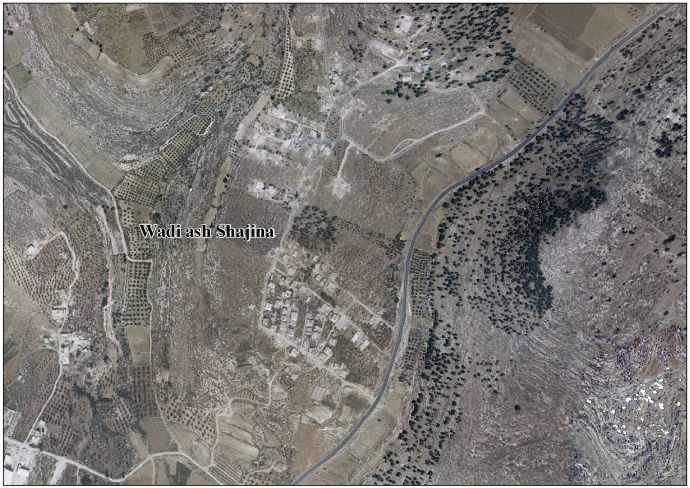
Wadi ash-Shajina in 2020.
Palestine location map wide.png
Red pog.svg
Wadi ash-Shajina
Location of Wadi ash-Shajina within Palestine
Coordinates: 31°28′6″N35°1′50″E / 31.46833°N 35.03056°E / 31.46833; 35.03056
State State of Palestine
Governorate Hebron
Government
  Type Village council
Population
 (2017) [1]
  Total762
Name meaningShagna Valley

Wadi ash-Shajina ( English : Shagna Valley) is a Palestinian village in the Hebron Governorate, in the south of the West Bank. [2] The village had a population of 762 in 2017. [1]

Related Research Articles

<span class="mw-page-title-main">Khan Yunis</span> City in Gaza, Palestine

Khan Yunis, also spelled Khan Younis or Khan Yunus, is a city in the southern Gaza Strip; it is the capital of the Khan Yunis Governorate in the Gaza Strip. Before the 14th century, Khan Yunis was a village known as "Salqah". To protect caravans, pilgrims and travellers a vast caravan serai was constructed there by the emir Yonus an-Nürüzi in 1387-88, an official of the Mamluk Empire. According to the Palestinian Central Bureau of Statistics, Khan Yunis had a population of 205,125 in 2017. Khan Yunis, which lies only four kilometres east of the Mediterranean Sea, has a semi-arid climate with temperature of 30 °C maximum in summer and 10 °C minimum in winter, with an annual rainfall of approximately 260 mm (10.2 in).

<span class="mw-page-title-main">Jabalia</span> Municipality type A in North Gaza, State of Palestine

Jabalia, also spelled Jabalya, is a city in Palestine located 4 kilometers (2.5 mi) north of Gaza City, in the North Gaza Governorate of the State of Palestine, in the Gaza Strip. According to the Palestinian Central Bureau of Statistics, Jabalia had a population of 172,704 in 2017. The Jabalia refugee camp is adjacent to the city to the north. The nearby town of Nazla is a part of the Jabalia municipality. The city is currently under the operational control of IDF's 162nd Division.

<span class="mw-page-title-main">Qalqilya</span> Main city in the Qalqilya Governorate, West Bank, State of Palestine

Qalqilya or Qalqiliya is a Palestinian city in the West Bank which serves as the administrative center of the Qalqilya Governorate of the State of Palestine. In the 2017 census, the city had a population of 51,683. Qalqilya is surrounded by the Israeli West Bank wall, with a narrow gap in the east controlled by the Israeli military and a tunnel to the Palestinian town of Hableh. Qalqilya is under the administration of the Palestinian National Authority, while remaining under Israeli military occupation. Oranges are a major part of the city's economy.

Beit Hanoun or Beit Hanun is a Palestinian city on the northeast edge of the Gaza Strip. According to the Palestinian Central Bureau of Statistics, the town had a population of 52,237 in 2017. From mid-2007 until late 2023, it was administered by the Hamas administration. Beit Hanoun has been entirely depopulated, and virtually all its structures have either been destroyed or rendered unusable due to extreme damage following the Israel-Hamas war. The remains of Beit Hanoun are located by the Nahal-Hanun stream, 6 kilometers (3.7 mi) away from the Israeli town of Sderot.

<span class="mw-page-title-main">Qabatiya</span> Municipality type B in Jenin, State of Palestine

Qabatiya is a city in Jenin Governorate, West Bank, Palestine. According to the Palestinian Central Bureau of Statistics (PCBS) census, the town had a population of 19,197 in 2007 and 24,439 by 2017.

<span class="mw-page-title-main">Huwara</span> Municipality type C in Nablus, State of Palestine

Huwara or Howwarah is a Palestinian town located in the Nablus Governorate of the State of Palestine. Located in the northern Israeli-occupied West Bank, Huwara is on the main road connecting Nablus southwards to Ramallah and Jerusalem, approximately 4 miles (6 km) from Jacob's Well. According to the Palestinian Central Bureau of Statistics, the town had a population of 6,659 in 2017.

Bani Na'im is a Palestinian town in the southern West Bank located 8 kilometers (5.0 mi) east of Hebron in the Hebron Governorate of the State of Palestine. It is situated at a higher elevation than most localities in the area, with an altitude of 951 meters (3,120 ft). The town is best known as the burial place of Lot, a fact already mentioned around 400 CE, when it was known as 'Caphar Barucha'. Following the Muslim conquest, its name was eventually Arabicized as Kafr al-Burayk. The tomb of Lot was turned into a mosque during Islamic rule and remained so under Crusader rule. Later, the Arab tribe of Bani Nu'aym settled there, giving the town its current name, Bani Na'im, first used by Muslim scholar Abd al-Ghani al-Nabulsi in 1690.

<span class="mw-page-title-main">Beit Ummar</span> Municipality type B in Hebron, State of Palestine

Beit Ummar is a Palestinian town located eleven kilometers northwest of Hebron in the Hebron Governorate of the State of Palestine. According to the Palestinian Central Bureau of Statistics, in 2017, the town had a population of 16,977 inhabitants. Over 4,800 residents of the town are under the age of 18. Since the Second Intifada, unemployment ranges between 60 and 80 percent due mostly to the inability of residents to work in Israel and a depression in the Palestinian economy. A part of the city straddles Road 60 and due to this, several propositions of house demolition have occurred.

<span class="mw-page-title-main">Burqa, Nablus</span> Municipality type C in Nablus, Palestine

Burqa is a village in the Nablus Governorate in the northern West Bank, Palestine, located northwest of Nablus. According to the Palestinian Central Bureau of Statistics (PCBS), the village had a population of 4,030 inhabitants in mid-year 2006 and 4,152 by 2017.

Qusra is a Palestinian village in the Nablus Governorate of the State of Palestine, in the northern West Bank, located 28 kilometers southeast of Nablus. According to the Palestinian Central Bureau of Statistics (PCBS), Qusra had a population of 5,418 inhabitants in 2017.

<span class="mw-page-title-main">Urif</span> Municipality type D in Nablus, State of Palestine

Urif is a Palestinian village in the Nablus Governorate of the State of Palestine, in the northern West Bank, located 13 kilometers south of Nablus. According to the Palestinian Central Bureau of Statistics (PCBS), the town had a population of 3,624 inhabitants in 2017.

al-Mughayyir is a Palestinian village in the West Bank, located 12 km Southeast of the city of Jenin in the northern West Bank. According to the Palestinian Central Bureau of Statistics, the village had a population of 2,240 inhabitants in mid-year 2006 and 3,249 by 2017.

<span class="mw-page-title-main">Silat al-Harithiya</span> Municipality type C in Jenin, State of Palestine

Silat al-Harithiya is a Palestinian village in the Jenin Governorate of Palestine, located 10 kilometres (6.2 mi) northwest of Jenin in the northern West Bank. According to the Palestinian Central Bureau of Statistics census, the town had a population of 9,422 in 2007 and 11,449 in 2017.

<span class="mw-page-title-main">Khirbet al-Deir</span> Municipality type D in Hebron, State of Palestine

Khirbet al-Deir, or Khirbet ed-Deir, is a Palestinian village located 10 kilometres (6.2 mi) southwest of Bethlehem, and 15 kilometres (9.3 mi) northwest of Hebron. The town is in the Hebron Governorate of central West Bank. According to the 2017 Palestinian Central Bureau of Statistics (PCBS) Census, the village had a population of 358 people.

<span class="mw-page-title-main">Tura al-Gharbiya</span> Municipality type D in Jenin, State of Palestine

Tura al Gharbiya is a Palestinian town in the Jenin Governorate in the Northern area of the West Bank, located 14 kilometers West of Jenin close to the separation barrier. According to the Palestinian Central Bureau of Statistics, the town had a population of over 1,110 inhabitants in mid-year 2006 and 1,053 in 2017. The healthcare facilities for the surrounding villages are based in Tura al Gharbiya, the facilities are designated as MOH level 1.

Nazlet Zeid is a Palestinian village in the northern West Bank, administratively part of the Jenin Governorate. The village is in Area C, putting it under full Israeli military and civilian control. The West Bank barrier runs through the village. According to the Palestinian Central Bureau of Statistics, the village had a population of 704 in the 2007 census and 843 in the 2017 census.

<span class="mw-page-title-main">Nabi Salih</span> Local Development Committee in State of Palestine

Nabi Salih is a small Palestinian village in the Ramallah and al-Bireh Governorate in the central West Bank, located 20 kilometers northwest of Ramallah. It had a population of 522 in 2017. It is noted for the weekly marches to protest the occupation undertaken since 2010, a practice suspended in 2016, after 350 villagers were estimated to have suffered injuries in clashes with Israeli troops over that period.

Deir Razih is a Palestinian village in the southern West Bank located 11 kilometers (6.8 mi) southwest of Hebron, in the Hebron Governorate. It relies mainly on nearby Dura for basic services. Its total land area is made of 540 dunams, including its built-up area. The village had a population of 294 residents in 2017.

Al-Judeida is a Palestinian village in the Jenin Governorate in the western area of the West Bank, located 14 kilometres (9 mi) south of Jenin. According to the Palestinian Central Bureau of Statistics, the town had a population of 4,738 in the 2007 census and 5,950 by 2017.

<span class="mw-page-title-main">Madama, Nablus</span> Palestinian village in the West Bank

Madama is a Palestinian village in the Nablus Governorate.

References

  1. 1 2 Preliminary Results of the Population, Housing and Establishments Census, 2017 (PDF). Palestinian Central Bureau of Statistics (PCBS) (Report). State of Palestine. February 2018. pp. 64–82. Retrieved 2023-10-24.
  2. "Palestine Census Data - knoema.com". Knoema. Retrieved 2023-01-17.