Al-Majd, Hebron

Last updated

Contents

al-Majd
Arabic transcription(s)
   Arabic خربة المجد
Palestine location map wide.png
Red pog.svg
al-Majd
Location of al-Majd within Palestine
Coordinates: 31°28′50″N34°57′01″E / 31.48056°N 34.95028°E / 31.48056; 34.95028
Palestine grid 145/098
State State of Palestine
Governorate Hebron
Government
  Type Village council
Population
 (2017) [1]
  Total
2,277
Name meaningGlory [2]

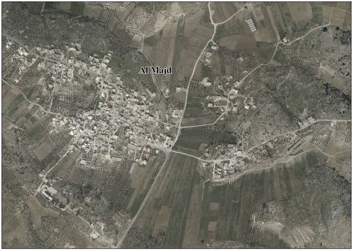
Al-Majd (Arabic : خربة المجد) is a Palestinian village located eighteen kilometers south-west of Hebron. The village is in the Hebron Governorate of Palestine, in the southern West Bank. The village had a population of 2,277 in 2017. [1]

History

Ceramics from the Byzantine era have been found here. [3]

Ottoman era

In 1863, Victor Guérin called it Khirbet Medjed. [4]

In 1883 the PEF's Survey of Palestine found here "Caves, cisterns, and pillar shafts; a ruined chapel seems to have stood there". [5]

1948-1967

In the wake of the 1948 Arab–Israeli War, and after the 1949 Armistice Agreements, Al-Majd came under Jordanian rule.

The Jordanian census of 1961 found 466 inhabitants in Al-Majd. [6]

1967-present

After the Six-Day War in 1967, Al-Majd has been under Israeli occupation.

According to the Palestinian Central Bureau of Statistics, the village had a population of 1,925 in 2007. [7]

Related Research Articles

<span class="mw-page-title-main">Al-Shuyukh</span> Municipality type C in Hebron, State of Palestine

Ash-Shuyukh or al-Shuyukh is a Palestinian town in the Hebron Governorate of the State of Palestine, located 6 km northeast of the city of Hebron. According to the Palestinian Central Bureau of Statistics, Ash-Shuyukh had a population of 12,052 in 2017.

Beit Einun or Bayt 'Anun is a Palestinian village in the Hebron Governorate, located five kilometers northeast of Hebron in the southern West Bank. According to the Palestinian Central Bureau of Statistics, the village had a population of 1,928 inhabitants in 2017.

Ajjul is a Palestinian village in the Ramallah and al-Bireh Governorate in the northern West Bank, located north of Ramallah. There are two archaeological sites or khirbets to the east of the village. One of the khirbets is dedicated to a former resident of Ajjul, Sheikh Abdul. Ajjul is governed by a village council of three members.

<span class="mw-page-title-main">Beit Kahil</span> Municipality type C in Hebron, State of Palestine

Beit Kahil is a Palestinian village in the Hebron Governorate in the southern West Bank, located seven kilometers northwest of Hebron. The village had a population of 8,880 in 2017.

<span class="mw-page-title-main">Jab'a</span> Local Development Committee in Bethlehem, State of Palestine

Jab'a is a Palestinian village in the central West Bank, located 17 kilometers north of Hebron and 15 kilometers southwest of Bethlehem. Located three kilometers east of the Green Line, it is located in the Seam Zone, surrounded by the Israeli settlements in the Gush Etzion Regional Council and the Israeli West Bank barrier.

<span class="mw-page-title-main">Budrus</span> Palestinian village in Ramallah and al-Bireh, State of Palestine

Budrus is a Palestinian village in the Ramallah and al-Bireh Governorate, located 31 kilometers northwest of Ramallah in the northern West Bank. According to the Palestinian Central Bureau of Statistics (PCBS), the village had a population of 1,596 inhabitants in 2017.

<span class="mw-page-title-main">Khirbet al-Deir</span> Municipality type D in Hebron, State of Palestine

Khirbet al-Deir, or Khirbet ed-Deir, is a Palestinian village located 10 kilometres (6.2 mi) southwest of Bethlehem, and 15 kilometres (9.3 mi) northwest of Hebron. The town is in the Hebron Governorate of central West Bank. According to the 2017 Palestinian Central Bureau of Statistics (PCBS) Census, the village had a population of 358 people.

Tarqumiyah is a city located 12 kilometers northwest of Hebron, in the southern West Bank, in the Hebron Governorate in the State of Palestine. The city had a population of 19,311 in 2017.

Deir Sammit is a Palestinian town located eight kilometers west of Hebron. The town is in the Hebron Governorate Southern West Bank. According to the Palestinian Central Bureau of Statistics, the town had a population of 8,114 in 2017.

Ar-Rihiya is a Palestinian town located six kilometers southwest of Hebron. The town is in the Hebron Governorate southern West Bank. According to the Palestinian Central Bureau of Statistics, the town had a population of over 5,754 in 2017.

<span class="mw-page-title-main">Deir al-'Asal al-Fauqa</span> Village in West Bank, Palestine

Deir al-'Asal al-Fauqa is a Palestinian town located sixteen kilometers west of Hebron.The town is in the Hebron Governorate Southern West Bank. According to the Palestinian Central Bureau of Statistics, the town had a population of 1,859 in 2017.

<span class="mw-page-title-main">Beit 'Amra</span> Village in West Bank, Palestine

Beit 'Amra is a Palestinian village located twelve kilometers southwest of Hebron. The village is in the Hebron Governorate Southern West Bank. According to the Palestinian Central Bureau of Statistics, the village had a population of 3,607 in 2017.

Beit ar-Rush al-Fauqa is a Palestinian village located eighteen kilometers southwest of Hebron.The village is in the Hebron Governorate Southern West Bank. According to the Palestinian Central Bureau of Statistics, the village had a population of 1,385 in 2017.

Al-Burj is a Palestinian village located twenty kilometers (12 mi) southwest of Hebron, in the Hebron Governorate of State of Palestine, in the southern West Bank. According to the Palestinian Central Bureau of Statistics, the village had a population of 3,205 in 2017. The primary health care facilities for the village are designated by the Ministry of Health as level 2. Al-Burj is the birth place of Tareq Talahma, Acting Director of the United Nations Office for the Coordination of Humanitarian Affairs.

Hadab al-Fawwar is a Palestinian village located seven kilometers southwest of Hebron. The village is in the Hebron Governorate Southern West Bank. According to the Palestinian Central Bureau of Statistics, the village had a population of 2,354 in 2017. The primary health care facilities for the village are designated by the Ministry of Health as level 2. It is adjacent to the Palestinian refugee camp of Fawwar.

al-Karmil Village in West Bank, Palestine

al-Karmil is a Palestinian village located twelve kilometers south of Hebron. The village is in the Hebron Governorate Southern West Bank, within Area A under total Palestinian control. According to the Palestinian Central Bureau of Statistics, the village had a population of 9,740 in 2017. The primary health care facilities for the village are designated by the Ministry of Health as level 2.

Tarrama is a Palestinian village situated on a hilltop with an elevation of 879 meters (2,884 ft) in the southern West Bank, part of the Hebron Governorate. Located just south of Dura, nearby localities include at-Tabaqa to the north, Fawwar to the east, Khursa to the west, and Deir Razih to the south. The village had a population of 642 in 2017.

Deir Razih is a Palestinian village in the southern West Bank located 11 kilometers (6.8 mi) southwest of Hebron, in the Hebron Governorate. It relies mainly on nearby Dura for basic services. Its total land area is made of 540 dunams, including its built-up area. The village had a population of 294 residents in 2017.

Al-Maniya is a Palestinian village in the Bethlehem Governorate in the central West Bank, 8.6 km southeast of Bethlehem and just south of Tuqu'. It incorporates the nearby hamlet of Wadi Muhammad within its jurisdiction. Most of the village, including much of its built-up area, is in Area C, giving the Israeli military full control over the village. It had a population of 1,346 in the 2017 census by the Palestinian Central Bureau of Statistics.

<span class="mw-page-title-main">Rabud</span> Municipality type D in Hebron, State of Palestine

Rabud is a Palestinian village in the southern West Bank, in the Hebron Governorate of the State of Palestine. The village was the site of an ancient Canaanite city. The village had a population of 2,816 in 2017.

References

  1. 1 2 Preliminary Results of the Population, Housing and Establishments Census, 2017 (PDF). Palestinian Central Bureau of Statistics (PCBS) (Report). State of Palestine. February 2018. pp. 64–82. Retrieved 2023-10-24.
  2. Palmer, 1881, p. 404
  3. Dauphin, 1998, p. 962
  4. Guérin, 1869, pp. 345-346: "d'autres ruines, très-étendues, sur les pentes et sur le sommet d'une haute colline, sollicitent mon examen : elles se nomment Khirbet Medjed, mot qui est à la fois arabe et hébreu, el qui signifie "gloire, honneur, excellence." Cette localité porte donc probablement encore aujourd'hui la dénomination qu'elle avait autrefois, bien que ni la Bible, ni l'historien Josèphe, ne fassent mention d'une ville ainsi appelée dans la tribu de Juda. Quoi qu'il en soit, on observe en cet endroit des vestiges considérables de nombreuses constructions en pierres bien équarries, les unes d'un grand appareil, les autres de dimension moyenne. Des silos, des citernes, des souterrains, qui ne sont plus connus maintenant que des bergers, auxquels ils offrent un asile, ont été pratiqués sur beaucoup de points."
  5. Conder and Kitchener, 1883, SWP III, p. 375
  6. Government of Jordan, Department of Statistics, 1964, p. 23
  7. 2007 PCBS Census Palestinian Central Bureau of Statistics. p.119.

Bibliography