As-Sura

Last updated
as-Sura
Arabic transcription(s)
Palestine location map wide.png
Red pog.svg
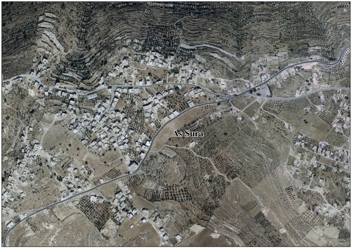
as-Sura
Location of as-Sura within Palestine
Coordinates: 31°28′16″N35°0′4″E / 31.47111°N 35.00111°E / 31.47111; 35.00111
State State of Palestine
Governorate Hebron
Government
  Type Village council
Population
 (2017) [1]
  Total3,941

as-Sura is a Palestinian village located fifteen kilometers south-west of Hebron. The village is in the Hebron Governorate Southern West Bank. According to the Palestinian Central Bureau of Statistics, the village had a population of 3,941 in 2017. [1] The primary health care facilities for the village are obtained at Imreish where they are designated by the Ministry of Health as level 1. [2]

Footnotes

  1. 1 2 Preliminary Results of the Population, Housing and Establishments Census, 2017 (PDF). Palestinian Central Bureau of Statistics (PCBS) (Report). State of Palestine. February 2018. pp. 64–82. Retrieved 2023-10-24.
  2. West Bank Health care


Related Research Articles

<span class="mw-page-title-main">Khirbet al-Deir</span> Municipality type D in Hebron, State of Palestine

Khirbet al-Deir, or Khirbet ed-Deir, is a Palestinian village located 10 kilometres (6.2 mi) southwest of Bethlehem, and 15 kilometres (9.3 mi) northwest of Hebron. The town is in the Hebron Governorate of central West Bank. According to the 2017 Palestinian Central Bureau of Statistics (PCBS) Census, the village had a population of 358 people.

Tarqumiyah is a Palestinian city located 12 kilometers northwest of Hebron, in the southern West Bank, in the Hebron Governorate of the State of Palestine. The city had a population of 19,311 in 2017.

Deir Sammit is a Palestinian town located eight kilometers west of Hebron. The town is in the Hebron Governorate Southern West Bank. According to the Palestinian Central Bureau of Statistics, the town had a population of 8,114 in 2017.

Al-Majd is a Palestinian village located eighteen kilometers south-west of Hebron. The village is in the Hebron Governorate of Palestine, in the southern West Bank. The village had a population of 2,277 in 2017.

an-Nassariya is a Palestinian town in the Nablus Governorate in the North central West Bank, located 14 kilometers East of Nablus. According to the Palestinian Central Bureau of Statistics (PCBS), the village had a population of 1,889 inhabitants in 2017. The healthcare facilities for the surrounding villages are based in an-Nassariya, and the facilities are designated as MOH level 2.

al-Ramadin Village in West Bank, Palestine

Al-Ramadin is a Palestinian village located 24 kilometers southwest of Hebron and includes the smaller village of 'Arab al-Fureijat to the southeast. The village is part the Hebron Governorate in the southern West Bank. According to the Palestinian Central Bureau of Statistics, the two villages had a combined population of 4,150 in 2017. The principal families are al-Sho'ur, al-Zagharna, al-Fureijat, al-Daraghmeh, al-Raghmat, al-Mlihat and al-Masamra.

Shuyukh al-Arrub is a Palestinian village located eleven kilometers north-east of Hebron. The village is in the Hebron Governorate Southern West Bank. According to the Palestinian Central Bureau of Statistics, the village had a population of 1,958 inhabitants in 2017. The primary health care facilities for the village are designated by the Ministry of Health as level 2.

Hadab al-Fawwar is a Palestinian village located seven kilometers southwest of Hebron. The village is in the Hebron Governorate Southern West Bank. According to the Palestinian Central Bureau of Statistics, the village had a population of 2,354 in 2017. The primary health care facilities for the village are designated by the Ministry of Health as level 2. It is adjacent to the Palestinian refugee camp of Fawwar.

Qalqas or Qilqis is a Palestinian village located four kilometers south of Hebron and adjacent to Beit Hagai. The village is in the Hebron Governorate Southern West Bank. According to the Palestinian Central Bureau of Statistics, the village had a population of 1,709 in 2017. The primary health care facilities for the village are designated by the Ministry of Health as level 1.

al-Heila is a Palestinian village located eight kilometers south of Hebron. The village is in the Hebron Governorate Southern West Bank. According to the Palestinian Central Bureau of Statistics, the village had a population of 1,277 in 2007. The primary health care facilities for the village are designated by the Ministry of Health as level 1.

Khursa is a Palestinian village located seven kilometers south-west of Hebron. The village is in the Hebron Governorate Southern West Bank. According to the Palestinian Central Bureau of Statistics, the village had a population of 3,481 in 2017. The primary health care facilities for the village are designated by the Ministry of Health as level 2.

Imreish is a Palestinian village located eleven kilometers south-west of Hebron. The village is in the Hebron Governorate in the southern West Bank. According to the Palestinian Central Bureau of Statistics, the village had a population of 2,208 in 2017. The primary health care facilities for the village are designated by the Ministry of Health as level 1.

al-Uddeisa, also spelled Al 'Uddeisa, is a Palestinian village located four kilometers east of Hebron.The village is a locality of Sa'ir, in the Hebron Governorate Southern West Bank. According to the Palestinian Central Bureau of Statistics, the village had a population of 1,474 in mid-year 2006. The primary health care facilities for the village are designated by the Ministry of Health as level 1.

Hureiz is a Palestinian village located seven kilometers south-east of Hebron. The village is in the Hebron Governorate Southern West Bank. According to the Palestinian Central Bureau of Statistics, the village had a population of 997 in mid-year 2006. The primary health care facilities for the village are at Zif designated by the Ministry of Health as level 1 and at Yatta, level 3.

Zif is a Palestinian village located 7 kilometers (4.3 mi) south of Hebron. The village is in the Hebron Governorate in the southern West Bank. According to the Palestinian Central Bureau of Statistics, Zif had a population of 1,061 in 2017. The primary health care facilities in the village itself are designated by the Ministry of Health as level 1 and at nearby Yatta as level 3.

Karma is a Palestinian village located nineteen kilometers south-west of Hebron. The village is in the Hebron Governorate Southern West Bank. The village had a population of 1,781 in 2017.

Khalet al-Maiyya خلة المية is a Palestinian village located nine kilometers south of Hebron and four kilometers west of Yatta. The village is in the Hebron Governorate Southern West Bank. According to the Palestinian Central Bureau of Statistics, the village had a population of 2,149 in 2017. The primary health care facilities for the village is designated by the Ministry of Health as level 2.

al-Kum Village in West Bank, Palestine

Al-Kum is a Palestinian village in the southern West Bank, part of the Hebron Governorate and located 13 kilometers west of Hebron. Its municipal borders stretch from the border with Israel in the west to boundaries of the city of Dura in the east. It had a population of 1,464 in the 2017 census by the Palestinian Central Bureau of Statistics.

Deir Razih is a Palestinian village in the southern West Bank located 11 kilometers (6.8 mi) southwest of Hebron, in the Hebron Governorate. It relies mainly on nearby Dura for basic services. Its total land area is made of 540 dunams, including its built-up area. The village had a population of 294 residents in 2017.

<span class="mw-page-title-main">Rabud</span> Municipality type D in Hebron, State of Palestine

Rabud is a Palestinian village in the southern West Bank, in the Hebron Governorate of the State of Palestine. The village was the site of an ancient Canaanite city. The village had a population of 2,816 in 2017.