Beit ar-Rush al-Fauqa

Last updated

Contents

Beit ar-Rush al-Fauqa
Arabic transcription(s)
   Arabic بيت الروش الفوقا
Palestine location map wide.png
Red pog.svg
Beit ar-Rush al-Fauqa
Location of Beit ar-Rush al-Fauqa within Palestine
Coordinates: 31°27′07″N34°55′34″E / 31.45194°N 34.92611°E / 31.45194; 34.92611
Palestine grid 144/095
State State of Palestine
Governorate Hebron
Government
  Type Village council
Population
 (2017) [1]
  Total
1,385
Name meaningThe house of er Rush; personal name [2]

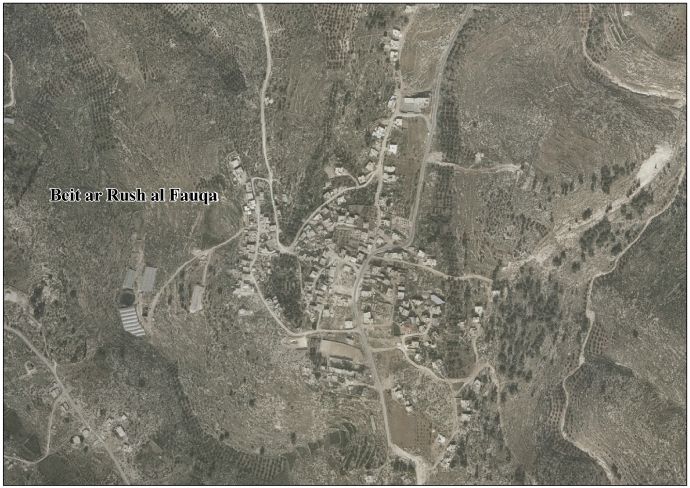
Beit ar-Rush al-Fauqa (Arabic : بيت الروش الفوقا) is a Palestinian village located eighteen kilometers southwest of Hebron.The village is in the Hebron Governorate Southern West Bank. According to the Palestinian Central Bureau of Statistics, the village had a population of 1,385 in 2017. [1]

History

Al-Dimashqi (d.1327) noted one area called Bait-ras in Palestine, and A. F. Mehren thought its description matched the location of the Beit er-Rush of Robinson. [3]

Ottoman era

In 1838, a Beit er-Rush was noted by Edward Robinson as a place "in ruins or deserted," part of the area between the mountains and Gaza, but subject to the government of el-Khulil. [4] [5]

In 1863, Victor Guérin noted about the ruins here: ”These ruins consist of a large number of heaps of irregular materials. Each of these heaps surrounds a cave hollowed in the rock, into which there is a descent of steps, or by an incline. These subterranean dwellings formed the basement of one-storied houses which stood above them. These have been pulled down and put up again several times, while the cellars are just the same as when they were cut in the rock." [6]

In 1883, the PEF's Survey of Western Palestine noted here: ”Traces of ruins on a mound.” [7]

British Mandate era

At the time of the 1931 census of Palestine the population of the village, called Kh. Beit er Rush al Ulya, was counted under Dura. [8]

Jordanian era

In the wake of the 1948 Arab–Israeli War, and after the 1949 Armistice Agreements, Beit ar-Rush al-Fauqa came under Jordanian rule. It was annexed by Jordan in 1950.

The Jordanian census of 1961 found 162 inhabitants in Beit ar-Rush al-Fauqa. [9]

Post 1967

Since the Six-Day War in 1967, Beit ar-Rush al-Fauqa has been under Israeli occupation.

Related Research Articles

<span class="mw-page-title-main">Beit Ur al-Tahta</span> Municipality type C in Ramallah and al-Bireh, State of Palestine

Beit Ur al-Tahta is a Palestinian village located in the central West Bank, in the Ramallah and Al-Bireh Governorate of the State of Palestine. According to the Palestinian Central Bureau of Statistics, Beit Ur at-Tahta had a population of 5,040 inhabitants in 2017.

<span class="mw-page-title-main">Beit Ummar</span> Municipality type B in Hebron, State of Palestine

Beit Ummar is a Palestinian town located eleven kilometers northwest of Hebron in the Hebron Governorate of the State of Palestine. According to the Palestinian Central Bureau of Statistics, in 2017, the town had a population of 16,977 inhabitants. Over 4,800 residents of the town are under the age of 18. Since the Second Intifada, unemployment ranges between 60 and 80 percent due mostly to the inability of residents to work in Israel and a depression in the Palestinian economy. A part of the city straddles Road 60 and due to this, several propositions of house demolition have occurred.

<span class="mw-page-title-main">Dura al-Qar'</span> Municipality type D in Ramallah and al-Bireh, State of Palestine

Dura al-Qar' or Dura al-Qari'a is a Palestinian town in the central West Bank, part of the Ramallah and al-Bireh Governorate. According to the Palestinian Central Bureau of Statistics, Dura al-Qar' had a population of 3,032 inhabitants in 2017.

<span class="mw-page-title-main">Beit Awwa</span> Municipality type B in Hebron, State of Palestine

Beit Awwa is a Palestinian town in the southern West Bank, in the Hebron Governorate of the State of Palestine, located 22 kilometers west of Hebron and 4 kilometers west of Dura. According to the Palestinian Central Bureau of Statistics, Beit Awwa had a population of 10,436 inhabitants in 2017.

<span class="mw-page-title-main">Kharbatha al-Misbah</span> Arab village in the Ramallah and al-Bireh Governate

Kharbatha al-Misbah is a Palestinian town in the central West Bank, located 12.5 kilometers (7.8 mi) west of Ramallah in the Ramallah and al-Bireh Governorate. According to the Palestinian Central Bureau of Statistics, the town had a population of 6,366 in 2017. It has a total land area of 4,431 dunams, of which 644 are built-up areas and the remainder agricultural lands and forests.

<span class="mw-page-title-main">Beit Liqya</span> Municipality type C in Ramallah and al-Bireh, State of Palestine

Beit Liqya is a Palestinian town located in the Ramallah and al-Bireh Governorate in the northern West Bank. According to the Palestinian Central Bureau of Statistics, it had a population of approximately 9,304 in 2017.

<span class="mw-page-title-main">Beit Ur al-Fauqa</span> Municipality type C in Ramallah and al-Bireh, State of Palestine

Beit Ur al-Fauqa is a Palestinian village located in the Ramallah and al-Bireh Governorate of the State of Palestine, in the northern West Bank, 14 kilometers (8.7 mi) west of Ramallah and 3 kilometers (1.9 mi) southeast of Beit Ur al-Tahta.

<span class="mw-page-title-main">Beit Sira</span> Municipality type D in Ramallah and al-Bireh, State of Palestine

Beit Sira is a Palestinian village in the central West Bank, located 22 kilometers west of Ramallah and is a part of the Ramallah and al-Bireh Governorate. The village is situated along the Green Line. During the 1948 Arab-Israeli War, around 4,000 dunams of its land became a part of the "No-Man's Land" strip between the north-central West Bank and Israel. Currently Beit Sira's jurisdiction is 3,120 dunams, of which 441 dunams are built-up areas and the remainder is open spaces for future construction or agricultural land.

<span class="mw-page-title-main">Deir Ibzi</span> Municipality type C in Ramallah and al-Bireh, State of Palestine

Deir Ibzi is a Palestinian town in the Ramallah and al-Bireh Governorate, located west of Ramallah in the northern West Bank. According to the Palestinian Central Bureau of Statistics, the town had a population of 2,590 inhabitants in 2017.

<span class="mw-page-title-main">Beit Duqqu</span> Municipality type D in Jerusalem

Beit Duqqu is a Palestinian village in the Jerusalem Governorate, located northwest of Jerusalem in the central West Bank. According to the Palestinian Central Bureau of Statistics, the town had a population of 1,754 in 2017.

<span class="mw-page-title-main">Jaba', Jerusalem</span> Municipality type D in Jerusalem, State of Palestine

Jaba’ is a Palestinian town in the Jerusalem Governorate of the State of Palestine, located northeast of Jerusalem in the central West Bank. According to the Palestinian Central Bureau of Statistics, the town had a population of 3,921 in 2017.

<span class="mw-page-title-main">Beit Ta'mir</span> West Bank village in the Bethlehem Governate

Beit Ta'mir is a Palestinian village located six kilometers southeast of Bethlehem.The town is in the Bethlehem Governorate central West Bank. According to the Palestinian Central Bureau of Statistics, the village had a population of 1,596 in 2017. The village is named after the 'Arab al-Ta'mira Bedouin tribe of the Bethlehem area, and along with Za'atara, Hindaza, Tuqu', Khirbet al-Deir, Nuaman, Ubeidiya and al-Asakra forms the 'Arab al-Ta'mira village cluster.

<span class="mw-page-title-main">Deir al-'Asal al-Fauqa</span> Village in West Bank, Palestine

Deir al-'Asal al-Fauqa is a Palestinian town located sixteen kilometers west of Hebron.The town is in the Hebron Governorate Southern West Bank. According to the Palestinian Central Bureau of Statistics, the town had a population of 1,859 in 2017.

<span class="mw-page-title-main">Beit 'Amra</span> Village in West Bank, Palestine

Beit 'Amra is a Palestinian village located twelve kilometers southwest of Hebron. The village is in the Hebron Governorate Southern West Bank. According to the Palestinian Central Bureau of Statistics, the village had a population of 3,607 in 2017.

al-Kum Village in West Bank, Palestine

Al-Kum is a Palestinian village in the southern West Bank, part of the Hebron Governorate and located 13 kilometers west of Hebron. Its municipal borders stretch from the border with Israel in the west to boundaries of the city of Dura in the east. It had a population of 1,464 in the 2017 census by the Palestinian Central Bureau of Statistics.

<span class="mw-page-title-main">Beit 'Anan</span> Municipality type C in Jerusalem, State of Palestine

Beit 'Anan is a Palestinian village in the Quds Governorate, located northwest of Jerusalem. In 2017, it had a population of 4,210. Some residents of Beit 'Anan hold Israeli identity cards, while others hold Palestinian identity cards.

<span class="mw-page-title-main">Burham, Ramallah</span> Local Development Committee in Ramallah and al-Bireh, State of Palestine

Burham is a Palestinian village in the Ramallah and al-Bireh Governorate located twelve kilometers north of Ramallah. The largest nearby town is Bir Zeit located to the southeast. The average elevation of Burham is 680 meters above sea level. The village was established during the Byzantine Empire rule over Palestine.

<span class="mw-page-title-main">Ein Siniya</span> Local Development Committee in Ramallah and al-Bireh, State of Palestine

Ein Siniya is a small Palestinian village in the Ramallah and al-Bireh Governorate, 10 kilometers (6.2 mi) north of Ramallah, and approximately 1km northeast from Jifna. It lies in a valley surrounded with olive and fig-terraces.

<span class="mw-page-title-main">Al-Ram</span> Municipality type B in Jerusalem, State of Palestine

Al-Ram, also transcribed as Al-Ramm, El-Ram, Er-Ram, and A-Ram, is a Palestinian town which lies northeast of Jerusalem, just outside the city's municipal border. The village is part of the built-up urban area of Jerusalem, the Atarot industrial zone and Beit Hanina lie to the west, and Neve Yaakov borders it on the south, with a built-up area of 3,289 dunums. According to the Palestinian Central Bureau of Statistics, a-Ram had a population of 15,814 in 2017. The head of A-Ram's village council estimates that 58,000 people live there, more than half of them holding Israeli identity cards.

At-Tira is a Palestinian village in the Ramallah and al-Bireh Governorate in the northern West Bank.

References

  1. 1 2 Preliminary Results of the Population, Housing and Establishments Census, 2017 (PDF). Palestinian Central Bureau of Statistics (PCBS) (Report). State of Palestine. February 2018. pp. 64–82. Retrieved 2023-10-24.
  2. Palmer, 1881, p. 365
  3. Al-Dimashqi, 1874, p. 270
  4. Robinson and Smith, 1841, vol 3, p. 6
  5. Robinson and Smith, 1841, vol 3, Appendix 2, p. 117
  6. Guérin, 1869, pp. 347-348; as translated by Conder and Kitchener, 1883, SWP III, p. 274
  7. Conder and Kitchener, 1883, SWP III, p. 274
  8. Mills, 1932, p. 30
  9. Government of Jordan, Department of Statistics, 1964, p. 22

Bibliography