Related Research Articles

Edmonton Strathcona is a federal electoral district in Alberta, Canada, that has been represented in the House of Commons of Canada since 1953. It spans the south-central part of the city of Edmonton. In the periods 2008–2015 and 2019–2021, during the 40th, 41st, and 43rd Canadian Parliaments, Edmonton Strathcona was the only federal riding in Alberta not represented by the Conservative Party.
Fort Edmonton was the name of a series of trading posts of the Hudson's Bay Company (HBC) from 1795 to 1914, all of which were located on the north banks of the North Saskatchewan River in what is now central Alberta, Canada. It was one of the last points on the Carlton Trail, the main overland route for Metis freighters between the Red River Colony and the points west and was an important stop on the York Factory Express route between London, via Hudson Bay, and Fort Vancouver in the Columbia District. It also was a connection to the Great Northland, as it was situated relatively close to the Athabasca River whose waters flow into the Mackenzie River and the Arctic Ocean. Located on the farthest north of the major rivers flowing to the Hudson Bay and the HBC's shipping posts there, Edmonton was for a time the southernmost of the HBC's forts.

Edmonton—Mill Woods—Beaumont was a federal electoral district in Alberta, Canada, that was represented in the House of Commons of Canada from 2004 to 2015.

Edmonton—St. Albert was a federal electoral district in Alberta, Canada, that was represented in the House of Commons of Canada from 2004 to 2015.

Division No. 11 is a census division in Alberta, Canada. Surrounding the City of Edmonton, the majority of the division comprises Alberta's Capital Region, while the western and southern portions of the division are located within central Alberta. The division also forms the northern segment of the Calgary–Edmonton Corridor.

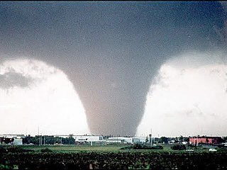
The Edmonton tornado of 1987, an event also known as Black Friday to Edmontonians, was a powerful and devastating tornado that ripped through the eastern parts of Edmonton, Alberta, Canada and parts of neighbouring Strathcona County on the afternoon of Friday, July 31, 1987. It was one of seven other tornadoes in central Alberta the same day.
Callingwood can refer to two neighbourhoods in west Edmonton, Alberta, Canada – Callingwood North and Callingwood South. Combined, the two neighbourhoods are bounded on the west by 178 Street, on the east by 170 Street, on the north by Whitemud Drive, and on the south by Callingwood Road. Callingwood North is located north of 69 Avenue, while Callingwood South located south of 69 Avenue.

D.L. MacDonald Yard is the maintenance facility, garage, and operations centre for the Capital and Metro light rail transit lines operated by Edmonton Transit Service, in Edmonton, Alberta, Canada. Located to the northeast in the Kennedale industrial area, at 13310 - 50A Street, the facility opened in December 1983 at a cost of $28.2 million.

Alberta's Industrial Heartland is the largest industrial area in Western Canada and a joint land-use planning and development initiative between five municipalities in the Edmonton Capital Region to attract investment in the chemical, petrochemical, oil, and gas industries to the region. It is "home to more than 40 petrochemical companies" and is one of Canada's largest petrochemical processing regions." By July 2015 there was $13 billion invested in new industrial projects providing employment for 25,000 in the Alberta's Industrial Heartland.

Strathcona County Transit provides local, commuter, and school bus services to the community of Sherwood Park, Alberta, Canada, which is east of Edmonton in Strathcona County. Transportation for elderly citizens and people with disabilities is provided by Mobility Bus within Sherwood Park and rural Strathcona County. Strathcona County is home to Alberta's first fleet of double-decker buses. It purchased 24 double-decker buses from 2010 to 2020 using a combination of municipal, provincial, and federal funding. In 2023, the system had a ridership of 1,274,700.
The Leduc-Nisku Economic Development Association (EDA) was an economic development partnership founded in 1984. It marketed Alberta's International Region, and became dissolved at the end of 2019.
Blackmud Creek is a creek in Edmonton that flows into Whitemud Creek. The creek starts at Saunders Lake East of Nisku and runs northwest into the City, joining Whitemud Creek in the neighbourhood of Twin Brooks.

Refinery Row is the unofficial name given to the concentration of oil refineries in west Sherwood Park, Strathcona County, Alberta, just east of the city of Edmonton.
Hermitage is a residential area in the northeast portion of the City of Edmonton in Alberta, Canada. It was established in 1970 through Edmonton City Council's adoption of the Hermitage General Outline Plan, which guides the overall development of the area.
Walterdale is a former industrial and residential neighbourhood in Edmonton, Alberta, Canada within the North Saskatchewan River valley. It is located on the south shore of the river in an area now occupied by Kinsmen Park within a river valley neighbourhood named River Valley Walterdale.
The Dunvegan Yards were rail yards in Edmonton, Alberta, named after, and originally owned by, the Edmonton, Dunvegan and British Columbia Railway. Located just east of the St. Albert Trail and connected to the Grand Trunk Pacific's transcontinental mainline, the yards were the southern terminus of the ED&BC which began construction in 1912, though the yards were not officially surveyed until 1914. The ED&BC, by 1915, reached Grande Prairie in the Peace Country some 400 miles or 640 kilometres northwest from Edmonton, and helped to cement Edmonton as a major Canadian rail hub, opened up the Westlock region to increased settlement, linked northern Alberta economically to the rest of the continent, and earned Edmonton a reputation as "the Gateway to the North".
Fulton Creek is a minor tributary which flows into the North Saskatchewan River. Fulton Creek originates within The Meadows area of Edmonton, Alberta. As with other urban Edmonton waterways, with long stretches running through underground culverts, and water volume managed by other urban land uses and for erosion control, Fulton Creek has been labeled a lost creek.
Edmonton-Belmont was a provincial electoral district in Alberta, Canada, mandated to return a single member to the Legislative Assembly of Alberta using the first past the post method of voting from 1971 to 1993.
Edmonton-Glengarry was a provincial electoral district in Alberta, Canada, mandated to return a single member to the Legislative Assembly of Alberta using the first past the post method of voting from 1979 to 2004.
References
- ↑ "City of Edmonton - Neighbourhoods (Map View)". City of Edmonton. Retrieved 2021-11-01.
- ↑ "Cannell". Geographical Names Data Base . Natural Resources Canada.
- ↑ Place-names of Alberta. Ottawa: Geographic Board of Canada. 1928. p. 29.
53°35′46″N113°37′12″W / 53.596°N 113.620°W