
Celles-sur-Durolle is a commune in the Puy-de-Dôme department in Auvergne-Rhône-Alpes in central France.
The arrondissement of Briançon is an arrondissement of France in the Hautes-Alpes department in the Provence-Alpes-Côte d'Azur region. It has 36 communes.

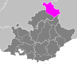
The arrondissement of Gap is an arrondissement of France in the Hautes-Alpes department in the Provence-Alpes-Côte d'Azur region. It has 126 communes.
The following is a list of the 15 cantons of the Hautes-Alpes department, in France, following the French canton reorganisation which came into effect in March 2015:
The Canton of Savines-le-Lac is a former canton in the Arrondissement of Gap in the department of Hautes-Alpes in the region Provence-Alpes-Côte d'Azur in France. It was disbanded following the French canton reorganisation which came into effect in March 2015. It consisted of 6 communes, which joined the canton of Chorges in 2015. Its main town and commune was Savines-le-Lac and its representative in the conseil général was Victor Berengue.
The canton of Barcelonnette is an administrative division in southeastern France. At the French canton reorganisation which came into effect in March 2015, the canton was expanded from 11 to 16 communes :
The canton of Castellane is an administrative division in southeastern France. At the French canton reorganisation which came into effect in March 2015, the canton was expanded from 7 to 32 communes:
The canton of Riez is an administrative division in southeastern France. At the French canton reorganisation which came into effect in March 2015, the canton was expanded from 9 to 26 communes:
The canton of Seyne is an administrative division in southeastern France. At the French canton reorganisation which came into effect in March 2015, the canton was expanded from 8 to 34 communes:
The canton of Briançon-2 is an administrative division in southeastern France. It consists of the eastern part of the commune of Briançon and its northeastern suburbs. It includes the following communes:
The canton of La Grave is a former administrative division in southeastern France. It was disbanded following the French canton reorganisation which came into effect in March 2015. It consisted of 2 communes, which joined the new canton of Briançon-1 in 2015. It included the following communes:
The canton of Le Monêtier-les-Bains is a former administrative division in southeastern France. It was disbanded following the French canton reorganisation which came into effect in March 2015. It consisted of 3 communes, which joined the new canton of Briançon-1 in 2015. It included the following communes:
The canton of Chorges is an administrative division in southeastern France. At the French canton reorganisation which came into effect in March 2015, the canton was expanded from 8 to 17 communes:
The canton of Saint-Bonnet-en-Champsaur is an administrative division in southeastern France. At the French canton reorganisation which came into effect in March 2015, the canton was expanded from 16 to 27 communes :
The canton of Serres is an administrative division in southeastern France. At the French canton reorganisation which came into effect in March 2015, the canton was expanded from 12 to 41 communes :
The canton of Tallard is an administrative division in southeastern France. At the French canton reorganisation which came into effect in March 2015, the canton was expanded from 9 to 19 communes:
The 2nd constituency of the Hautes-Alpes is a French legislative constituency in the Hautes-Alpes department.
The canton of Montbrison is a French administrative division located in the department of Loire and the Auvergne-Rhône-Alpes region. At the French canton reorganisation which came into effect in March 2015, the canton was expanded from 19 to 31 communes:
The canton of Vence is an administrative division of the Alpes-Maritimes department, southeastern France. Its borders were modified at the French canton reorganisation which came into effect in March 2015. Its seat is in Vence.

