Loir-et-Cher is a department in the Centre-Val de Loire region of France. Its name is originated from two rivers which cross it, the Loir in its northern part and the Cher in its southern part. Its prefecture is Blois. The INSEE and La Poste gave it the number 41. It had a population of 329,470 in 2019.

Sologne is a natural region in Centre-Val de Loire, France, extending over portions of the departements of Loiret, Loir-et-Cher and Cher. Its area is about 5,000 square kilometres (1,900 sq mi). To its north is the river Loire, to its south the river Cher, while the districts of Sancerre and Berry are to its east. Its inhabitants are known as the Solognots (masculine) and Solognotes (feminine).

The arrondissement of Blois is an arrondissement (district) of France, located in the Loir-et-Cher department, Centre-Val de Loire. It has 93 communes. Its population is 150,805 (2016), and its area is 1,950.2 km2 (753.0 sq mi).

The Arrondissement of Vendôme is an arrondissement of France, located in the Loir-et-Cher departement, region of Centre-Val de Loire. It has 100 communes. Its population is 69,819 (2016), and its area is 1,722.3 km2 (665.0 sq mi).

The arrondissement of Romorantin-Lanthenay is an arrondissement of France in the Loir-et-Cher department, in the Centre-Val de Loire region. It has 74 communes. Its population is 112,145 (2016), and its area is 2,670.9 km2 (1,031.2 sq mi).
The following is a list of the 15 cantons of the Loir-et-Cher department, in France, following the French canton reorganisation which came into effect in March 2015:
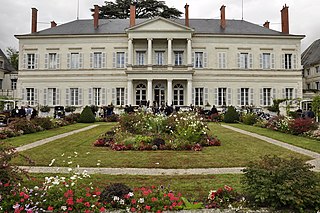
Salbris is a commune in the Loir-et-Cher department in central France.
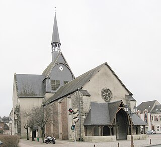
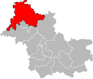
Sargé-sur-Braye is a commune in the French department of Loir-et-Cher, administrative region of Centre-Val de Loire, France.

The canton of La Beauce is a canton of the Loir-et-Cher department, central France. Its seat is Beauce-la-Romaine. It was created at the canton reorganisation that came into effect in March 2015. Since then it elects two members of the Departmental Council of Loir-et-Cher.
The canton of Montrichard Val de Cher is an administrative division of the Loir-et-Cher department, central France. Its borders were modified at the French canton reorganisation which came into effect in March 2015. Its seat is in Montrichard Val de Cher.
The canton of Veuzain-sur-Loire is an administrative division of the Loir-et-Cher department, central France. It was created at the French canton reorganisation which came into effect in March 2015. Its seat is in Veuzain-sur-Loire.
The Canton of Blois-3 is an administrative division of the Loir-et-Cher department, central France. Its borders were modified at the French canton reorganisation which came into effect in March 2015. Its seat is in Blois.
The canton of Chambord is a canton of the Loir-et-Cher department, central France. Its seat is Chambord. It was created at the canton reorganisation that came into effect in March 2015. Since then, it elects two members of the Departmental Council of Loir-et-Cher.
The canton of Montoire-sur-le-Loir is an administrative division of the Loir-et-Cher department, central France. Its borders were modified at the French canton reorganisation which came into effect in March 2015. Its seat is in Montoire-sur-le-Loir.
The canton of Romorantin-Lanthenay is an administrative division of the Loir-et-Cher department, central France. It was created at the French canton reorganisation which came into effect in March 2015. Its seat is in Romorantin-Lanthenay.
The canton of Le Perche is a canton of the Loir-et-Cher department, central France. Its seat is Savigny-sur-Braye. It was created at the canton reorganisation that came into effect in March 2015. Since then it elects two members of the Departmental Council of Loir-et-Cher.
The canton of Saint-Aignan is an administrative division of the Loir-et-Cher department, central France. Its borders were modified at the French canton reorganisation which came into effect in March 2015. Its seat is in Saint-Aignan.
The Canton of Selles-sur-Cher is an canton of the French department of Loir-et-Cher, central France. Its borders were modified at the French canton reorganisation which came into effect in March 2015. Its seat is in Selles-sur-Cher.

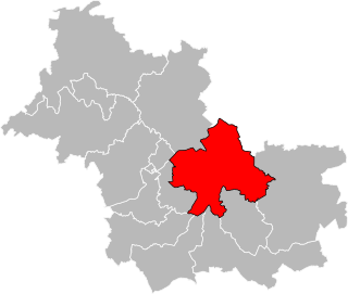
The 2nd constituency of Loir-et-Cher is one of three French legislative constituencies in the Loir-et-Cher department, in the Centre-Val de Loire region.
