The arrondissement of Le Mans is an arrondissement of France in the Sarthe department in the Pays de la Loire region. It has 47 communes. In 2006 it lost the five cantons of La Chartre-sur-le-Loir, Château-du-Loir, Le Grand-Lucé, Loué and La Suze-sur-Sarthe to the arrondissement of La Flèche, and the six cantons of Bouloire, Conlie, Montfort-le-Gesnois, Saint-Calais, Sillé-le-Guillaume and Vibraye to the arrondissement of Mamers.
The following is a list of the 21 cantons of the Sarthe department, in France, following the French canton reorganisation which came into effect in March 2015:
The canton of Tiercé is an administrative division of the Maine-et-Loire department, in western France. Its borders were modified at the French canton reorganisation which came into effect in March 2015. Its seat is in Tiercé.
The canton of Radon is an administrative division of the Orne department, northwestern France. It was created at the French canton reorganisation which came into effect in March 2015. Its seat is in Écouves.
The canton of Bonnétable is an administrative division of the Sarthe department, northwestern France. Its borders were modified at the French canton reorganisation which came into effect in March 2015. Its seat is in Bonnétable.
The canton of Changé is an administrative division of the Sarthe department, northwestern France. It was created at the French canton reorganisation which came into effect in March 2015. Its seat is in Changé.
The canton of Château-du-Loir is an administrative division of the Sarthe department, northwestern France. Its borders were modified at the French canton reorganisation which came into effect in March 2015. Its seat is in Montval-sur-Loir.
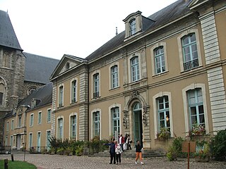
The canton of La Flèche is an administrative division of the Sarthe department, northwestern France. Its borders were modified at the French canton reorganisation which came into effect in March 2015. Its seat is in La Flèche.
The canton of Mamers is an administrative division of the Sarthe department, northwestern France. Its borders were modified at the French canton reorganisation which came into effect in March 2015. Its seat is in Mamers.
The canton of Écommoy is an administrative division of the Sarthe department, northwestern France. Its borders were modified at the French canton reorganisation which came into effect in March 2015. Its seat is in Écommoy.
The canton of Le Lude is an administrative division of the Sarthe department, northwestern France. Its borders were modified at the French canton reorganisation which came into effect in March 2015. Its seat is in Le Lude.
The canton of Le Mans-1 is an administrative division of the Sarthe department, northwestern France. It was created at the French canton reorganisation which came into effect in March 2015. Its seat is in Le Mans.
The canton of Le Mans-2 is an administrative division of the Sarthe department, northwestern France. It was created at the French canton reorganisation which came into effect in March 2015. Its seat is in Le Mans.
The canton of Le Mans-3 is an administrative division of the Sarthe department, northwestern France. It was created at the French canton reorganisation which came into effect in March 2015. Its seat is in Le Mans.
The canton of Le Mans-4 is an administrative division of the Sarthe department, northwestern France. It was created at the French canton reorganisation which came into effect in March 2015. Its seat is in Le Mans.
The canton of Le Mans-5 is an administrative division of the Sarthe department, northwestern France. It was created at the French canton reorganisation which came into effect in March 2015. Its seat is in Le Mans.
The canton of Le Mans-7 is an administrative division of the Sarthe department, northwestern France. It was created at the French canton reorganisation which came into effect in March 2015. Its seat is in Le Mans.
The canton of Sablé-sur-Sarthe is an administrative division of the Sarthe department, northwestern France. Its borders were modified at the French canton reorganisation which came into effect in March 2015. Its seat is in Sablé-sur-Sarthe.
The canton of Saint-Calais is an administrative division of the Sarthe department, northwestern France. Its borders were modified at the French canton reorganisation which came into effect in March 2015. Its seat is in Saint-Calais.
The canton of La Suze-sur-Sarthe is an administrative division of the Sarthe department, northwestern France. Its borders were modified at the French canton reorganisation which came into effect in March 2015. Its seat is in La Suze-sur-Sarthe.