The following is a list of the 23 cantons of the Seine-et-Marne department, in France, following the French canton reorganisation which came into effect in March 2015:

The arrondissement of Meaux is an arrondissement of France in the Seine-et-Marne department in the Île-de-France region. In 1993 it lost the six cantons of Claye-Souilly, Lagny-sur-Marne, Torcy, Vaires-sur-Marne, Champs-sur-Marne and Noisiel to the new arrondissement of Noisiel. In 2006 it lost the canton of Rebais to the arrondissement of Provins. Since the January 2017 reorganization of the arrondissements of Seine-et-Marne, it has 143 communes.

The arrondissement of Torchy is an arrondissement of France in the Seine-et-Marne department in the Île-de-France region. It was formed in February 1993 from parts of the arrondissements of Meaux and Melun. Until April 1994 it was called arrondissement of Noisiel. Since the January 2017 reorganization of the arrondissements of Seine-et-Marne, it has 43 communes.

The canton of Combs-la-Ville is a French administrative division, located in the arrondissement of Melun, in the Seine-et-Marne département.

The canton of Savigny-le-Temple is a French administrative division that is in the arrondissement of Melun, in the Seine-et-Marne département.
The canton of Champs-sur-Marne is a French administrative division, located in the arrondissement of Torcy, in the Seine-et-Marne département.

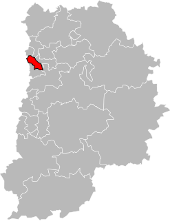
The canton of Claye-Souilly is a French administrative division, located in the arrondissement of Torcy, in the Seine-et-Marne département.

The canton of Pontault-Combault is a French administrative division, located in the arrondissement of Torcy, in the Seine-et-Marne département.

The canton of Torcy is a French administrative division, located in the arrondissement of Torcy, in the Seine-et-Marne département.

The canton of Coulommiers is a French administrative division, located in the arrondissement of Meaux, in the Seine-et-Marne département.
The canton of Crécy-la-Chapelle is a French former administrative division, located in the Arrondissement of Meaux, in the Seine-et-Marne département. It was disbanded following the French canton reorganisation which came into effect in March 2015. It consisted of 18 communes, which joined the canton of Serris in 2015.
The canton of Dammartin-en-Goële is a French former administrative division, located in the arrondissement of Meaux, in the Seine-et-Marne département. It was disbanded following the French canton reorganisation which came into effect in March 2015.
The canton of La Ferté-sous-Jouarre is a French administrative division, located in the arrondissement of Meaux, in the Seine-et-Marne département.
The canton of Lizy-sur-Ourcq is a French former administrative division, located in the arrondissement of Meaux, in the Seine-et-Marne département. It was disbanded following the French canton reorganisation which came into effect in March 2015. It consisted of 22 communes, which joined the canton of La Ferté-sous-Jouarre in 2015.
The canton of Meaux-Nord is a French former administrative division, located in the arrondissement of Meaux, in the Seine-et-Marne département. It was disbanded following the French canton reorganisation which came into effect in March 2015.
The canton of Meaux-Sud is a French former administrative division, located in the arrondissement of Meaux, in the Seine-et-Marne département. It was disbanded following the French canton reorganisation which came into effect in March 2015.

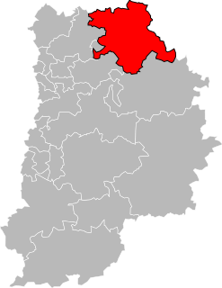
The canton of Mitry-Mory is a French administrative division, located in the arrondissement of Meaux, in the Seine-et-Marne département.

The canton of Montereau-Fault-Yonne is a French administrative division, located in the arrondissement of Provins, in the Seine-et-Marne département.
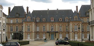
The Communauté d'agglomération du Pays de Meaux (CAPM) is a communauté d'agglomération in the Seine-et-Marne département and in the Île-de-France région of France. The 4 communes of the former Communauté de communes des Monts de la Goële were merged into it on 1 January 2017.

The canton of Villeparisis is a French administrative division, located in the arrondissement of Torcy, in the Seine-et-Marne département.