Roquebrune may refer to the following communes in France:
The arrondissement of Draguignan is an arrondissement of France in the Var department in the Provence-Alpes-Côte d'Azur region. Since the January 2017 reorganization of the arrondissements of Var, it has 54 communes.
The arrondissement of Brignoles is an arrondissement of France in the Var department in the Provence-Alpes-Côte d'Azur region. Since the January 2017 reorganization of the arrondissements of Var, it has 67 communes.
The following is a list of the 23 cantons of the Var department, in France, following the French canton reorganisation which came into effect in March 2015:

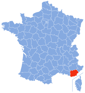
Roquebrune-sur-Argens is a commune in the Var department in the Provence-Alpes-Côte d'Azur region in southeastern France.

The A8 autoroute, also known as La Provençale, is a 224-kilometer (139 mi)-long highway in France that runs between Aix-en-Provence and the A7 to the Côte d'Azur.

The canton of Fontainebleau is a French administrative division, located in the arrondissement of Fontainebleau, in the Seine-et-Marne département.
The canton of Guillestre is an administrative division in the southeastern France. At the French canton reorganisation which came into effect in March 2015, the canton was expanded from 9 to 15 communes (two of mich were merged into the new commune Abriès-Ristolas:

The 2010 Var floods were the result of heavy rainfall in southern France that caused severe floods in the department of the Var in the evening of 15 June 2010. As well as generalized flooding, there were also flash floods. Meteorologists say the floods are the worst in the region since 1827, with more than 400 mm (16 in) of rain falling in less than 24 hours. At least 25 people have been killed. The worst hit municipalities were Les Arcs, Figanières, Roquebrune-sur-Argens, Trans-en-Provence, and the subprefecture of Draguignan.
The canton of Vence is an administrative division of the Alpes-Maritimes department, southeastern France. Its borders were modified at the French canton reorganisation which came into effect in March 2015. Its seat is in Vence.
The canton of Étampes is an administrative division of the Essonne department, Île-de-France region, northern France. Its borders were modified at the French canton reorganisation which came into effect in March 2015. Its seat is in Étampes.
The canton of Romilly-sur-Andelle is an administrative division of the Eure department, northern France. It was created at the French canton reorganisation which came into effect in March 2015. Its seat is in Romilly-sur-Andelle.
The canton of Brignoles is an administrative division of the Var department, southeastern France. Its borders were modified at the French canton reorganisation which came into effect in March 2015. Its seat is in Brignoles.
The canton of Flayosc is an administrative division of the Var department, southeastern France. It was created at the French canton reorganisation which came into effect in March 2015. Its seat is in Flayosc.
The canton of Garéoult is an administrative division of the Var department, southeastern France. It was created at the French canton reorganisation which came into effect in March 2015. Its seat is in Garéoult.
The canton of Le Luc is an administrative division of the Var department, southeastern France. Its borders were modified at the French canton reorganisation which came into effect in March 2015. Its seat is in Le Luc.
The canton of Sainte-Maxime is an administrative division of the Var department, southeastern France. It was created at the French canton reorganisation which came into effect in March 2015. Its seat is in Sainte-Maxime.
The canton of Saint-Maximin-la-Sainte-Baume is an administrative division of the Var department, southeastern France. Its borders were modified at the French canton reorganisation which came into effect in March 2015. Its seat is in Saint-Maximin-la-Sainte-Baume.
The canton of Eymoutiers is an administrative division of the Haute-Vienne department, western France. Its borders were modified at the French canton reorganisation which came into effect in March 2015. Its seat is in Eymoutiers.
The 1991 Tour du Haut Var was the 23rd edition of the Tour du Haut Var cycle race and was held on 23 February 1991. The race started in Sainte-Maxime and finished in Roquebrune-sur-Argens. The race was won by Éric Caritoux.


