
Saint-Maur-des-Fossés is a commune in the southeastern suburbs of Paris, France. It is located 11.7 kilometres from the center of Paris.

The arrondissement of Créteil is an arrondissement of France in the Val-de-Marne department in the Île-de-France region. It has 23 communes.

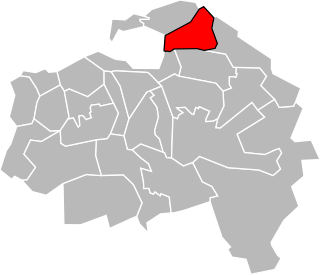
The arrondissement of Nogent-sur-Marne is an arrondissement of France in the Val-de-Marne departement in the Île-de-France region. It has 14 communes.
The following is a list of the 25 cantons of the Val-de-Marne department, in France, following the French canton reorganisation which came into effect in March 2015:
The canton of Nogent-sur-Marne is a French canton, located in the arrondissement of Nogent-sur-Marne, in the Val-de-Marne département.

Le Parc de Saint-Maur is a French railway station in Saint-Maur-des-Fossés, in Val-de-Marne département.

La Varenne–Chennevières is a French railway station in Saint-Maur-des-Fossés, in Val-de-Marne département.
The canton of Alfortville is an administrative division of the Val-de-Marne department, Île-de-France region, northern France. It was created at the French canton reorganisation which came into effect in March 2015. Its seat is in Alfortville.
The canton of Champigny-sur-Marne-1 is an administrative division of the Val-de-Marne department, Île-de-France region, northern France. It was created at the French canton reorganisation which came into effect in March, 2015. Its seat is in Champigny-sur-Marne.
The canton of Champigny-sur-Marne-2 is an administrative division of the Val-de-Marne department, Île-de-France region, northern France. It was created at the French canton reorganisation which came into effect in March 2015. Its seat is in Champigny-sur-Marne.
The canton of Charenton-le-Pont is an administrative division of the Val-de-Marne department, Île-de-France region, northern France. Its borders were modified at the French canton reorganisation which came into effect in March 2015. Its seat is in Charenton-le-Pont.
The canton of Choisy-le-Roi is an administrative division of the Val-de-Marne department, Île-de-France region, northern France. Its borders were modified at the French canton reorganisation which came into effect in March 2015. Its seat is in Choisy-le-Roi.
The canton of Ivry-sur-Seine is an administrative division of the Val-de-Marne department, Île-de-France region, northern France. It was created at the French canton reorganisation which came into effect in March 2015. Its seat is in Ivry-sur-Seine.
The canton of Le Kremlin-Bicêtre is an administrative division of the Val-de-Marne department, Île-de-France region, northern France. Its borders were modified at the French canton reorganisation which came into effect in March 2015. Its seat is in Le Kremlin-Bicêtre.
The canton of Maisons-Alfort is an administrative division of the Val-de-Marne department, Île-de-France region, northern France. It was created at the French canton reorganisation which came into effect in March 2015. Its seat is in Maisons-Alfort.
The canton of Plateau briard is an administrative division of the Val-de-Marne department, Île-de-France region, northern France. It was created at the French canton reorganisation which came into effect in March 2015. Its seat is in Boissy-Saint-Léger.
The canton of Saint-Maur-des-Fossés-2 is an administrative division of the Val-de-Marne department, Île-de-France region, northern France. It was created at the French canton reorganisation which came into effect in March 2015. Its seat is in Saint-Maur-des-Fossés.
The canton of Villeneuve-Saint-Georges is an administrative division of the Val-de-Marne department, Île-de-France region, northern France. Its borders were modified at the French canton reorganisation which came into effect in March 2015. Its seat is in Villeneuve-Saint-Georges.
The canton of Vincennes is an administrative division of the Val-de-Marne department, Île-de-France region, northern France. It was created at the French canton reorganisation which came into effect in March 2015. Its seat is in Vincennes.
The canton of Fosses is an administrative division of the Val-d'Oise department, Île-de-France region, northern France. It was created at the French canton reorganisation which came into effect in March 2015. Its seat is in Fosses.

