
The arrondissement of Créteil is an arrondissement of France in the Val-de-Marne department in the Île-de-France region. It has 23 communes.
The following is a list of the 25 cantons of the Val-de-Marne department, in France, following the French canton reorganisation which came into effect in March 2015:
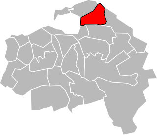
The canton of Nogent-sur-Marne is a French canton, located in the arrondissement of Nogent-sur-Marne, in the Val-de-Marne département.

The canton of Coulommiers is a French administrative division, located in the arrondissement of Meaux, in the Seine-et-Marne département.

The canton of Mitry-Mory is a French administrative division, located in the arrondissement of Meaux, in the Seine-et-Marne département.

The canton of Provins is a French administrative division, located in the arrondissement of Provins, in the Seine-et-Marne département.
The canton of Ozoir-la-Ferrière is an administrative division of the Seine-et-Marne department, in northern France. It was created at the French canton reorganisation which came into effect in March 2015. Its seat is in Ozoir-la-Ferrière.
The canton of Champigny-sur-Marne-1 is an administrative division of the Val-de-Marne department, Île-de-France region, northern France. It was created at the French canton reorganisation which came into effect in March, 2015. Its seat is in Champigny-sur-Marne.
The canton of Champigny-sur-Marne-2 is an administrative division of the Val-de-Marne department, Île-de-France region, northern France. It was created at the French canton reorganisation which came into effect in March 2015. Its seat is in Champigny-sur-Marne.
The canton of Charenton-le-Pont is an administrative division of the Val-de-Marne department, Île-de-France region, northern France. Its borders were modified at the French canton reorganisation which came into effect in March 2015. Its seat is in Charenton-le-Pont.
The canton of Choisy-le-Roi is an administrative division of the Val-de-Marne department, Île-de-France region, northern France. Its borders were modified at the French canton reorganisation which came into effect in March 2015. Its seat is in Choisy-le-Roi.
The canton of Orly is an administrative division of the Val-de-Marne department, Île-de-France region, northern France. Its borders were modified at the French canton reorganisation which came into effect in March 2015. Its seat is in Orly.
The canton of Plateau briard is an administrative division of the Val-de-Marne department, Île-de-France region, northern France. It was created at the French canton reorganisation which came into effect in March 2015. Its seat is in Boissy-Saint-Léger.
The canton of Saint-Maur-des-Fossés-1 is an administrative division of the Val-de-Marne department, Île-de-France region, northern France. It was created at the French canton reorganisation which came into effect in March 2015. Its seat is in Saint-Maur-des-Fossés.
The canton of Saint-Maur-des-Fossés-2 is an administrative division of the Val-de-Marne department, Île-de-France region, northern France. It was created at the French canton reorganisation which came into effect in March 2015. Its seat is in Saint-Maur-des-Fossés.
The canton of Thiais is an administrative division of the Val-de-Marne department, Île-de-France region, northern France. Its borders were modified at the French canton reorganisation which came into effect in March 2015. Its seat is in Thiais.
The canton of Villiers-sur-Marne is an administrative division of the Val-de-Marne department, Île-de-France region, northern France. Its borders were modified at the French canton reorganisation which came into effect in March 2015. Its seat is in Villiers-sur-Marne.
The canton of Vincennes is an administrative division of the Val-de-Marne department, Île-de-France region, northern France. It was created at the French canton reorganisation which came into effect in March 2015. Its seat is in Vincennes.
The canton of Pays de Lafayette is an administrative division of the Haute-Loire department, south-central France. It was created at the French canton reorganisation which came into effect in March 2015. Its seat is in Mazeyrat-d'Allier.
The canton of Vertus-Plaine Champenoise is an administrative division of the Marne department, northeastern France. It was created at the French canton reorganisation which came into effect in March 2015. Its seat is in Blancs-Coteaux.

