Meurthe is a former department of France created in 1790. Its prefecture (capital) was Nancy. It ceased to exist following the annexation of Alsace-Lorraine by Germany in 1871.

The arrondissement of Lunéville is an arrondissement of France in the Meurthe-et-Moselle department in the Grand Est region. It has 164 communes.

The arrondissement of Nancy is an arrondissement of France in the Meurthe-et-Moselle department in the Grand Est region. It has 188 communes.

The following is a list of the 23 cantons of the Meurthe-et-Moselle department, in France, following the French canton reorganisation which came into effect in March 2015:
The canton of Baccarat is an administrative division of the Meurthe-et-Moselle department, northeastern France. Its borders were modified at the French canton reorganisation which came into effect in March 2015. Its seat is in Baccarat.
The canton of Entre Seille et Meurthe is an administrative division of the Meurthe-et-Moselle department, northeastern France. It was created at the French canton reorganisation which came into effect in March 2015. Its seat is in Dieulouard.
The canton of Grand Couronné is an administrative division of the Meurthe-et-Moselle department, northeastern France. It was created at the French canton reorganisation which came into effect in March 2015. Its seat is in Laneuveville-devant-Nancy.
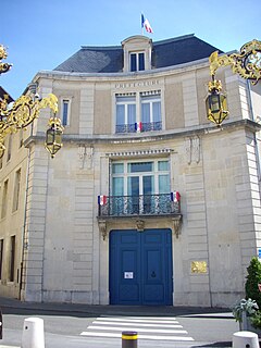
The canton of Pont-à-Mousson is an administrative division of the Meurthe-et-Moselle department, northeastern France. Its borders were modified at the French canton reorganisation which came into effect in March 2015. Its seat is in Pont-à-Mousson.
The canton of Jarville-la-Malgrange is an administrative division of the Meurthe-et-Moselle department, northeastern France. Its borders were modified at the French canton reorganisation which came into effect in March 2015. Its seat is in Jarville-la-Malgrange.
The canton of Laxou is an administrative division of the Meurthe-et-Moselle department, northeastern France. Its borders were not modified at the French canton reorganisation which came into effect in March 2015. Its seat is in Laxou.
The canton of Lunéville-1 is an administrative division of the Meurthe-et-Moselle department, northeastern France. It was created at the French canton reorganisation which came into effect in March 2015. Its seat is in Lunéville.
The canton of Lunéville-2 is an administrative division of the Meurthe-et-Moselle department, northeastern France. It was created at the French canton reorganisation which came into effect in March 2015. Its seat is in Lunéville.
The canton of Meine au Saintois is an administrative division of the Meurthe-et-Moselle department, northeastern France. It was created at the French canton reorganisation which came into effect in March 2015. Its seat is in Vézelise.
The canton of Toul is an administrative division of the Meurthe-et-Moselle department, northeastern France. It was created at the French canton reorganisation which came into effect in March 2015. Its seat is in Toul.
The canton of Neuves-Maisons is an administrative division of the Meurthe-et-Moselle department, northeastern France. Its borders were modified at the French canton reorganisation which came into effect in March 2015. Its seat is in Neuves-Maisons.
The canton of Le Nord-Toulois is an administrative division of the Meurthe-et-Moselle department, northeastern France. It was created at the French canton reorganisation which came into effect in March 2015. Its seat is in Liverdun.
The canton of Saint-Max is an administrative division of the Meurthe-et-Moselle department, northeastern France. Its borders were modified at the French canton reorganisation which came into effect in March 2015. Its seat is in Saint-Max.
The canton of Val de Lorraine Sud is an administrative division of the Meurthe-et-Moselle department, northeastern France. It was created at the French canton reorganisation which came into effect in March 2015. Its seat is in Maxéville.
The canton of Vandœuvre-lès-Nancy is an administrative division of the Meurthe-et-Moselle department, northeastern France. It was created at the French canton reorganisation which came into effect in March 2015. Its seat is in Vandœuvre-lès-Nancy.