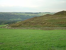
The Chevin is the ridge on the south side of Wharfedale in Leeds, West Yorkshire, England, overlooking the market town of Otley, and often known as Otley Chevin.
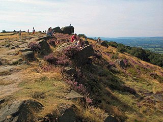
Ilkley Moor is part of Rombalds Moor, the moorland between Ilkley and Keighley in West Yorkshire, England. The moor, which rises to 402 m (1,319 ft) above sea level, is well known as the inspiration for the Yorkshire "county anthem" On Ilkla Moor Baht 'at.

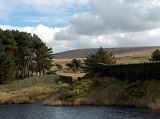
The Forest of Bowland, also known as the Bowland Fells and formerly the Chase of Bowland, is an area of gritstone fells, deep valleys and peat moorland, mostly in north-east Lancashire, England, with a small part in North Yorkshire. It is a western outlier of the Pennines.

The Dark Peak is the higher and wilder part of the Peak District in England, mostly forming the northern section but also extending south into its eastern and western margins. It is mainly in Derbyshire but parts are in Staffordshire, Cheshire, Greater Manchester, West Yorkshire and South Yorkshire.
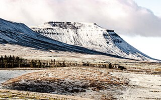
Ingleborough is the second-highest mountain in the Yorkshire Dales, England. It is one of the Yorkshire Three Peaks, and is frequently climbed as part of the Three Peaks walk. A large part of Ingleborough is designated as a Site of Special Scientific Interest and National Nature Reserve and is the home of a joint project, Wild Ingleborough, with aims to improve the landscape for wildlife and people.

Blorenge, also called The Blorenge, is a prominent hill overlooking the valley of the River Usk near Abergavenny, Monmouthshire, southeast Wales. It is situated in the southeastern corner of the Brecon Beacons National Park. The summit plateau reaches a height of 561 metres (1,841 ft).

Carl Wark is a rocky promontory on Hathersage Moor in the Peak District National Park, just inside the boundary of Sheffield, England. The promontory is faced by vertical cliffs on all but one side, which is protected by a prehistoric embankment. The cliffs and embankment form an enclosure that has been interpreted as an Iron Age hill fort, though the date of construction and purpose of the fortifications remains unknown. The site is a scheduled monument.

Derwent Edge is a Millstone Grit escarpment that lies above the Upper Derwent Valley in the Peak District National Park in the English county of Derbyshire. An Ordnance Survey column marks the highest point of the Edge at Back Tor. North of Back Tor the edge extends into Howden Edge and enters the county of South Yorkshire.
Millstone Grit is any of a number of coarse-grained sandstones of Carboniferous age which occur in the British Isles. The name derives from its use in earlier times as a source of millstones for use principally in watermills. Geologists refer to the whole suite of rocks that encompass the individual limestone beds and the intervening mudstones as the Millstone Grit Group. The term Millstone Grit Series was formerly used to refer to the rocks now included within the Millstone Grit Group together with the underlying Edale Shale Group.
The Totley Brook is a stream in Sheffield, South Yorkshire, England. It rises on a millstone grit ridge some 7 miles (11 km) to the south-west of the centre of Sheffield. Over its course it drops from 740 feet (230 m) to 430 feet (130 m) near its junction with the Old Hay Brook close to Baslow Road. The streams form the River Sheaf once they have joined.

Wild Boar Fell is a mountain in the Yorkshire Dales National Park, on the eastern edge of Cumbria, England. At 2,323 feet (708 m), it is either the 4th-highest fell in the Yorkshire Dales or the 5th, depending on whether nearby High Seat (2,326 ft) is counted or not.

Eldon Hill is a hill in the Peak District National Park in the county of Derbyshire, England, 4 kilometres (2.5 mi) southwest of the village of Castleton. It is a 470-metre (1,540 ft) limestone hill whose pastureland is used for rough grazing, although a large proportion has been lost to limestone quarrying. It lies within the Castleton Site of Special Scientific Interest. Eldon Hill was formed when a bed of pure limestone was squeezed and upfolded by geological forces to form a dome; it is the highest limestone hill north of the River Wye.
Boulsworth Hill is a large expanse of moorland, the highest point of the South Pennines of south-eastern Lancashire, England, separating the Borough of Pendle from Calderdale.

Burbage Brook is an upper tributary stream of the River Derwent in the Peak District of England.

The South Pennines is a region of moorland and hill country in northern England lying towards the southern end of the Pennines. In the west it includes the Rossendale Valley and the West Pennine Moors. It is bounded by the Greater Manchester conurbation in the west and the Bowland Fells and Yorkshire Dales to the north. To the east it is fringed by the towns of West Yorkshire whilst to the south it is bounded by the Peak District. The rural South Pennine Moors constitutes both a Site of Special Scientific Interest and Special Area of Conservation.

The Geology of Yorkshire in northern England shows a very close relationship between the major topographical areas and the geological period in which their rocks were formed. The rocks of the Pennine chain of hills in the west are of Carboniferous origin whilst those of the central vale are Permo-Triassic. The North York Moors in the north-east of the county are Jurassic in age while the Yorkshire Wolds to the south east are Cretaceous chalk uplands. The plain of Holderness and the Humberhead levels both owe their present form to the Quaternary ice ages. The strata become gradually younger from west to east.

Almscliffe Crag, or Almscliff Crag, also known as Great Almscliff Crag to distinguish from Little Almscliff, 3 miles (5 km) north west, is a Millstone Grit outcrop at the top of a small hill near the village of North Rigton, between Leeds and Harrogate in North Yorkshire, England. The crag lies on the boundary of the civil parishes of North Rigton and Stainburn. The crag was formed due to the softer adjacent strata of shale and mudstone eroding at a faster rate than the hard wearing millstone.
Esclusham Mountain is an area in Wrexham County Borough, Wales, United Kingdom, and is part of the Ruabon Moors. It rises to a height of 460 m, with the nearby spur of Cyrn-y-Brain, to the west, reaching 473 m. It lies mostly within the community of Esclusham. A smaller spur to the north, known as Minera Mountain, is within the neighbouring community of Minera.

How Stean Gorge is a limestone gorge in Nidderdale in North Yorkshire, England. It forms a unit of the Upper Nidderdale Site of Special Scientific Interest. The gorge lies between the villages of Stean and Lofthouse and extends for about a kilometre along the course of How Stean Beck, a tributary of the River Nidd.