Canyon Island

Last updated
Canyon Island
Geography
Location Juneau City and Borough, Alaska
Coordinates 58°32′53″N133°40′32″W / 58.54806°N 133.67556°W / 58.54806; -133.67556 Coordinates: 58°32′53″N133°40′32″W / 58.54806°N 133.67556°W / 58.54806; -133.67556
Archipelago Alexander Archipelago
Width0.8 mi (1.3 km)
Highest elevation69 ft (21 m)
Administration
United States
State Alaska
Borough Juneau

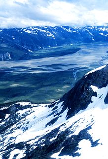
Canyon Island is an island in the City and Borough of Juneau, Alaska, United States. Located in the Taku River, it is 2.5 miles (4.0 km) northeast of the mouth of the Wright River and 32 miles (51 km) northeast of the city of Juneau. The name was first reported by the United States Geological Survey in 1960, collected between 1976 and 1981, and entered into the Geographic Names Information System on March 31, 1981. [1]

Juneau, Alaska State capital city and borough in Alaska, United States

The City and Borough of Juneau, commonly known as Juneau, is the capital city of Alaska. It is a unified municipality on Gastineau Channel in the Alaskan panhandle, and it is the second largest city in the United States by area. Juneau has been the capital of Alaska since 1906, when the government of what was the District of Alaska was moved from Sitka as dictated by the U.S. Congress in 1900. The municipality unified on July 1, 1970, when the city of Juneau merged with the city of Douglas and the surrounding Greater Juneau Borough to form the current municipality, which is larger by area than both Rhode Island and Delaware.

Alaska State of the United States of America

Alaska is a U.S. state in the northwest extremity of North America, just across the Bering Strait from Asia. The Canadian province of British Columbia and territory of Yukon border the state to the east, its most extreme western part is Attu Island, and it has a maritime border with Russia to the west across the Bering Strait. To the north are the Chukchi and Beaufort seas—southern parts of the Arctic Ocean. The Pacific Ocean lies to the south and southwest. It is the largest U.S. state by area and the seventh largest subnational division in the world. In addition, it is the 3rd least populous and the most sparsely populated of the 50 United States; nevertheless, it is by far the most populous territory located mostly north of the 60th parallel in North America: its population—estimated at 738,432 by the United States Census Bureau in 2015— is more than quadruple the combined populations of Northern Canada and Greenland. Approximately half of Alaska's residents live within the Anchorage metropolitan area. Alaska's economy is dominated by the fishing, natural gas, and oil industries, resources which it has in abundance. Military bases and tourism are also a significant part of the economy.

Taku River

The Taku River is a river running from British Columbia, Canada, to the northwestern coast of North America, at Juneau, Alaska. The river basin spreads across 27,500 square kilometres (10,600 sq mi). The Taku is a very productive salmon river and its drainage basin is primarily wilderness.

The island is 0.8 miles (1.3 km) across. [2]

History

The Taku people previously lived on the island. [3] A radio station operated by Pacific Alaska Airways was located on the island as of the 1930s. [4]

Taku people

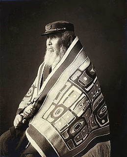
The Taku are an Alaskan Native people, a ḵwáan or geographic subdivision of the Tlingit, known in their own language as the Tʼaaḵu Ḵwáan or "Geese Flood Upriver Tribe". The Taku lived along the northwestern coast of North America, in the area that is now the Alexander Archipelago of Alaska, and on the lower basin of the Taku River of the adjoining British Columbia mainland above that river's mouth.

Pacific Alaska Airways was a subsidiary of Pan American World Airways that flew routes around Alaska. The airline was eventually completely absorbed into Pan Am in 1941.

The Alaska Department of Fish and Game operated a research station on the island. [5] Fish wheels are present on the island for the study of salmon. [6]

The Alaska Department of Fish and Game (ADF&G) is a department within the government of Alaska. ADF&G's mission is to protect, maintain, and improve the fish, game, and aquatic plant resources of the state, and manage their use and development in the best interest of the economy and the well-being of the people of the state, consistent with the sustained yield principle. ADF&G manages approximately 750 active fisheries, 26 game management units, and 32 special areas. From resource policy to public education, the department considers public involvement essential to its mission and goals. The department is committed to working with tribes in Alaska and with a diverse group of State and Federal agencies. The department works cooperatively with various universities and nongovernmental organizations in formal and informal partnership arrangements, and assists local research or baseline environmental monitoring through citizen science programs.

Fish wheel

A fish wheel, also known as a salmon wheel, is a device situated in rivers for catching fish which looks and operates like a watermill. However, in addition to paddles, a fish wheel is outfitted with wire baskets designed to catch and carry fish from the water and into a nearby holding tank. The current of the river presses against the submerged paddles and rotates the wheel, passing the baskets through the water where they intercept fish that are swimming or drifting. Naturally a strong current is most effective in spinning the wheel, so fish wheels are typically situated in shallow rivers with brisk currents, close to rapids, or waterfalls. The baskets are built at an outward-facing slant with an open end so the fish slide out of the opening and into the holding tank where they await collection. Yield is increased if fish swimming upstream are channeled toward the wheel by weirs.

Salmon Family of fish related to trout

Salmon is the common name for several species of ray-finned fish in the family Salmonidae. Other fish in the same family include trout, char, grayling and whitefish. Salmon are native to tributaries of the North Atlantic and Pacific Ocean. Many species of salmon have been introduced into non-native environments such as the Great Lakes of North America and Patagonia in South America. Salmon are intensively farmed in many parts of the world.

Related Research Articles

Petersburg, Alaska CDP in Alaska, United States

Petersburg is a census-designated place (CDP) in Petersburg Borough, Alaska, United States. The population was 2,948 at the 2010 census, down from 3,224 in 2000.

Copper River (Alaska) river in the United States of America

The Copper River or Ahtna River, Ahtna Athabascan ‘Atna’tuu, "river of the Ahtnas", Tlingit Eeḵhéeni, "river of copper", is a 290-mile (470 km) river in south-central Alaska in the United States. It drains a large region of the Wrangell Mountains and Chugach Mountains into the Gulf of Alaska. It is known for its extensive delta ecosystem, as well as for its prolific runs of wild salmon, which are among the most highly prized stocks in the world. The river is the tenth largest in the United States, as ranked by average discharge volume at its mouth.

Chichagof Island island in the United States of America

Chichagof Island, or Shee Kaax, is an island in the Alexander Archipelago of the Alaska Panhandle. At 75 miles (121 km) long and 50 miles (80 km) wide, it has a land area of 2,048.61 square miles (5,305.9 km2), making it the fifth largest island in the United States and the 109th largest island in the world. Its coastline measures 742 miles. There was a 2000 census population of 1,342 persons. It is one of the ABC islands of Alaska. Chichagof Island has the highest population of bears per square mile of any place on Earth.

Iliamna Lake lake in southwest Alaska

Iliamna Lake or Lake Iliamna is a lake in southwest Alaska, at the north end of the Alaska Peninsula, between Kvichak Bay and Cook Inlet, about 100 miles (160 km) west of Seldovia, Alaska.

Geography of Alaska

Alaska is one of two U.S. states not bordered by another state; Hawaii the other. Alaska has more ocean coastline than all of the other U.S. states combined. About 500 miles (800 km) of Canadian territory separate Alaska from Washington State. Alaska is thus an exclave of the United States that is part of the continental U.S. and the U.S. West Coast, but is not part of the contiguous U.S. Alaska is also the only state, other than Hawaii, whose capital city is accessible only via ship or air, because no roads connect Juneau to the rest of the continent.

Taku Harbor is a small, remote bay located on the eastern shore of Stephens Passage about 22 miles southeast of central Juneau, Alaska, United States.
Rivers Without Borders

Rivers Without Borders is a nonprofit organization fiscally sponsored by the Tides Center in the United States. Rivers Without Borders works as a project of Tides Canada Initiatives in Canada. Tides Canada's mission is to provide uncommon solutions for the common good by leading and supporting actions that foster a healthy environment and just Canadian society.

Snettisham is a locale and former populated place in the City and Borough of Juneau, Alaska, United States. Based on the mainland coast of Stephens Passage, it is 31 miles (50 km) southeast of the city of Juneau. The area was named by George Vancouver in 1794; the bay on which Snettisham was located was named for the town of Snettisham in England. It was established as a gold- and silver-mining camp around 1895, its operations being linked to those in the immediate Juneau area, and it remained a small harbor village until 1926. The United States Department of the Treasury designated Snettisham as one of several of Alaska's "special" landing places for vessels carrying "coal, salt, railroad iron, and other like items in bulk". The designation was meant to encourage the construction of facilities to accommodate these shipments, thus stimulating creation and growth of local businesses.

Cropley Lake lake in United States

Cropley Lake is an alpine lake in the City and Borough of Juneau, Alaska, United States. Located on Douglas Island, it is 2 miles (3.2 km) southwest of Table Top Mountain, and 5 miles (8.0 km) southwest of the city of Juneau. Cropley Lake is the source of Fish Creek.

Kowee Creek

Kowee Creek is a river on Douglas Island in the City and Borough of Juneau, Alaska, United States. Its origin is southeast of Mount Troy and it flows north-northeast to Gastineau Channel near West Juneau; it is 0.5 miles (0.80 km) southwest of the city of Juneau. Kowee Creek is nearly 10 miles (16 km) long. It has a drainage basin of about 50 square miles (130 km2) and two transverse tributaries.

Elevenmile Creek is a river on Douglas Island in the City and Borough of Juneau (CBJ), Alaska, United States. Its origin is in hills to the southeast and it flows northwest to Fritz Cove, a part of Stephens Passage; it is 1.6 miles (2.6 km) southwest of Entrance Point and 8.6 miles (13.8 km) west of the city of Juneau.

Zipper Creek is a river in the City and Borough of Juneau, Alaska, United States. Located 19 miles (31 km) northeast of the city of Juneau, its origin is in the Brassiere Hills. It flows southward past Taku Glacier and ends at the head of Taku Inlet.

Fritz Cove is a bay on the northwestern coast of Douglas Island in the City and Borough of Juneau, Alaska, United States. Lying in Stephens Passage, it is 8 miles (13 km) northwest of the city of Juneau.

Sheep Creek (Juneau, Alaska)

Sheep Creek is located 4 miles (6.4 km) southeast of Juneau, in the U.S. state of Alaska. The Juneau community of Thane was originally called Sheep Creek. Draining an area of about 5 square miles (13 km2), it empties into Gastineau Channel. The valley formed by the river has a flat, gravel, trekking trail of 3.5 miles (5.6 km), south of Mount Roberts. The Snettisham hydroelectric dam substation is situated on a trail spur. Sheep Creek Hatchery is located at the outflow.
Kootznahoo Inlet waterway in Alaska

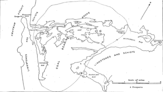
Kootznahoo Inlet is located on the eastern shore of Chatham Strait in the U.S. state of Alaska. Comprising an area of about 15 square miles (39 km2), it is an intricate group of narrow passages, lagoons, and bays, having its entrance 3 miles (4.8 km) north of Killisnoo. Kootznahoo, which means bear fortress, is also the name given by the Tlingit to mean Admiralty. The Kootznoowoo Wilderness also of the Admiralty Island covers some of the largest reserve areas covering about 1 million acres. The island is inhabited by about 1500 brown bears, the largest number recorded anywhere on the earth.

Port Snettisham Fjord in Alaska, United States

Port Snettisham is a narrow fjord 30 miles (48 km) southeast of Juneau in the U.S. state of Alaska. It is a semi protected deep water port that was developed to transport many mineral deposits found in the Snettisham Peninsula. Lieutenant Joseph Whidbey of the Royal Navy discovered the fjord on August 12, 1794; George Vancouver named it after the town of Snettisham in England.

Berners Bay Bay in Alaska, United States

Berners Bay (Daxanaak) is a waterway in the U.S. state of Alaska, approximately 40 miles (64 km) north of Juneau. It is a large and deep indentation, about 3.5 miles (5.6 km) wide at the entrance, which is formed by Point Bridget and Point St. Marys. It runs in a north-northwest direction for 6 miles (9.7 km) from Point Bridget, with a width of 3 miles (4.8 km) opposite Point St. Marys. The bay is surrounded by Tongass National Forest.

References

  1. USGS GNIS Feature Detail Report: Canyon Island
  2. Orth, Donald J. Dictionary of Alaska Place Names. United States Government Printing Office, Washington: 1967.
  3. Goldschmidt, Walter R., and Haas, Theodore H. Haa Aaní (Our Land): Tlingit and Haida Land Rights and Use. Sealaska Heritage Foundation, 1998.
  4. Greiner, Mary Anne. Mary Joyce: Taku to Fairbanks, 1,000 Miles by Dogteam. AuthorHouse, 2007.
  5. 1959 Annual Report. State of Alaska, Alaska Board of Fish and Game and Alaska Department of Fish and Game.
  6. Andel, James Everett, and Boyce, Ian M. Mark-Recapture Studies of Taku River Adult Sockeye Salmon Stocks from 1998 to 2002, Volume 11. Pacific Salmon Commission, 2004.