Related Research Articles

The Hudson Strait links the Atlantic Ocean and the Labrador Sea to Hudson Bay in Canada. This strait lies between Baffin Island and Nunavik, with its eastern entrance marked by Cape Chidley in Newfoundland and Labrador and Resolution Island off Baffin Island. The strait is about 750 km long with an average width of 125 km, varying from 70 km at the eastern entrance to 240 km at Deception Bay.

Victoria Island is a large island in the Arctic Archipelago that straddles the boundary between Nunavut and the Northwest Territories of Canada. It is the eighth-largest island in the world, and at 217,291 km2 (83,897 sq mi) in area, it is Canada's second-largest island. It is nearly double the size of Newfoundland (111,390 km2 [43,010 sq mi]), and is slightly larger than the island of Great Britain (209,331 km2 [80,823 sq mi]) but smaller than Honshu (225,800 km2 [87,200 sq mi]). The western third of the island lies in the Inuvik Region of the Northwest Territories; the remainder is part of Nunavut's Kitikmeot Region. The population of 2,168 is divided among 2 settlements, the larger of which is in Nunavut and the other of which is in the Northwest Territories.

The Arctic Archipelago, also known as the Canadian Arctic Archipelago, is an archipelago lying to the north of the Canadian continental mainland, excluding Greenland and Iceland.
This is a list of the extreme points of Ireland – the points that are farthest north, south, east or west in Ireland. It includes the Republic of Ireland and Northern Ireland.

Cape Colbeck is a prominent ice-covered cape which forms the northwestern extremity of the Edward VII Peninsula and Marie Byrd Land in Antarctica. It was discovered in January 1902 by the British National Antarctic Expedition and named for Captain William Colbeck, Royal Naval Reserve, who commanded Robert Scott's relief ship, the Morning.
Waterloo with Seaforth was an Urban District in the administrative county of Lancashire until 1937 when it was annexed to the municipal borough of Crosby, Merseyside. It included the settlements of Seaforth and Waterloo.

Soubakaniédougou is a department or commune of Comoé Province in south-western Burkina Faso. Its capital lies at the town of Soubakaniédougou. According to the 1996 census the department has a total population of 24,136.
Cape Bexley is a headland in the northern Canadian territory of Nunavut. It is located on the mainland, on the south shore of Dolphin and Union Strait, and bounded on the south by Souths Bay. It was named after Nicholas Vansittart, 1st Baron Bexley.
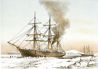
HMS Discovery was a wood-hulled screw expedition ship, and later storeship, formerly the sealing ship Bloodhound built in 1873 in Dundee. She was purchased in 1874 for the British Arctic Expedition of 1875–1876 and later served as a store ship. Discovery was sold in 1902, reverting to the name Bloodhound and her previous sealing trade. The ship was wrecked in Newfoundland in 1917.
Cape Vera is an uninhabited headland on Devon Island, in the Qikiqtaaluk Region of Nunavut, Canada. Protruding off the island's northwestern Colin Archer Peninsula, it faces Jones Sound. Often, a polynya forms in the Cardigan Strait, a waterway that separates the cape from North Kent Island.
Cape Parry is a headland in Canada's Northwest Territories. Located at the northern tip of the Parry Peninsula, it projects into Amundsen Gulf. The nearest settlement is Paulatuk, 100 km (62 mi) to the south, and Fiji Island is located 9 km (5.6 mi) to the west. Cape Parry was formerly accessible through Cape Parry Airport that was located at the Distant Early Warning Line. The airport was listed as abandoned after the closure of the DEW line site.

The borders of the oceans are the limits of Earth's oceanic waters. The definition and number of oceans can vary depending on the adopted criteria. The principal divisions of the five oceans are the Pacific Ocean, Atlantic Ocean, Indian Ocean, Southern (Antarctic) Ocean, and Arctic Ocean. Smaller regions of the oceans are called seas, gulfs, bays, straits, and other terms. Geologically, an ocean is an area of oceanic crust covered by water.

Cape Lloyd is a cape which forms the north end of Clarence Island in the South Shetland Islands of Antarctica, on the north side of the entrance to Kutela Cove. The name "Lloyd's Promontory" appears on charts of the 1821–25 period, but in more recent years the feature has become internationally known as Cape Lloyd.
Cape Roux is a cape marking the northwest extremity of Pasteur Peninsula, northern Brabant Island, in the Palmer Archipelago. Discovered by the French Antarctic Expedition, 1903–05, and named by Charcot for Emile Roux, noted French physician and bacteriologist, then Director of the Pasteur Institute, Paris.
Cape Christian is a land point on eastern Baffin Island, in Qikiqtaaluk Region, Nunavut, Canada. The nearest settlement is Clyde River to the north. Cape Christian was used as a weather station. From 1954 until 1974, it was also an Arctic military site that was run by the U.S. Coast Guard as a LORAN station which supported ships and aircraft that operated out of Thule, Greenland.
Cape Hewitt is a peninsula on eastern Baffin Island, Qikiqtaaluk Region, Nunavut, Canada. Located on Baffin Bay near Clyde Inlet, the closest settlement is Clyde River, 39.6 kilometres (24.6 mi) away.
Tiétar is a municipality located in the province of Cáceres, Extremadura, Spain. According to the 2013 census (INE), the municipality has a population of 948 inhabitants. Tiétar broke away of Talayuela on 1 July 2011.
References
- ↑ Stefansson, V. (1914-12-30). "Prehistoric and Present Commerce among the Arctic Coast Eskimo". Geological Survey Museum Bulletin. 6: 14.
Coordinates: 70°1′N117°28′W / 70.017°N 117.467°W
| | This Canadian Northwest Territories location article is a stub. You can help Wikipedia by expanding it. |