
Emona Anchorage is a roughly square embayment, the internal part of South Bay, Livingston Island in the South Shetland Islands, Antarctica used as an anchorage for ships visiting the Bulgarian base St. Kliment Ohridski.

Magura Glacier on the southeast side of Tangra Mountains on Livingston Island in the South Shetland Islands, Antarctica is located to the north of M'Kean Point, northeast of Srebarna Glacier, south of Iskar Glacier and southwest of Dobrudzha Glacier. It is bounded by Great Needle Peak to the west, Vitosha Saddle, Vihren Peak and Helmet Peak to the northwest, Plovdiv Peak and Shishman Peak to the north, and Devin Saddle and Kuber Peak to the northeast. The glacier extends 3.5 km in southwest-northeast direction and 1.9 km in northwest-southeast direction, and flows southeastward into Bransfield Strait.

Pomorie Point is a point on the coast of McFarlane Strait forming the north side of the entrance to Lister Cove, Varna Peninsula, Livingston Island in the South Shetland Islands, Antarctica.

Zlatograd Rock is a rocky 240 m peak forming the eastern extremity of Bowles Ridge, Livingston Island in the South Shetland Islands, Antarctica. The peak overlooks Struma Glacier to the northwest and Huron Glacier to the southeast. It is named after the town of Zlatograd in the Rhodope Mountains, Southern Bulgaria.
Avitohol Point is a point on the north coast of Livingston Island, Antarctica projecting 1.15 km (0.71 mi) into Hero Bay to form the west side of the entrance to Skravena Cove and the southeast side of the entrance to Prisoe Cove. It is surmounted by Fletcher Nunatak and Belev Nunatak. The point is named after the legendary Khan Avitohol listed in the 8th Century Nominalia of the Bulgarian Khans, who laid the foundations of the Bulgarian statehood in Europe in 165 AD.

Start Point is a point marking the northwest end of Byers Peninsula, Livingston Island in the South Shetland Islands, Antarctica and forming the southwest side of the entrance to Svishtov Cove and the northeast side of the entrance to the New Plymouth bay. Discovered by Edward Bransfield in January 1820, and so named by him because of its resemblance to a point on the south coast of England by the same name and because it was the place where his operations began.

Desolation Island is one of the minor islands in the South Shetlands archipelago, Antarctica situated at the entrance to Hero Bay, Livingston Island. The island is V-shaped with its northern coast indented by Kozma Cove. Surface area is 3.12 square kilometres (1.20 sq mi).

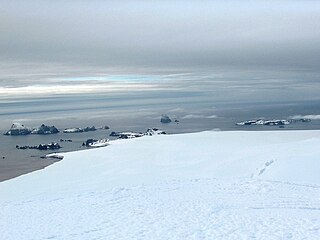
Iratais Point is a point forming both the south extremity and the vertex of the V-shaped Desolation Island situated in the entrance to Hero Bay, Livingston Island, Antarctica. Separated from Miladinovi Islets to the south by Neck or Nothing Passage.

Elemag Reef is the 100 m long in southeast-northwest direction and 40 m wide moraine reef in Moon Bay, Livingston Island in the South Shetland Islands, with a narrow shoal extending for over 400 m eastwards. Surface area 0.33 ha. Situated 5.4 km south-southwest of Edinburgh Hill, 5.95 km west of Half Moon Island, 5.18 km northwest of Rila Point, 3.3 km northeast of Zlatograd Rock and 1.85 km east-southeast of Sindel Point. Formed at the terminus of merging Struma and Huron Glaciers, it was originally named Elemag Point. The current reef configuration is due to glacier retreat of up to 1.8 km in the area in the late 20th and early 21st century. Bulgarian mapping in 2009. Bulgarian topographic survey Tangra 2004/05 and mapping in 2009.
Yana Point is the point forming the west side of the entrance to Bruix Cove in eastern Livingston Island in the South Shetland Islands, Antarctica. The point separates the glacier termini of Huron Glacier to the northwest and Iskar Glacier to the southeast. The feature is named after the settlement of Yana in western Bulgaria.
Edinburgh Hill is a narrow point projecting 650 m from the east coast of Varna Peninsula, Livingston Island in the South Shetland Islands, Antarctica into McFarlane Strait and ending up in a conspicuous rocky hill of elevation 180 m. The point forms the northwest side of the entrance to Moon Bay. The area was visited by early 19th century sealers.

Triangle Point is the low ice-free tipped point forming the northwest side of the entrance to Shopski Cove in the south coast of Parvomay Neck linking the northwest and southeast parts of Greenwich Island in the South Shetland Islands, Antarctica. The area was frequented by early 19th century sealers operating from Yankee Harbour.
Window Island is a small ice-free island off the north coast of Ray Promontory in the northwest of Byers Peninsula, Livingston Island in the South Shetland Islands, Antarctica. The island has a surface area of 23 hectares and rises to 72 m (236 ft). It was known to the early 19th century sealers operating on Byers Peninsula.
Pyramid Island is a conspicuous, pillar-shaped rocky island rising to 205 m (673 ft) off the north entrance to McFarlane Strait in the South Shetland Islands, Antarctica. Its surface area is 9 hectares. Cone Rock
(62°25′56.9″S60°06′08.3″W) is rising to 6 m (19.7 ft) 1.33 km (0.83 mi) south of the island,
2.03 km (1.26 mi) north-northwest of Meade Islands, 2.8 km (1.7 mi) northeast of Williams Point and
1.65 km (1.03 mi) east of Koshava Island, Zed Islands. The vicinity of Pyramid Island was visited on 19 February 1819 during the discovery of the South Shetlands by Captain William Smith in the British brig Williams, and later by early 19th century sealers.
Craggy Island is a narrow island marked by crags, lying in Hero Bay, Livingston Island in the South Shetland Islands, Antarctica and forming the northeast side of Blythe Bay. Its surface area is 9 hectares .) The area was frequented by early nineteenth century English and American sealers operating from Blythe Bay.

Scesa Point is a rounded, low ice-free tipped point on the west coast of Ioannes Paulus II Peninsula, western Livingston Island in the South Shetland Islands, Antarctica forming the north side of the entrance to Zornitsa Cove.
Cora Cove is the 750 m wide cove in the northwest part of Blythe Bay indenting for 590 m the southeast coast of Desolation Island off Livingston Island in the South Shetland Islands, Antarctica. The cove was used by early 19th century sealers operating from Blythe Bay.

Eddystone Rocks is a group of two rocks lying to the northwest of Rugged Island off western Livingston Island in the South Shetland Islands, Antarctica.
Burel Hill is an ice-free hill rising 152 metres (499 ft) in the northwest part of Desolation Island off Livingston Island in the South Shetland Islands, Antarctica. It surmounts Kozma Cove to the east, and Hero Bay to the south and southwest.
Boynik Point is the rounded rocky point on the southeast side of the entrance to Kozma Cove, forming the northeast extremity of Desolation Island in the entrance to Hero Bay, Livingston Island in Antarctica. The feature is named after the settlement of Boynik in Southern Bulgaria.

