Williams Point

Last updated
Location of Varna Peninsula, Livingston Island in the South Shetland Islands. Varna-Peninsula-location-map.png
Location of Varna Peninsula, Livingston Island in the South Shetland Islands.
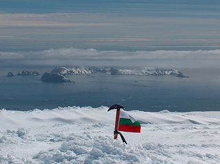
Williams Point from Miziya Peak, with Zed Islands in the background, Pyramid Island on the right and Zavala Island in the foreground. Williams-Point.jpg
Williams Point from Miziya Peak, with Zed Islands in the background, Pyramid Island on the right and Zavala Island in the foreground.
Topographic map of Livingston Island. Livingston-Island-Map-2010-15.png
Topographic map of Livingston Island.

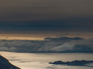
Williams Point is the point forming both the north extremity of Varna Peninsula and the northeast tip of Livingston Island in the South Shetland Islands, Antarctica. Separated from Zed Islands to the north by Iglika Passage.

Varna Peninsula

Varna Peninsula is a roughly rectangular predominantly ice-covered peninsula forming the northeast extremity of Livingston Island in the South Shetland Islands, Antarctica. It is bounded by Hero Bay to the northwest, by Moon Bay to the southeast, and by McFarlane Strait to the northeast.

Livingston Island Island of the South Shetland Islands

Livingston Island is an Antarctic island in the Southern Ocean, part of the South Shetlands Archipelago. It was the first land discovered south of 60° south latitude in 1819, a historic event that marked the end of a centuries-long pursuit of the mythical Terra Australis Incognita and the beginning of the exploration and utilization of real Antarctica. The name Livingston, although of unknown derivation, has been well established in international usage since the early 1820s.

South Shetland Islands A group of islands north of the Antarctic Peninsula

The South Shetland Islands are a group of Antarctic islands with a total area of 3,687 square kilometres (1,424 sq mi). They lie about 120 kilometres (75 mi) north of the Antarctic Peninsula, and between 430 kilometres (270 mi) to 900 kilometres (560 mi) south-west from the nearest point of the South Orkney Islands. By the Antarctic Treaty of 1959, the islands' sovereignty is neither recognized nor disputed by the signatories and they are free for use by any signatory for non-military purposes.

Contents

The discovery of the South Shetland Islands was first reported in 1819 by William Smith, Master of the brig Williams who had sighted the point on 19 February that year. An 1820 publication suggests that Smith gave the name ‘Williams’ to a point of land in this vicinity. In recent years the place name Williams Point has been established in international usage for the point described.

William Smith (mariner) English captain who discovered the South Shetland Islands

William Smith was the English captain born in Blyth, Northumberland, who discovered the South Shetland Islands, an archipelago off the Graham Land in Antarctica. His discovery was the first ever made south of 60° south latitude, in the present Antarctic Treaty area.

Location

The point is located at 62°27′08″S60°08′11″W / 62.45222°S 60.13639°W / -62.45222; -60.13639 Coordinates: 62°27′08″S60°08′11″W / 62.45222°S 60.13639°W / -62.45222; -60.13639 which is 9.47 km north of Miziya Peak in Vidin Heights, 8.8 km east of Desolation Island, 1.5 km south of Zed Islands and 5.5 km west of Duff Point on Greenwich Island. British mapping in 1822, Chilean in 1971, Argentine in 1980, Spanish in 1991, and Bulgarian in 2005 and 2009.

Geographic coordinate system Coordinate system

A geographic coordinate system is a coordinate system that enables every location on Earth to be specified by a set of numbers, letters or symbols. The coordinates are often chosen such that one of the numbers represents a vertical position and two or three of the numbers represent a horizontal position; alternatively, a geographic position may be expressed in a combined three-dimensional Cartesian vector. A common choice of coordinates is latitude, longitude and elevation. To specify a location on a plane requires a map projection.

Miziya Peak mountain in Livingston Island, South Shetland Islands, Antarctica

Miziya Peak is the 604 m summit of Vidin Heights on Varna Peninsula, eastern Livingston Island in the South Shetland Islands, Antarctica. The peak overlooks Kaliakra Glacier to the south, and Saedinenie Snowfield to the northwest.

Vidin Heights

Vidin Heights are predominantly ice-covered heights rising to 604 m on Varna Peninsula, eastern Livingston Island in the South Shetland Islands, Antarctica. The feature is approximately 8 km long from the north end of Leslie Gap east-northeastwards to Inott Point and 9.6 km north-northeastwards to Sayer Nunatak. The summit, Miziya Peak, is located 9.25 km north by east of Mount Bowles, 4.24 km north-northeast of Leslie Hill, 9.47 km south of Williams Point and 7.52 km west of Edinburgh Hill. The heights feature also Samuel Peak 1.9 km east-southeast of Miziya Peak, and Sharp Peak at their east-northeast extremity. The heights surmount Saedinenie Snowfield to the northwest, Rose Valley Glacier to the northeast, Debelt Glacier and Panega Glacier to the southeast, and Kaliakra Glacier to the south.

Maps

Antarctic Place-names Commission

The Antarctic Place-names Commission was established by the Bulgarian Antarctic Institute in 1994, and since 2001 has been a body affiliated with the Ministry of Foreign Affairs of Bulgaria.

International Standard Book Number Unique numeric book identifier

The International Standard Book Number (ISBN) is a numeric commercial book identifier which is intended to be unique. Publishers purchase ISBNs from an affiliate of the International ISBN Agency.

Related Research Articles

Rugged Island (South Shetland Islands) island of the South Shetland Islands

Rugged Island is an island 3 miles (4.8 km) long and 1 mile (1.6 km) wide, lying west of Livingston Island in the South Shetland Islands. Its surface area is 10.4 square kilometres (4.0 sq mi). The island's summit San Stefano Peak rises to 256 metres (840 ft) above sea level. Rugged Island is located at 62°38′S61°15′W. Rugged Island was known to both American and British sealers as early as 1820, and the name has been well established in international usage for over 100 years.

Boyana Glacier glacier in Antarctica

Boyana Glacier in Levski Ridge, Tangra Mountains on Livingston Island, South Shetland Islands in Antarctica is situated southeast of Macy Glacier and west-southwest of Srebarna Glacier. It is bounded by Vazov Rock on the west, St. Naum Peak, Starosel Gate, Silistra Knoll and Kotel Gap on the north, and Christoff Cliff on the east. The glacier extends 3 km in east-west direction and 1.6 km in north-south direction, and flows southeastward into the Bransfield Strait between Vazov Point and Aytos Point.

Osogovo Bay bay

Osogovo Bay, "named after the Osogovo region in western Bulgaria", is bounded by the south coast of Rugged Island, by Astor Island, and by the west coast of the Byers Peninsula south of Laager Point, Livingston Island in the South Shetland Islands, Antarctica.

Spanish Knoll

Spanish Knoll has a highest point of elevation 48 m located on Bulgarian Beach on Hurd Peninsula, eastern Livingston Island in the South Shetland Islands, Antarctica.

Spanish Point (Antarctica)

Spanish Point is located on Bulgarian Beach on Hurd Peninsula, eastern Livingston Island in the South Shetland Islands, Antarctica formed by an offshoot of Spanish Knoll.

Start Point (Livingston Island) headland of the South Shetland Islands

Start Point is a point marking the northwest end of Byers Peninsula, Livingston Island in the South Shetland Islands, Antarctica and forming the southwest side of the entrance to Svishtov Cove and the northeast side of the entrance to the New Plymouth bay. Discovered by Edward Bransfield in January 1820, and so named by him because of its resemblance to a point on the south coast of England by the same name and because it was the place where his operations began.
Desolation Island (South Shetland Islands)

Desolation Island is one of the minor islands in the South Shetlands archipelago, Antarctica situated at the entrance to Hero Bay, Livingston Island. The island is V-shaped with its northern coast indented by Kozma Cove. Surface area 3.12 square kilometres (1.20 sq mi).

Cape Shirreff

Cape Shirreff is a prominent cape at the north end of the rocky peninsula which separates Hero Bay and Barclay Bay on the north coast of Livingston Island, in the South Shetland Islands of Antarctica. The cape was named by Edward Bransfield in 1820 after Captain William H. Shirreff, the British commanding officer in the Pacific at that time.

South Bay (Livingston Island) bay on Livingston Island in the South Shetland Islands, Antarctica

South Bay is a 11.6 kilometres (7.2 mi) wide bay indenting for 12.5 kilometres (7.8 mi) the south coast of Livingston Island in the South Shetland Islands, Antarctica. The bay is lying northwest of False Bay and east of Walker Bay, and is entered between Hannah Point and Miers Bluff. The glaciers Kamchiya, Pimpirev, Perunika, Contell, Johnsons and Hurd Ice Cap feed the bay.

McFarlane Strait

McFarlane Strait is a strait lying between Greenwich Island and Livingston Island, in the South Shetland Islands off Antarctica. It is 24 kilometres (13 nmi) long and 3 kilometres (1.6 nmi) wide. The name appears on an 1822 chart by Captain George Powell, a British sealer, and is now well established in international usage.

Renier Point

Renier Point is a narrow point forming the east extremity of both Burgas Peninsula and Livingston Island in the South Shetland Islands, Antarctica. The feature was known to sealers as Point Renier as early as 1821. The name ‘Pin Point’, given by Discovery Investigations personnel on the Discovery II in 1935, has been rejected in favor of the original name.

Hurd Peninsula

Hurd Peninsula lies between South Bay and False Bay on the south coast of Livingston Island in the South Shetland Islands, Antarctica. The Spanish Juan Carlos I Antarctic Base and the Bulgarian St. Kliment Ohridski Base are situated on its west coast.

New Plymouth (Livingston Island) Bay at Livingston Island

New Plymouth is a bay bordered by an extensive line of beaches, lying south of Start Point and between Rugged Island and the west end of Livingston Island in the South Shetland Islands, Antarctica.

Blythe Bay bay

Blythe Bay is an anchorage at the southeast side of Desolation Island, lying north of Livingston Island in the South Shetland Islands, Antarctica. The bay is bounded by Craggy Island to the northeast, Desolation Island to the northwest, the Miladinovi Islets to the west and Wood Island to the south.

Johnsons Dock cove

Johnsons Dock is a sheltered 500 m wide cove indenting for 900 m the northwest coast of Hurd Peninsula on Livingston Island in the South Shetland Islands, Antarctica. It is part of South Bay entered north of Ballester Point. Surmounted by Charrúa Ridge on the northeast. The cove was frequented by early 19th century sealers.

Essex Point headland in South Shetland Islands, Antarctica

Essex Point is a point at the northwest end of Byers Peninsula, Livingston Island in the South Shetland Islands, Antarctica. It forms the west side of the entrance to Barclay Bay and the northeast side of the entrance to Svishtov Cove, and is surmounted by Drong Hill.

Window Island

Window Island is a small ice-free island off the north coast of Ray Promontory in the northwest of Byers Peninsula, Livingston Island in the South Shetland Islands, Antarctica. The island has a surface area of 23 hectares and rises to 72 m (236 ft). It was known to the early 19th century sealers operating on Byers Peninsula.

Eddystone Rocks (South Shetland Islands)

Eddystone Rocks is a group of two rocks lying to the northwest of Rugged Island off western Livingston Island in the South Shetland Islands, Antarctica.

Ivanov Beach

Ivanov Beach is the mostly ice-free beach on Drake Passage stretching 5 km (3.1 mi) in southwest-northeast direction on the southeast coast of Barclay Bay in western Livingston Island, South Shetland Islands in Antarctica. It extends to Nedelya Point and Byers Peninsula on the southwest, Rowe Point and Etar Snowfield on the northeast, and the slopes of Rotch Dome on the southeast. Its ice-free area is ca. 144 hectares. The beach features Bilyar Point 1.7 km (1.1 mi) northeast of Nedelya Point, and a minor point 1.1 km (0.68 mi) southwest of Rowe Point. It is protected by shallows and numerous offshore rocks and islets, the largest of the latter being Cutler Stack off Nedelya Point.

References

United States Geological Survey Scientific agency of the United States government

The United States Geological Survey is a scientific agency of the United States government. The scientists of the USGS study the landscape of the United States, its natural resources, and the natural hazards that threaten it. The organization has four major science disciplines, concerning biology, geography, geology, and hydrology. The USGS is a fact-finding research organization with no regulatory responsibility.

Geographic Names Information System geographical database

The Geographic Names Information System (GNIS) is a database that contains name and locative information about more than two million physical and cultural features located throughout the United States of America and its territories. It is a type of gazetteer. GNIS was developed by the United States Geological Survey in cooperation with the United States Board on Geographic Names (BGN) to promote the standardization of feature names.