Kununurra is a town in far northern Western Australia located at the eastern extremity of the Kimberley approximately 45 kilometres (28 mi) from the border with the Northern Territory. Kununurra was initiated to service the Ord River Irrigation Scheme. It is located on the traditional lands of the Miriwoong, an Aboriginal Australian people.
The Kimberley is the northernmost of the nine regions of Western Australia. It is bordered on the west by the Indian Ocean, on the north by the Timor Sea, on the south by the Great Sandy and Tanami deserts in the region of the Pilbara, and on the east by the Northern Territory.

Lake Argyle is Western Australia's largest and Australia's second largest freshwater man-made reservoir by volume. The reservoir is part of the Ord River Irrigation Scheme and is located near the East Kimberley town of Kununurra. The lake flooded large parts of the Shire of Wyndham-East Kimberley on the Kimberley Plateau about 80 kilometres (50 mi) inland from the Joseph Bonaparte Gulf, close to the border with the Northern Territory.

The Ord River is a 651-kilometre long (405 mi) river in the Kimberley region of Western Australia. The river's catchment covers 55,100 square kilometres (21,274 sq mi).

Wyndham is the northernmost town in the Kimberley region of Western Australia, 3,315 kilometres (2,060 mi) northeast of Perth via the Great Northern Highway. It was established in 1886 to service a new goldfield at Halls Creek, and it is now a port and service centre for the east Kimberley with a population of 941 as of the 2021 census. Aboriginal and Torres Strait Islander people make up 54% of the population. Wyndham comprises two areas - the original town site at Wyndham Port situated on Cambridge Gulf, and 5 kilometres (3.1 mi) by road to the south, the Three Mile area with the residential and shopping area for the port, also founded in 1886. Wyndham is part of the Shire of Wyndham-East Kimberley.

Cambridge Gulf is a gulf on the north coast of the Kimberley region of Western Australia. Many rivers flow into the gulf, including the Ord River, Pentecost River, Durack River, King River and the Forrest River, making the environment an estuarine one.

Dunham River is a river in the Kimberley region of Western Australia.
The Nicholson River is a river in the Kimberley region of Western Australia. It takes its name from the Nicholson Plains, named in 1879 by Alexander Forrest after Sir Charles Nicholson, the central figure in the circle of Australian 'colonists' in London, and a promoter of the Forrest brothers' explorations. In 1870 Nicholson had presented a paper entitled On Forrest's Expedition into the Interior of Western Australia, Goyder's Survey of the Neighbourhood of Port Darwin, and on the Recent Progress of Australian Discovery to a meeting of the Royal Geographical Society of London.

Lake Kununurra is a freshwater man-made reservoir located in the Ord River valley. The lake was formed in 1963 by the construction of the Ord Diversion Dam in Kununurra, northern Western Australia, which was built to supply water to the Ord River Irrigation Area. Prior to the diversion dam construction a natural permanent waterhole held back by the Bandicoot Bar was known as "Carlton Reach", which was reputed to be the largest waterhole in the Kimberley.

The Ord River floodplain is the floodplain of the lower Ord River in the Shire of Wyndham-East Kimberley, in the Kimberley region of northern Western Australia. It lies within the Victoria Bonaparte IBRA bioregion and contains river, seasonal creek, tidal mudflat and floodplain wetlands, with extensive stands of mangroves, that support saltwater crocodiles and many waterbirds. It is recognised as an internationally important wetland area, with 1,384 square kilometres (534 sq mi) of it designated on 7 June 1990 as Ramsar Site 477 under the Ramsar Convention on Wetlands.
The Behn River or Behm River is a river in the Kimberley region of Western Australia.
Ivanhoe or Ivanhoe Station is a pastoral lease and cattle station located just north of Kununurra in the Kimberley region of Western Australia. Founded in 1893 by the Durack brothers, station is presently owned by the Consolidated Pastoral Company.

Fossil Downs Station is a pastoral lease and cattle station located about 50 kilometres (31 mi) north east of Fitzroy Crossing in the Kimberley region of Western Australia.
Carlton Hill Station is a pastoral lease and cattle station located in the Kimberley region of Western Australia. Situated approximately 39 kilometres (24 mi) to the north-west of Kununurra and 44 kilometres (27 mi) east of Wyndham, the station covers an area of 3,675 square kilometres (1,419 sq mi).
Cape Dussejour is located at the western side of the entrance to the Cambridge Gulf in the Kimberley region of Western Australia.
Capes of Kimberley coastline of Western Australia are located along the Kimberley coastline of Western Australia from the border with the Northern Territory in the north east of the Kimberley land region around to south of Broome.
Lacrosse Island is an island in the Cambridge Gulf in the Kimberley region of Western Australia, located between Cape Domett on the eastern shore and Cape Dussejour on the western. The island is in the local government area of the Shire of Wyndham-East Kimberley.
Charles Eugene Dortch is a US born archaeologist, largely known for his life and works in Western Australia.
Hoochery Distillery is a farm-based microdistillery located in Kununurra, Western Australia, founded by Raymond Bernard "Spike" Dessert III. The distillery produces approximately 50,000 gallons of rum annually, and also produces gin, whiskey and liqueurs. It is the oldest continually operating legal distillery in Western Australia.

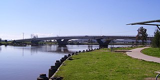
The Fitzgerald Bridge is a prestressed concrete bridge that carries Seaham Road across the Williams River from Raymond Terrace to Nelsons Plains in New South Wales, Australia.