Cape Freels, Newfoundland and Labrador

Last updated

Cape Freels is one of the communities that comprise an area (also known as Cape Freels) on the northeast coast of the Island of Newfoundland, called Bonavista North, in the province of Newfoundland and Labrador, Canada. These communities have a shared history in that they were settled by people from England, predominantly from the West Country - Dorset, Devon, Somerset and Hampshire.

Cape Freels headland on north coast of Newfoundland island

Cape Freels is a headland on the island of Newfoundland, in the province of Newfoundland and Labrador, Canada, and the location of a community of the same name. This cape, located at the northern extremity of Bonavista Bay, is not to be confused with another Cape Freels which is located at the southern extremity of the Avalon Peninsula of Newfoundland.

Newfoundland (island) Island portion of Newfoundland and Labrador, Canada

Newfoundland is a large Canadian island off the east coast of the North American mainland, and the most populous part of the Canadian province of Newfoundland and Labrador. It has 29 percent of the province's land area. The island is separated from the Labrador Peninsula by the Strait of Belle Isle and from Cape Breton Island by the Cabot Strait. It blocks the mouth of the Saint Lawrence River, creating the Gulf of Saint Lawrence, the world's largest estuary. Newfoundland's nearest neighbour is the French overseas community of Saint-Pierre and Miquelon.

Bonavista North

Bonavista North is a provincial electoral district for the House of Assembly of Newfoundland and Labrador, Canada. As of 2011 the district has 6,956 eligible voters.

Contents

History

Cape Freels, on the northern point of Bonavista Bay, Newfoundland, is said to have been visited as early as 1506. It also has one of the earliest known Beothuk sites on the island. Originally, European settlers went to Middle Bill Cove and by 1836 there were 67 people living there. The settlement relied on a small local cod fishing industry and seals. On Gull Island, Cape Freels in 1924, a gas lamp was erected to help aid mariners with their navigation. In 1961 the population of Cape Freels and Cape Freels South was 157 and the population of Cape Freels North was 179. In 1963 Cape Freels received electricity and still depended on the local fishery and Labrador fishery. In 1966 there were 341 people in Cape Freels, by 1976 there were only 95. [1]

Bonavista Bay

Bonavista Bay (BB) is a large bay located on the northeast coast of the island of Newfoundland in the province of Newfoundland and Labrador in Canada. It opens directly onto the Atlantic Ocean.

Newfoundland and Labrador Province of Canada

Newfoundland and Labrador is the most easterly province of Canada. Situated in the country's Atlantic region, it comprises the island of Newfoundland and mainland Labrador to the northwest, with a combined area of 405,212 square kilometres (156,500 sq mi). In 2018, the province's population was estimated at 525,073. About 92% of the province's population lives on the island of Newfoundland, of whom more than half live on the Avalon Peninsula.

Beothuk ethnic group

The Beothuk were an indigenous people based on the island of Newfoundland.

Church History

In 1836, 35 of the 46 inhabitants in Cape Freels were Church of England and eleven were Roman Catholic. Although there was no church at this time, missionaries from other communities would visit there. For example, the first missionary stationed at Greenspond, Rev N.A. Coster records visiting Cape Freels as early as 1832. [2] By 1845, with a population of only 80 people, a Church of England church and school was built and had an initial enrolment of 51 pupils. [1] In 1844 Mr. Thomas Parker became the school master and taught there for more than 20 years. In 1857 113 if the 121 inhabitants were Church of England. By 1869, however, only nine people were of the Church of England, five were Roman Catholic, and 177 were Methodists. [3]

Church of England Anglican state church of England

The Church of England is the established church of England. The Archbishop of Canterbury is the most senior cleric, although the monarch is the supreme governor. The Church of England is also the mother church of the international Anglican Communion. It traces its history to the Christian church recorded as existing in the Roman province of Britain by the third century, and to the 6th-century Gregorian mission to Kent led by Augustine of Canterbury.

Census Information

18361845185718691874
population6680121161191
inhabited houses77202327
Church of England51711131439
Roman Catholic159835
Wesleyans---15177
No. Churches-1 (Ch. of Eng)1
No. of Schools-11
students-51453945
who can read/write---7386
total boats67231412
boats built--2--
potatoes produced455 bus.140 barrels405 bars.533 bars.409 bars.
barrels of turnip--225381
swine/goats--356693
horses---45
nets and seines-47251336
people catching/curing fish--1004886
seamen and fishermen--32-29
cod fish cured (qtls)--3100-2200
stores/barns/outhouses--141013
fishing rooms in use--131112
vessels in seal fishery--451
men on board--403510
tonnage in fishery--15812935
seals caught--463-40
seal nets--543721

Directories

- Hutchinson's Newfoundland Directory for 1864 lists some of the inhabitants of Middle Bill Cove: [4]

- Lovell's Newfoundland Directory for 1871 describes Middle Bill Cove as the most northern settlement in the Bonavista district, distant from Greenspond about 15 miles by boat and a population of 161. The people listed are: [5]

Interesting facts

See also

Related Research Articles

Newtown is a part of the Municipality of New-Wes-Valley, located at the North end of Bonavista Bay in the province of Newfoundland and Labrador, Canada. The approximate population is 400. Settlement in Newtown originated around 1850 when people relocated from nearby areas. Newtown is well known for being built on many small islands, and is the home of the Barbour Living Heritage Village.

Wesleyville, Newfoundland and Labrador human settlement in Canada

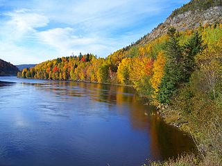
Wesleyville is a small coastal community in Newfoundland and Labrador, Canada. It is located on the Straight Shore of Bonavista Bay, on the northeast coast of Newfoundland, near the communities of Greenspond and Newtown. It was settled in the early 19th century, when residents relocated from nearby islands.

Greenspond Town in Newfoundland and Labrador, Canada

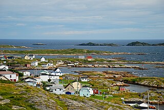
Greenspond is a community in the province of Newfoundland and Labrador, Canada.

Safe Harbour is an abandoned outport on the northeast coast of Newfoundland in the Canadian province of Newfoundland and Labrador. It is now a part of the town of New-Wes-Valley.

Templeman, Newfoundland is located on the north side of Bonavista Bay just south of Cape Freels and north of Wesleyville. Templeman has a shallow and rocky harbour, therefore its harbour can only accommodate and is only suitable for small boats.

Valleyfield, Newfoundland is a village and was served by the C.N.R. It joined the Rural District of Badger's Quay-Valleyfield-Pool's Island in April 1980 until 1992 when the District merged with other nearby towns to form New-Wes-Valley. Valleyfield has a good harbour, and is the location of the Beothic Fisheries fish plant.

1832 Newfoundland general election

The 1st Newfoundland general election came after many years of agitation against the British Parliament. Newfoundland was the last British colony in North America to gain representative government.

Musgrave Harbour is a Canadian town in the province of Newfoundland and Labrador.

Cape Island is the name of both an island and a community in the Canadian province of Newfoundland and Labrador.

Deadman's Bay, Newfoundland is located on the "Straight Shore" of Bonavista Bay near the community of Lumsden. The community is located near excellent fishing grounds, contributing to its diversified and successful fishery despite its exposed, sandy coastline and harsh fall storms.

Indian Bay is located in Newfoundland, Canada.

Flower's Island is one of the communities that comprise an area on the northeast coast of the Island of Newfoundland, called Bonavista North. These communities have a shared history in that they were settled by people from England, predominantly from the West Country—Dorset, Devon Somerset and Hampshire.

Pool's Island is an incorporated community of Badger's Quay-Valleyfield-Pool's Island in the province of Newfoundland and Labrador, Canada. It is now part of the town of New-Wes-Valley.

Fair Island, Newfoundland and Labrador

Fair Island, also called Vere Island, is one of the communities that comprise an area on the northeast coast of the Island of Newfoundland, called Bonavista North. These communities have a shared history in that they were settled by people from England, predominantly from the West Country - Dorset, Devon Somerset and Hampshire.

Swain's Island, Newfoundland, is actually a group of eight islands on the north side of Bonavista Bay, southeast of Wesleyville. All of these islands once had inhabitants but eventually all of them were resettled, mostly to Wesleyville.

Located on the northwest side of Bonavista Bay, Newfoundland at the mouth of the Indian Bay inlet is a small island named Silver Fox Island that was once inhabited. It is about 3 km in length and about 3 km from Fair Island. The first settling began at Warren's Harbour on the southern side of the island.

Pinchard's Island is one of the communities that comprise an area on the northeast coast of the Island of Newfoundland, called Bonavista North. These communities have a shared history in that they were settled by people from England, predominantly from the West Country - Dorset, Devon Somerset and Hampshire.

Naboth Winsor was born to Robert Stewart Winsor and Jane (Butt) Winsor, on Winsor's Island, one of the islands comprising Swain's Island, Bonavista Bay, Newfoundland. Winsor and his family moved to nearby Wesleyville when he was four years old. Winsor received a Bachelor of Arts Degree, the Degree of Master of Divinity, and a Master of Arts Degree. He was an Ordained United Church Minister, and later, an author. Winsor was a United Church Minister for forty-four years, and he wrote several books on certain aspects of Newfoundland History, primarily on areas in Bonavista Bay, Newfoundland.

Robert Dyer left the village of Heytesbury, in the county of Wiltshire, England, to voyage across the Atlantic Ocean to serve as a Newfoundland School Society teacher in the fishing community of Greenspond, Newfoundland. The Newfoundland School Society was established by the English merchant, Samuel Codner, who realised the need for educating the poor population of Newfoundland, and other poor colonies in British North America as well. Dyer first arrived in Newfoundland in 1839 and began his career as a teacher. He stayed in Greenspond for twenty years, earning the respect and admiration of the inhabitants and those who met or worked with him. Dyer was also ordained a Church of England Deacon in 1849; therefore, his work in Greenspond consisted of both teaching and ministerial duties. Dyer and his family later moved to Alberton, Prince Edward Island, where he was a minister in a Church of England Parish.

References

  1. 1 2 Encyclopedia of Newfoundland and Labrador
  2. Naboth Winsor, Through Peril Toil and Pain, 1981.
  3. Naboth Winsor, Through Peril Toil and Pain, 1981.
  4. Thomas Hutchinson, Hutchinson's Newfoundland Directory, 1864.
  5. J. Lovell, Lovell's Newfoundland Directory, 1871
  6. Newfoundland Almanac
  7. The Journal of the House of Assembly, 1865.
  8. Newfoundland Almanac.

Coordinates: 49°13′59″N53°31′01″W / 49.233°N 53.517°W / 49.233; -53.517