
The Gulf of Saint Lawrence is the outlet of the North American Great Lakes via the Saint Lawrence River into the Atlantic Ocean. The gulf is a semi-enclosed sea, covering an area of about 226,000 square kilometres (87,000 sq mi) and containing about 34,500 cubic kilometres (8,300 cu mi) of water, which results in an average depth of 152 metres (499 ft).

The Skerries are a group of sparsely vegetated rocky islets (skerries), with a total area of about 17 hectares lying 3 kilometres (1.9 mi) offshore from Carmel Head at the northwest corner of Anglesey, Wales. The islands are important as a breeding site for seabirds, and they attract divers, who come to visit the numerous shipwrecks. The Skerries Lighthouse sits atop the highest point in the islands.

Funk Island is a small, barren, isolated, uninhabited island approximately 60 kilometres (37 mi) northeast of Wesleyville, New-Wes-Valley, Newfoundland and Labrador, Canada.
Bonavista Bay (BB) is a large bay located on the northeast coast of the island of Newfoundland in the province of Newfoundland and Labrador in Canada. It opens directly onto the Atlantic Ocean.

Cape Ray is a headland located at the southwestern extremity of the island of Newfoundland in the Canadian province of Newfoundland and Labrador.
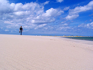
Templeman is a community of New-Wes-Valley in Newfoundland, Canada, located on the north side of Bonavista Bay just south of Cape Freels and north of Wesleyville. Templeman has a shallow and rocky harbour, and can only accommodate small boats.
Cape Bonavista is a headland located on the east coast of the island of Newfoundland in the Canadian province of Newfoundland and Labrador. It is located at the northeastern tip of the Bonavista Peninsula, which separates Trinity Bay to the south from Bonavista Bay to the north. The nearby town of Bonavista takes its name from this historic landmark.
Musgrave Harbour is a Canadian town in the province of Newfoundland and Labrador.
New-Wes-Valley is a municipality in Newfoundland and Labrador, Canada.
Cape Freels is a headland on the island of Newfoundland at the southern tip of the Avalon Peninsula. It is the most southerly point of land on the island of Newfoundland and hence the most southerly of the province of Newfoundland and Labrador. This cape on the Avalon Peninsula is not to be confused with another Cape Freels in Newfoundland, located at the northern extremity of Bonavista Bay. In addition, Cape Freels (Avalon) shares the distinction of being the most southerly point in Newfoundland with nearby Cape Pine, which is situated at the same latitude.
Back Shore was a locality located west of Cape Freels. The name was approved by the Newfoundland Geographical Names Board on July 29, 1982.
Cape Island is the name of both an island and a community in the Canadian province of Newfoundland and Labrador.
Deadman's Bay, Newfoundland is located on the Straight Shore of Bonavista Bay near the community of Lumsden. The community is located near excellent fishing grounds, contributing to its diversified and successful fishery despite its exposed, sandy coastline and harsh fall storms.
Cape Freels is one of the communities that comprise an area on the northeast coast of the Island of Newfoundland, called Bonavista North, in the province of Newfoundland and Labrador, Canada. These communities have a shared history in that they were settled by people from England, predominantly from the West Country - Dorset, Devon, Somerset and Hampshire.
The community of Lumsden, formerly known as Cat Harbour, is located on the Straight Shore of Newfoundland and Labrador near communities such as Musgrave Harbour and Newtown. Lumsden was formerly made up of two settlements, Lumsden North on the tip of a sandy peninsula and Lumsden South on the main road. Although the harbour in Lumsden is not ideal because it is not sheltered, Lumsden has excellent fishing grounds.
Pinchard's Island was one of the communities that comprise an area on the northeast coast of the Island of Newfoundland, called Bonavista North. These communities have a shared history in that they were settled by people from England, predominantly from the West Country - Dorset, Devon Somerset and Hampshire.

Cape St. Mary's Ecological Reserve is an ecological reserve located near Cape St. Mary's on the Cape Shore, on the southwestern Avalon Peninsula of Newfoundland.
St. Mary's Bay is one of many bays in Newfoundland, Canada, where bay is taken as a regional subdivision, somewhat along the lines of county divisions. It is the most southern and eastern of Newfoundland's major bays.

Mistaken Point Ecological Reserve is a wilderness area and a UNESCO World Heritage Site located at the southeastern tip of Newfoundland's Avalon Peninsula in the Canadian province of Newfoundland and Labrador. The reserve is home to the namesake Mistaken Point Formation, which contains one of the most diverse and well-preserved collections of Precambrian fossils in the world. Ediacaran fossils discovered at the site constitute the oldest known remnants of multicellular life on Earth.
At the end of the last Ice Age, Newfoundland and Labrador were covered in thick ice sheets. The province has had a continuous human presence for approximately 5000 years. Although Paleo-Indians are known from Nova Scotia dating back 11,000 years, no sites have been found north of the St. Lawrence. The oldest traces of human activity, in the form of quartz and quartzite knives, were discovered in 1974 in southern Labrador, but some archaeologists have speculated that a human presence may go back as much as 9000 years. Highly acidic soils have destroyed much of the bone and other organic material left behind by early humans and thus complicates archaeological research.
