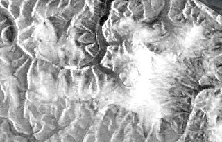
Jørgen Brønlund Fjord or Bronlund Fjord is a fjord in southern Peary Land, northern Greenland.

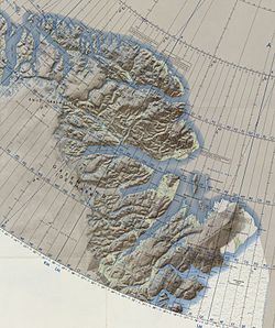
Peary Land is a peninsula in northern Greenland, extending into the Arctic Ocean. It reaches from Victoria Fjord in the west to Independence Fjord in the south and southeast, and to the Arctic Ocean in the north, with Cape Morris Jesup, the northernmost point of Greenland's mainland, and Cape Bridgman in the northeast.
Brønlundhus, on some maps also Brønlundfjord, is a former research station and radio station located on the western shore of Jørgen Brønlund Fjord in southern Peary Land, in northern Greenland. It is named after Greenlandic Arctic researcher Jørgen Brønlund, or after the namesake fjord on which it is located. It is close to the mouth of Jørgen Brønlund Fjord where it opens into Independence Fjord.
Count Eigil Knuth was a Danish explorer, archaeologist, sculptor and writer. He is referred to as the Nestor of Danish polar explorers. His archaeological investigations were made in Peary Land and adjacent areas of High Arctic Greenland. Knuth was made a Knight of the Dannebrog.

Frederick E. Hyde Fjord is a fjord in Peary Land, far northern Greenland.

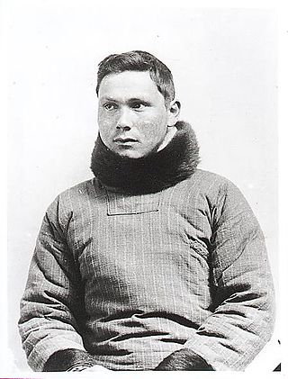
Jørgen Brønlund, was a Greenlandic polar explorer, educator, and catechist. He participated in two Danish expeditions to Greenland in the early 20th century.

Cape Bridgman is a headland in the Wandel Sea, Arctic Ocean, northeast Greenland.

Sands Fjord is a fjord in Peary Land, northern Greenland. To the north, the fjord opens into the Lincoln Sea of the Arctic Ocean. Administratively it belongs to the Northeast Greenland National Park.

Nordkrone is a mountainous area in Peary Land, Northern Greenland. Administratively it is part of the Northeast Greenland National Park.

Cape Washington is a headland in North Greenland. Administratively it belongs to the Northeast Greenland National Park.

Frigg Fjord is a fjord in Peary Land, far northern Greenland.

Johannes V. Jensen Land is an area in Peary Land, Northern Greenland. Administratively it lies in the Northeast Greenland National Park zone. The area is remote and currently uninhabited.

Cape Moltke is a headland in the North Atlantic Ocean, southeast Greenland, Kujalleq municipality.

Wyckoff Land is an area or peninsula in Peary Land, Northern Greenland.

Cape Clarence Wyckoff, also known as Cape Wyckoff, is a broad headland in the Wandel Sea, Arctic Ocean, northernmost Greenland. Administratively it is part of the Northeast Greenland National Park.

Cape Henry Parish is a broad headland in the Wandel Sea, Arctic Ocean, northernmost Greenland. Administratively it is part of the Northeast Greenland National Park.

Herluf Trolle Land is an area in Peary Land, North Greenland. Administratively it is part of the Northeast Greenland National Park.

Cape Eiler Rasmussen is a broad headland in the Wandel Sea, Arctic Ocean, northernmost Greenland. Administratively it is part of the Northeast Greenland National Park.

Cape Kane is a headland in North Greenland. Administratively it belongs to the Northeast Greenland National Park.

Cape Christiansen is a headland in North Greenland. Administratively it belongs to the Northeast Greenland National Park.


