Related Research Articles

The Arctic Archipelago, also known as the Canadian Arctic Archipelago, is an archipelago lying to the north of the Canadian continental mainland, excluding Greenland and Iceland.

The Celebes Sea or Sulawesi Sea of the western Pacific Ocean is bordered on the north by the Sulu Archipelago and Sulu Sea and Mindanao Island of the Philippines, on the east by the Sangihe Islands chain, on the south by Sulawesi's Minahasa Peninsula, and the west by northern Kalimantan in Indonesia. It extends 420 miles (675 km) north-south by 520 mi (840 km) east-west and has a total surface area of 110,000 square miles (280,000 km2), to a maximum depth of 20,300 feet (6,200 m). South of the Cape Mangkalihat, the sea opens southwest through the Makassar Strait into the Java Sea.

Makassar Strait is a strait between the islands of Borneo and Sulawesi in Indonesia. To the north it joins the Celebes Sea, while to the south it meets the Java Sea. To the northeast, it forms the Sangkulirang Bay south of the Mangkalihat Peninsula. The strait is an important regional shipping route in Southeast Asia.

The Second Happy Time was a phase in the Battle of the Atlantic during which Axis submarines attacked merchant shipping and Allied naval vessels along the east coast of North America. The First Happy Time was in 1940–1941 in the North Atlantic and North Sea. Adolf Hitler and Benito Mussolini declared war on the United States on 11 December 1941, and as a result their navies could begin the Second Happy Time.

The Bruce Peninsula is a peninsula in Ontario, Canada, that divides Georgian Bay of Lake Huron from the lake's main basin. The peninsula extends roughly northwestwards from the rest of Southwestern Ontario, pointing towards Manitoulin Island, with which it forms the widest strait joining Georgian Bay to the rest of Lake Huron. The Bruce Peninsula contains part of the geological formation known as the Niagara Escarpment. The entire peninsula and nearby communities to the south along Lake Huron are located within Bruce County, Ontario.
This is a list of the extreme points of the United Kingdom: the points that are farther north, south, east or west than any other location. Traditionally the extent of the island of Great Britain has stretched "from Land's End to John o' Groats".

This is a list of the extreme points of North America: the points that are highest and lowest, and farther north, south, east or west than any other location on the continent. Some of these points are debatable, given the varying definitions of North America.

Area code 867 is the area code in the North American Numbering Plan (NANP) for the three Canadian territories, all of which are in Northern Canada. The area code was created on October 21, 1997, by combining regions that were previously served with area code 403 and area code 819 in one numbering plan area (NPA). As the least populated NPA in mainland North America, serving about 130,000 people, it is geographically the largest, at 3,921,739 km2 (1,514,192 sq mi), with Alaska (907) a distant second.
The Thiel Mountains are isolated, mainly snow-capped mountains of the Transantarctic Mountains System, located in the Ellsworth Land region of Antarctica. The mountain range is 45 nautical miles long, is located roughly between the Horlick Mountains and the Pensacola Mountains, and extends from Moulton Escarpment on the west to Nolan Pillar on the east. Major components include Ford Massif, Bermel Escarpment and a group of eastern peaks near Nolan Pillar.
Martin Peninsula is a peninsula about 60 nautical miles long and 20 nautical miles wide that is ice-covered except for a few rock outcrops along its margins, located between Getz Ice Shelf and Dotson Ice Shelf on the coast of Marie Byrd Land, Antarctica. The farthest point of the peninsula is Jacobsen Head.

Admiral John Holloway was an officer of the Royal Navy who saw service during the American War of Independence, and the French Revolutionary and Napoleonic Wars, before serving as Governor of Newfoundland between 1807 and 1809.
Boularderie Island is an island separating the Cabot Strait from Bras d'Or Lake on the eastern coast of Cape Breton Island, Nova Scotia, Canada. It takes its name from Louis-Simon le Poupet de la Boularderie, who was granted the area as a concession from the King of France.
Gardner Inlet is a large, ice-filled inlet at the southwest side of Bowman Peninsula, on the east coast of Palmer Land, Antarctica.
Asamankese is a town in south Ghana and is the capital of West Akim Municipal District, a district in the Eastern Region of south Ghana. Asamankese has a 2013 settlement population of approximately 39,435 people. Asamankese is on the main highway to Kumasi and Accra in the interior. The people of Asamankese celebrate the Obuodwan festival.

The Great Escarpment is a major topographical feature in Africa that consists of steep slopes from the high central Southern African plateau downward in the direction of the oceans that surround southern Africa on three sides. While it lies predominantly within the borders of South Africa, in the east the escarpment extends northward to form the border between Mozambique and Zimbabwe, continuing on beyond the Zambezi river valley to form the Muchinga Escarpment in eastern Zambia. In the west, it extends northward into Namibia and Angola. It is the combination of this escarpment and the aridity of Southern Africa that leads to the lack of navigable rivers in South Africa.
The Bermel Escarpment is a snow and rock escarpment, 15 nautical miles long, extending from the base of the Ford Massif to King Peak, in the Thiel Mountains of Antarctica. The escarpment drops 300 to 400 metres from the Antarctic Plateau to the ice surface north of these mountains.
The Harold Byrd Mountains are a group of exposed mountains and nunataks which extend in an east–west direction between the lower part of Leverett Glacier and the head of the Ross Ice Shelf in Antarctica. They were discovered in December 1929 by the Byrd Antarctic Expedition geological party under Laurence Gould, and named by Rear Admiral Richard E. Byrd for D. Harold Byrd, a cousin of his and a contributor towards the purchase of furs for the expedition.
German submarine U-93 was a Type VIIC U-boat of Nazi Germany's Kriegsmarine during World War II. She was laid down on 9 September 1939 at the F. Krupp Germaniawerft in Kiel as yard number 598, launched on 8 June 1940 and commissioned on 30 July 1940 under Kapitänleutnant Claus Korth.

Taï Department is a department of Cavally Region in Montagnes District, Ivory Coast. In 2021, its population was 117,387 and its seat is the settlement of Taï. The sub-prefectures of the department are Taï and Zagné.
References
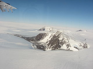
- ↑ "Cape Hotham Escarpment". Geographical Names Data Base . Natural Resources Canada . Retrieved 2024-09-24.
74°52′N93°27′W / 74.867°N 93.450°W
| | This Qikiqtaaluk Region, Nunavut location article is a stub. You can help Wikipedia by expanding it. |