Cape James Hill

Last updated
Cape James Hill
Kap James Hill
Roosevelt Range 1903.png
1903 Robert Peary map section showing his 1900 explorations in far Northern Greenland.
Greenland edcp location map.svg
Red pog.svg
Location Northeast Greenland National Park, Greenland
Coordinates 83°36′N30°25′W / 83.600°N 30.417°W / 83.600; -30.417 Coordinates: 83°36′N30°25′W / 83.600°N 30.417°W / 83.600; -30.417
Offshore water bodies Wandel Sea, Arctic Ocean
Area Arctic

Cape James Hill (Danish : Kap James Hill) is a headland in the Wandel Sea, Arctic Ocean, northeast Greenland.

Danish language North Germanic language spoken in Denmark

Danish is a North Germanic language spoken by around six million people, principally in Denmark and in the region of Southern Schleswig in northern Germany, where it has minority language status. Also, minor Danish-speaking communities are found in Norway, Sweden, Spain, the United States, Canada, Brazil, and Argentina. Due to immigration and language shift in urban areas, around 15–20% of the population of Greenland speak Danish as their first language.

A headland is a coastal landform, a point of land usually high and often with a sheer drop, that extends into a body of water. It is a type of promontory. A headland of considerable size often is called a cape. Headlands are characterised by high, breaking waves, rocky shores, intense erosion, and steep sea cliff.

Wandel Sea A body of water in the Arctic Ocean from northeast of Greenland to Svalbard

The Wandel Sea is a body of water in the Arctic Ocean, stretching from northeast of Greenland to Svalbard. It is obstructed by ice most of the year.

Contents

The cape was named by Robert Peary after James J. Hill, one of the members of the Peary Arctic Club in New York. [1]

Robert Peary explorer from the United States

Robert Edwin Peary Sr. was an American explorer and United States Navy officer who made several expeditions to the Arctic in the late 19th and early 20th centuries. He is best known for claiming to have reached the geographic North Pole with his expedition on April 6, 1909.

James J. Hill United States railroad promoter and financier

James Jerome Hill, was a Canadian-American railroad executive. He was the chief executive officer of a family of lines headed by the Great Northern Railway, which served a substantial area of the Upper Midwest, the northern Great Plains, and Pacific Northwest. Because of the size of this region and the economic dominance exerted by the Hill lines, Hill became known during his lifetime as "The Empire Builder".

Peary Arctic Club

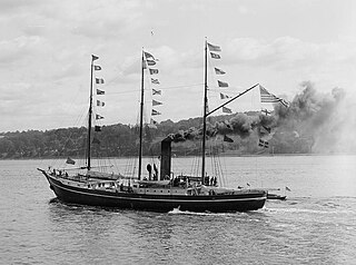
The Peary Arctic Club was an American-based club with the goal of promoting the Arctic expeditions of Robert Peary.

Geography

Cape James Hill is located east of Cape Morris Jesup, Peary Land, between Constable Bay to the west and Bliss Bay to the east. [2] It is the nearest land to Kaffeklubben Island (Oodaap Qeqertaa) located about 9 km (5.6 mi) to the northeast. [3] Administratively it is part of the Northeast Greenland National Park.

Cape Morris Jesup cape

Cape Morris Jesup is a headland in Peary Land, Greenland.

Peary Land peninsula

Peary Land is a peninsula in northern Greenland, extending into the Arctic Ocean. It reaches from Victoria Fjord in the west to Independence Fjord in the south and southeast, and to the Arctic Ocean in the north, with Cape Morris Jesup, the northernmost point of Greenland's mainland, and Cape Bridgman in the northeast.

Constable Bay bay in Northeast Greenland National Park, Greenland

Constable Bay is a bay in the Wandel Sea, Northern Greenland.Administratively Constable Bay and its surroundings belong to the Northeast Greenland National Park.

Map of Greenland section. North Greenland section-txu-pclmaps-oclc-8322829 a 1.jpg
Map of Greenland section.

Related Research Articles

Danmark Fjord fjord in Greenland

Danmark Fjord, also known as Denmark Sound, is a fjord in northeast Greenland within Northeast Greenland National Park.

Cape York (Greenland) cape on the northwestern coast of Greenland

Cape York is a cape on the northwestern coast of Greenland, in northern Baffin Bay.

<i>Effie M. Morrissey</i> United States national historic site

Effie M. Morrissey was a schooner skippered by Robert Bartlett that made many scientific expeditions to the Arctic, sponsored by American museums, the Explorers Club and the National Geographic Society. She also helped survey the Arctic for the United States Government during World War II. She is currently designated by the United States Department of the Interior as a National Historic Landmark as part of the New Bedford Whaling National Historical Park. She is the State Ship of Massachusetts.

Brønlundhus

Brønlundhus, on some maps also Brønlundfjord, is a former research station and radio station located on the western shore of Jørgen Brønlund Fjord in southern Peary Land, in northern Greenland. It is named after Greenlandic Arctic researcher Jørgen Brønlund, or after the namesake fjord on which it is located. It is close to the mouth of Jørgen Brønlund Fjord where it opens into Independence Fjord.

Academy Glacier (Greenland) glacier in Greenland

Academy Glacier, is one of the major glaciers in northern Greenland.

Cape Bridgman peninsula in Northeast Greenland National Park, Greenland

Cape Bridgman is a headland in the Wandel Sea, Arctic Ocean, northeast Greenland.

Weyprecht Fjord

Weyprecht Fjord is a fjord in Peary Land, northern Greenland. To the northwest, the fjord opens into the Lincoln Sea of the Arctic Ocean. It is part of the Northeast Greenland National Park.

Sands Fjord

Sands Fjord is a fjord in Peary Land, northern Greenland. To the north, the fjord opens into the Lincoln Sea of the Arctic Ocean. Administratively it belongs to the Northeast Greenland National Park.

Benedict Fjord

Benedict Fjord is a fjord in Peary Land, northern Greenland. To the north, the fjord opens into the Lincoln Sea of the Arctic Ocean.

Cape Washington, Greenland peninsula in Northeast Greenland National Park, Greenland

Cape Washington is a headland in North Greenland. Administratively it belongs to the Northeast Greenland National Park.

Bliss Bay bay in Northeast Greenland National Park, Greenland

Bliss Bay is a bay in the Wandel Sea, Northern Greenland. The area of the bay is uninhabited. Administratively Bliss Bay and its surroundings belong to the Northeast Greenland National Park.

Roosevelt Range mountain range in Greenland

The Roosevelt Range or Roosevelt Mountains is a mountain range in Northern Greenland. Administratively this range is part of the Northeast Greenland National Park. Its highest peak is the highest point in Peary Land.

Cape Cannon peninsula in Northeast Greenland National Park, Greenland

Cape Cannon is a headland in the Lincoln Sea, Arctic Ocean, North Greenland. Administratively it is part of the Northeast Greenland National Park.

Cape Peary peninsula in Avannaata, Greenland

Cape Peary is a headland in the Avannaata municipality, NW Greenland.

Daly Range

The Daly Range or Daly Mountains is a mountain range in Peary Land, Northern Greenland. Administratively this range is part of the Northeast Greenland National Park.

Cape Harald Moltke peninsula in Northeast Greenland National Park, Greenland

Cape Harald Moltke is a headland in Peary Land, North Greenland. Administratively it is part of the Northeast Greenland National Park.

References

  1. Robert E. Peary, Nearest the Pole: A Narrative of the Polar Expedition of the Peary Arctic Club in the S. S. Roosevelt, 1905 -1906. p. 329
  2. Prostar Sailing Directions 2005 Greenland and Iceland Enroute, p. 130
  3. "Kap James Hill". Mapcarta. Retrieved 11 February 2019.