Cape Morris Jesup is a headland in Peary Land, Greenland.
Cape Farewell is a headland on the southern shore of Egger Island, Nunap Isua Archipelago, Greenland. As the southernmost point of the country, it is one of the important landmarks of Greenland.

The Cape York meteorite, also known as the Innaanganeq meteorite, is one of the largest known iron meteorites, classified as a medium octahedrite in chemical group IIIAB. In addition to many small fragments, at least eight large fragments with a total mass of 58 tonnes have been recovered, the largest weighing 31 tonnes. The meteorite was named after Cape York, a prominent geographic feature located approximately 30 miles (48 km) west of the east coast of Meteorite island and the nearby peninsulas in northern Melville Bay, Greenland, where the first meteorite fragments were discovered.
Cape York is a cape on the northwestern coast of Greenland, in northern Baffin Bay.

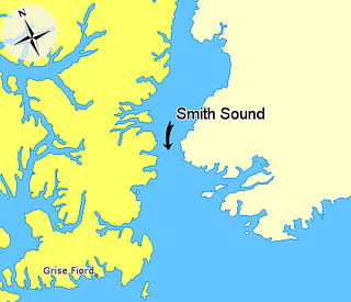
Smith Sound is an Arctic sea passage between Greenland and Nunavut's northernmost island, Ellesmere Island. It links Baffin Bay with Kane Basin and forms part of the Nares Strait. On the Canadian side it extends from Cape Sabine in the north to Cape Isabella in the south.

Cape Alexander is a headland in the Baffin Bay, northwest Greenland, Avannaata municipality. It is one of the important landmarks of Greenland.
Savissivik or Havighivik (Inuktun) is a settlement in the Avannaata municipality in northern Greenland. Located on Meteorite Island, off the northern shores of Melville Bay, the settlement had 55 inhabitants in 2020.
Sabine Island is an island to the northeast of Wollaston Foreland, previously known as Inner Pendulum Island. It is in the Northeast Greenland National Park area.

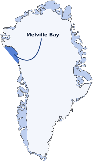
Melville Bay, is a large bay off the coast of northwestern Greenland. Located to the north of the Upernavik Archipelago, it opens to the south-west into Baffin Bay. Its Kalaallisut name, Qimusseriarsuaq, means "the great dog sledding place".
Wilcox Head is a cape in Avannaata municipality in northwestern Greenland.
Nuussuup Nuua is a cape in Avannaata municipality in northwestern Greenland.
Meteorite Island is an island in Baffin Bay, in Avannaata municipality, off NW Greenland.
Cape Cort Adelaer, also known as Cape Adelaer, is a headland in the North Atlantic Ocean, southeast Greenland, Sermersooq municipality. This cape is named after Norwegian seaman Cort Adeler (1622–1675) who distinguished himself for services rendered to the Royal Dano-Norwegian Navy.
Cape Murdoch is a headland in the Avannaata municipality, NW Greenland.

Cape James Hill is a headland in the Wandel Sea, Arctic Ocean, northeast Greenland.

Cape Harald Moltke is a headland in Peary Land, North Greenland. Administratively it is part of the Northeast Greenland National Park.

Herluf Trolle Land is an area in Peary Land, North Greenland. Administratively it is part of the Northeast Greenland National Park.


