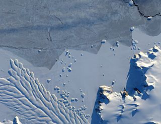
The Geologists Range is a mountain range about 55 km (34 mi) long, standing between the heads of Lucy and Nimrod Glaciers in Antarctica. Seen by the northern party of the New Zealand Geological Survey Antarctic Expedition (NZGSAE) (1961–62) and named to commemorate the work of geologists in Antarctic exploration. The Churchill Mountains are to the north, the Queen Elizabeth Range to the east and the Miller Range to the southeast
The Aviator Glacier is a major valley glacier in Antarctica that is over 60 nautical miles long and 5 nautical miles wide, descending generally southward from the plateau of Victoria Land along the west side of Mountaineer Range, and entering Lady Newnes Bay between Cape Sibbald and Hayes Head where it forms a floating tongue.
Northeast Glacier is a steep, heavily crevassed glacier, 13 nautical miles long and 5 nautical miles wide at its mouth, which flows from McLeod Hill westward and then south-westwards into Marguerite Bay between the Debenham Islands and Roman Four Promontory, on the west coast of Graham Land, Antarctica.

Ninnis Glacier is a large, heavily hummocked and crevassed glacier descending steeply from the high interior to the sea in a broad valley, on George V Coast in Antarctica. It was discovered by the Australasian Antarctic Expedition (1911–14) under Douglas Mawson, who named it for Lieutenant B. E. S. Ninnis, who lost his life on the far east sledge journey of the expedition on 14 December 1912 through falling into the Black Crevasse in the glacier.
The Merz Peninsula is an irregular, ice-covered peninsula, about 15 nautical miles long in an east–west direction and averaging 25 nautical miles wide, between Hilton Inlet and Violante Inlet on the east coast of Palmer Land, Antarctica.
Sibelius Glacier is a glacier, 12 miles (19 km) long and 6 miles (10 km) wide, flowing south into the Mozart Ice Piedmont 10 miles (16 km) southwest of Mount Stephenson in the northern portion of Alexander Island, Antarctica. The glacier was first sighted from the air by the British Graham Land Expedition in 1937. Mapped from air photos taken by the Ronne Antarctic Research Expedition in 1947–48, by Searle of the Falkland Islands Dependencies Survey in 1960. This feature was named by the United Kingdom Antarctic Place-Names Committee for Jean Sibelius (1865-1957), Finnish composer.

The Adare Peninsula, is a high ice-covered peninsula, 40 nautical miles long, in the northeast part of Victoria Land, extending south from Cape Adare to Cape Roget. The peninsula was named by the New Zealand Antarctic Place-Names Committee (NZ-APC) for Cape Adare. The peninsula is considered the southernmost point of the Borchgrevink Coast, named for Carsten Borchgrevink (1864-1934).

Robertson Bay is a large, roughly triangular bay that indents the north coast of Victoria Land between Cape Barrow and Cape Adare. Discovered in 1841 by Captain James Clark Ross, Royal Navy, who named it for Dr. John Robertson, surgeon on HMS Terror.
Conway Range is a mountain range in the Cook Mountains of Antarctica, on the west edge of the Ross Ice Shelf. It is south of the Worcester Range.
The Nash Range is a mainly ice-covered coastal range in the Churchill Mountains of Antarctica.
Davies Bay is a bay on the coast of Antarctica, 10 nautical miles wide, between Drake Head and Cape Kinsey.
Violante Inlet is an ice-filled inlet 16 nautical miles long, in an east–west direction, and 12 to 15 nautical miles wide, lying between Cape Fanning and Cape Herdman along the east coast of Palmer Land, Antarctica.

Matusevich Glacier is a broad glacier about 50 nautical miles long, with a well developed glacier tongue, flowing to the coast of East Antarctica between the Lazarev Mountains and the northwestern extremity of the Wilson Hills.
The Mawson Glacier is a large glacier on the east coast of Victoria Land, Antarctica, descending eastward from the Antarctic Plateau to the north of Trinity Nunatak and the Kirkwood Range, to enter the Ross Sea, where it forms the Nordenskjöld Ice Tongue. The glacier was first mapped by the British Antarctic Expedition (1907–09) and named for Douglas Mawson, the expedition physicist, who later led two other Antarctic expeditions, 1911–14, and 1929–31.
Scripps Heights are rugged heights which are largely ice-covered, surmounting the peninsula between Casey Glacier and Lurabee Glacier on the east coast of Palmer Land, Antarctica. Deeply scarred by glaciers, the heights terminate on the east in Cape Walcott.
The Smith Peninsula is an ice-covered, "dog-legged" peninsula 25 nautical miles long and 10 nautical miles wide, extending in an easterly direction between Keller Inlet and Nantucket Inlet from the east coast of Palmer Land, Antarctica.
Horteriset Dome is a broad ice-covered hill about 13 nautical miles (24 km) west of the southern part of the Weyprecht Mountains in Queen Maud Land, Antarctica. First photographed from the air by the Third German Antarctic Expedition (1938–39), it was mapped by Norwegian cartographers from surveys and air photos by the Sixth Norwegian Antarctic Expedition (1956–60) and named by them.
Rennick Bay is an embayment of the coastline of Antarctica at the terminus of Rennick Glacier. It is bounded on the west and east by Belousov Point and Stuhlinger Ice Piedmont.
![]() This article incorporates public domain material from "Cape Sedov". Geographic Names Information System . United States Geological Survey.
This article incorporates public domain material from "Cape Sedov". Geographic Names Information System . United States Geological Survey. 


