
Nova Scotia is one of the thirteen provinces and territories of Canada. It is one of the three Maritime provinces and one of the four Atlantic provinces. Nova Scotia is Latin for "New Scotland". Most of the population are native English-speakers.
The Cabot Trail is a scenic highway on Cape Breton Island in Nova Scotia, Canada. It is a 298 km (185 mi) loop around the northern tip of the island, passing along and through the Cape Breton Highlands and the Cape Breton Highlands National Park.

Westport, Nova Scotia is a village in Digby County, Nova Scotia and it is located on Brier Island in the Bay of Fundy. As of 2016, the population was 218.
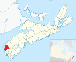
Clare, officially named the Municipality of the District of Clare, is a district municipality in western Nova Scotia, Canada. Statistics Canada classifies the district municipality as a municipal district.
The Eastern Shore is a region of the Canadian province of Nova Scotia. It is the Atlantic coast running northeast from Halifax Harbour to the eastern end of the peninsula at the Strait of Canso.
The Fleur-de-lis Trail is a scenic roadway located on Nova Scotia's Cape Breton Island. It is approximately 182 km (113 mi) long and runs along the southeastern part of the island through an Acadian region, with a 35 km (22 mi) spur route to and encircling Isle Madame, for a total distance of 217 km (135 mi).

St. Marys Bay south western Nova Scotia, Canada, surrounded by the modern municipal districts of Clare Municipal District and Digby.

Long Island is a Canadian island in Digby County, Nova Scotia.
Digby Neck is a Canadian peninsula extending into the Bay of Fundy in Digby County, Nova Scotia.
Seal Island is an island on the outermost extreme of Southwestern Nova Scotia, Canada, in the Municipality of the District of Argyle in Yarmouth County. It is approximately 4.3 kilometres (2.7 mi) long and 0.8 kilometres (0.50 mi) wide and is surrounded on its east, south and west sides by dangerous shoals. It is surrounded by the Atlantic Ocean and is the biggest of a group of five islands which extend north for 12 kilometres (7.5 mi). It is the second southernmost point of land of Nova Scotia. The southern tip of nearby Cape Sable Island is 250 metres (820 ft) farther south than the southern tip of land on Seal Island.

The Wilkie Sugarloaf Trail is a hiking trail in northern Cape Breton Island in the Canadian province of Nova Scotia. The trail leads to the 411.8 metres (1,351 ft) summit of Wilkie Sugar Loaf in the Cape Breton Highlands.
Cape St. Mary's (French:Cap-Sainte-Marie) is a community in the Canadian province of Nova Scotia, located in the District of Clare in Digby County. The harbor is home to a $5,000,000 dollar a year fishery that supports a fleet of 42 fish harvesters, 14 vessels, and nine transient ships. In 2014 a hydrographic survey was conducted by the Fisheries and Oceans Canada and found that the harbor was in need of major dredging to protect the local fleet. Cape St. Mary's is scheduled for a major capital construction project that will improve the harbor by adding a new breakwater and groyne extension.
Sydney Forks is a community in the Canadian province of Nova Scotia, located in the Cape Breton Regional Municipality on Cape Breton Island.
Edwardsville is a community in the Canadian province of Nova Scotia, located in the Cape Breton Regional Municipality on Cape Breton Island.
Saint Alphonse de Clare is an Acadian community in the Canadian province of Nova Scotia, located in the District of Clare in Digby County. Formerly Chéticamp-de-Clare, the name was changed because there is another Chéticamp in Nova Scotia on Cape Breton. The similar names caused confusion for postal and other services.
Upper Leitches Creek is a community in the Canadian province of Nova Scotia, located in the Cape Breton Regional Municipality on Cape Breton Island.
Howie Centre is a community in the Canadian province of Nova Scotia, located in the Cape Breton Regional Municipality on Cape Breton Island. The community has a school, Mountainview Elementary, which is a complex with East Bay Elementary.
Salem Road is a community in the Canadian province of Nova Scotia, located in the Cape Breton Regional Municipality on Cape Breton Island.

A township in Nova Scotia, Canada, was an early form of land division and local administration during British colonial settlement in the 18th century. They were created as a means of populating the colony with people loyal to British rule. They were typically rural or wilderness areas of around 100,000 acres (400 km2) that would eventually include several villages or towns. Some townships, but not all, returned a member to the General Assembly of Nova Scotia; others were represented by the members from the county. Townships became obsolete by 1879 by which time towns and counties had become incorporated.
