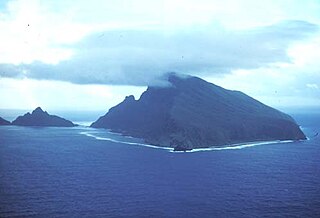
The Samoan Islands are an archipelago covering 3,030 km2 (1,170 sq mi) in the central South Pacific, forming part of Polynesia and of the wider region of Oceania. Administratively, the archipelago comprises all of the Independent State of Samoa and most of American Samoa. The land masses of the two Samoan jurisdictions are separated by 64 km of ocean at their closest points.
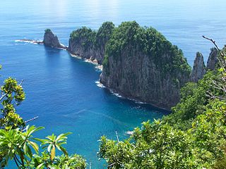
The National Park of American Samoa is a national park of the United States located in the territory of American Samoa, distributed across four islands: Tutuila, Ofu, Olosega, and Ta‘ū. The park preserves and protects coral reefs, tropical rainforests, fruit bats, and the Samoan culture. Popular activities include hiking and snorkeling. Of the park's 8,257 acres (3,341 ha), 2,500 acres (1,000 ha) is coral reefs and ocean. The park is the only American National Park Service system unit south of the equator.

Rainmaker Mountain is the name of a mountain located near Pago Pago, American Samoa on Tutuila Island. Rainmaker Mountain traps rain clouds and gives Pago Pago the highest annual rainfall of any harbor. The average annual rainfall on the mountain is around 200 inches (510 cm). It has a three-pronged summit. Rainmaker Mountain and its base were designated a National Natural Landmark in 1972 due to the slopes’ tropical vegetation.

Fatu Rock is a natural landmark and offshore islet of American Samoa. It is located near the entrance of Pago Pago Harbor, close to the village of Fatumafuti. Fatu and nearby Futi are also known as Flowerpot Rock.
Nuʻuuli is a village on the central east coast of Tutuila Island, American Samoa. It is located on a peninsula several miles up from Pago Pago International Airport. Nuʻuuli is located between Pago Pago International Airport and Coconut Point. It is a shopping district which is home to stores, groceries and many more shops.
ʻAmanave is a village on the coast of Tutuila Island, American Samoa. It is located close to the island's western tip, Cape Taputapu, and to the south of the village of Poloa. It is located in Lealataua County.

Alega is a village on the southeast coast of Tutuila Island, American Samoa. One of the island's least populous villages, it is located to the east of Pago Pago Harbor and to the west of Faga'itua Bay. Alega, with a population of 29 according to the 2020 U.S. Census, is one of the smallest villages in American Samoa, surpassing only Maloata and Sili in population.
Aʻumi is a village on the central south coast of Tutuila Island, American Samoa.
Futiga is a village in the southwest of Tutuila Island, American Samoa. It is located inland, 7 miles (11 km) southwest of Pago Pago, between the villages of 'Ili'ili and Puapua. It is in Tualatai County.

Faʻilolo is a village in the far west of Tutuila Island, American Samoa. It is located just south of ʻAmanave, close to the island's westernmost point, Cape Taputapu. It is located in Lealataua County.

Matafao Peak is a mountain in American Samoa, on the island of Tutuila. With an elevation of 653 metres (2,142 ft), it is the highest peak on Tutuila Island. The mountain, like Rainmaker Mountain across Pago Pago Harbor, is a remnant of a volcanic plug and is part of the volcanic origins of the island. The mountain can be hiked from the high point of the Pago Pago-to-Fagasa Road. It is designated a National Natural Landmark above the 492-foot (150 m) level, an area known as Matafao Peak National Natural Landmark.

Vatia is a village on Tutuila Island in American Samoa. It is a north shore village located on Vatia Bay. The road to Vatia, American Samoa Highway 006, is the only road going through National Park of American Samoa. Vatia is a scenic community at the foot of Pola Ridge and surrounded by the national park. It is only reached by Route 6 which traverses the national park before reaching Vatia. There was once a hiking trail over Maugaloa Ridge from Leloaloa, but since the completion of Route 6, this trail is now overgrown. It is home to a beach, and panoramic views of jungle-covered peaks surround the village on all sides. Vatia is the center of the Tutuila-section of National Park of American Samoa. It is located in Vaifanua County.
Tula is a village in the Eastern District of Tutuila Island in American Samoa. Tula is located in Vaifanua County and had a population of 405 as of the 2010 U.S. Census.

Fagamalo is a village in American Samoa. It is located on the north shore of Tutuila Island. The village was long only reachable by narrow trails over rugged vertical terrain. The trails were often obscured by brush and seldom traveled because they traversed the thick rain forests. It often required hours of hiking before reaching the village. Route 1 now climbs steeply and winds up to the village of Fagamalo, where the road ends. It is located in Lealataua County in the Western District of Tutuila Island.
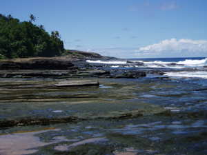
Taputimu is a village in southwestern Tutuila Island in American Samoa. It is the nearest village to the Fagatele Bay National Marine Sanctuary, although the main access is from the neighboring village of Futiga. It is home to Leala Shoreline National Natural Landmark and Leala Sliding Rock. Leala Sliding Rock is a natural rock formation between Vailoatai and Taputimu, which is a scenic landmark as well as a natural playground or slide. It was created by the ebb and flow of the ocean; the erosion has created a smooth shoreline site. It is located in Tualatai County in the Western District of Tutuila.
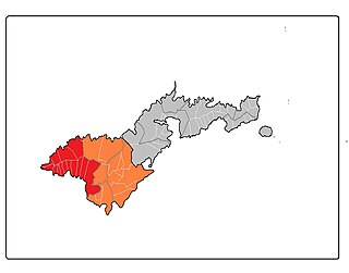
Lealataua County is a county in the Western District in American Samoa.
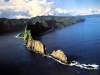
Pola Island is an island just offshore from the village of Vatia on Tutuila Island in American Samoa. It is also known as Cockscomb. Pola Island is designated as part of the National Park American Samoa and is a popular tourist attraction. It is located on the west side of Vatia Bay, and serves as both a landmark and an icon for Vatia. Pola Island has been named one of American Samoa's Seven National Wonders by the Pago Pages. It has been named "the most beautiful natural feature of Tutuila Island” by travel guide publisher Lonely Planet. Pola Island is known for its high cliffs, populated by seabirds, and is one of American Samoa's primary seabird nesting sites.

Leʻala Shoreline is located near Taputimu, just west of Fagatele Point, on Tutuila Island in American Samoa. It is a U.S. National Natural Landmark. The coast is marked by rocky outcroppings, deep and shallow surge channels, as well as tide pools and a mixture of coconut, scrub and grass forest. Sliding Rock is located nearby. Leʻala Shoreline is a young flow of basalt, inter-bedded with layers of tuff that illustrate erosion by wave action. The area is covered with dense tropical vegetation. Leʻala Shoreline was designated a U.S. National Natural Landmark in 1972. The National Natural Landmark covers 35 acres (14 ha).
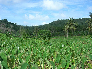
Fogamaʻa Crater is a valley basin on Tutuila Island, American Samoa, immediately north of Larsen Bay. It is within the village of Futiga, just below Logotala Hill. It is also known as Hidden Beach or Larsen’s Cove.
Nuusetoga Island is situated along the northern coast of Tutuila Island in American Sāmoa. It forms the western entrance to Masefau Bay, approximately 0.5 miles northeast of the village of Masefau. The island’s geographic coordinates are 14°15'15" S, 170°37'20" W. Historically, the island has also been referred to as Bartlett Islet or Bartlett Island. Nuusetoga Island is a small landform approximately 0.3 miles long. It is connected to the west point of Masefau Bay by a coral reef. The island plays a significant role in narrowing the anchorage in the bay due to the surrounding reefs. The coral reefs around the island create a natural barrier, leaving only a small channel available for boat access to the beach.


