
The Territory of Papua comprised the southeastern quarter of the island of New Guinea from 1883 to 1975. In 1883, the Government of Queensland annexed this territory for the British Empire. The United Kingdom Government refused to ratify the annexation but in 1884 a protectorate was proclaimed over the territory, then called "British New Guinea". There is a certain ambiguity about the exact date on which the entire territory was annexed by the British. The Papua Act 1905 recites that this happened "on or about" 4 September 1888. On 18 March 1902, the Territory was placed under the authority of the Commonwealth of Australia. Resolutions of acceptance were passed by the Commonwealth Parliament, which accepted the territory under the name of Papua.

Wewak is the capital of the East Sepik province of Papua New Guinea. It is on the northern coast of the island of New Guinea. It is the largest town between Madang and Jayapura. It is the see city (seat) of the Roman Catholic Diocese of Wewak.

The Torricelli languages are a family of about fifty languages of the northern Papua New Guinea coast, spoken by about 80,000 people. They are named after the Torricelli Mountains. The most populous and best known Torricelli language is Arapesh, with about 30,000 speakers.
The Territory of New Guinea was an Australian-administered United Nations trust territory on the island of New Guinea from 1914 until 1975. In 1949, the Territory and the Territory of Papua were established in an administrative union by the name of the Territory of Papua and New Guinea. That administrative union was renamed as Papua New Guinea in 1971. Notwithstanding that it was part of an administrative union, the Territory of New Guinea at all times retained a distinct legal status and identity until the advent of the Independent State of Papua New Guinea.

Blup Blup Island is a small forested island off the northern coast of Papua New Guinea about 30 km offshore from Cape Girgir and is considered part of the Schouten Islands. It is located at latitude S 3°30'46" and longitude E 144°35'16". The island has a small population and is theoretically part of the Papuan province of East Sepik, although officially it is still a protectorate.

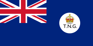
The Territory of Papua and New Guinea, officially the Administrative Union of the Territory of Papua and the Territory of New Guinea, was established by an administrative union between the Australian-administered territories of Papua and New Guinea in 1949. In December 1971, the name of the Territory changed to "Papua New Guinea" and in 1975 it became the Independent State of Papua New Guinea.
Wom or Wam is a Papuan language of the Torricelli language family spoken by 4,264 people in East Sepik province, Papua New Guinea.

Daru Island is an island in the Western Province of Papua New Guinea. It is one of the Torres Strait Islands. The eponymous town on the island is the capital of the province, and houses the vast majority of the island's population of 20,524 (2009). Daru Island is elliptical in shape, with dimensions of 5.0 by 3.7 kilometers, an area of 14.7 km², and an elevation of up to 27 m. The island is separated from the mainland in the north, specifically the mouth of Oriomo River, by the 3.5 km wide Daru Roads. The shortest distance to the larger Bristow Island in the south is 1.3 km.

The Japanese 18th Army was a field army of the Imperial Japanese Army during World War II.

Aua is an island in the Bismarck Archipelago. It is part of the Western Islands, region and Manus Province of northern Papua New Guinea.

Tabo, also known as Waia (Waya), is a Papuan language of Western Province, Papua New Guinea, just north of the Fly River delta. The language has also been known as Hiwi and Hibaradai.
Juwal a.k.a. Muniwara is a Torricelli language of Papua New Guinea. Other names are Mambe and Tumara ~ Tumaru. It is spoken in Mambe and Tumeru villages of Turubu Rural LLG, East Sepik Province.
Andai is an Arafundi language of Papua New Guinea.
Waboda is a Papuan language of southern Papua New Guinea. In Kiwai Rural LLG, it is spoken in Dameratamu, Gesoa, Kabaturi, Maduduo, Meipani, Sagero, Tirere, and Wapi villages.
Koiwat is one of the Ndu languages of Sepik River region of northern Papua New Guinea.
Urimo is a Torricelli language of Papua New Guinea. It is spoken in Yaugiba village of Turubu Rural LLG, East Sepik Province.
Kaiep is one of three Kairiru languages of Turubu Rural LLG, East Sepik Province, Papua New Guinea. It is spoken in the Kep, Taul, and Samap village area in Turubu Rural LLG.
Terebu (Turubu) is one of three Kairiru languages spoken in East Sepik Province, Papua New Guinea. It is spoken in Turubu village of Turubu Rural LLG, East Sepik Province.
Keram Rural LLG is a local-level government (LLG) of East Sepik Province, Papua New Guinea.
